Ambès (Ambès)
- commune in Gironde, France
- Country:

- Postal Code: 33810
- Coordinates: 45° 0' 38" N, 0° 31' 55" E


- GPS tracks (wikiloc): [Link]
- Area: 28.85 sq km
- Population: 3167
- Web site: http://www.mairie-ambes.fr
- Wikipedia en: wiki(en)
- Wikipedia: wiki(fr)
- Wikidata storage: Wikidata: Q243135
- Wikipedia Commons Category: [Link]
- Freebase ID: [/m/03mhdkd]
- GeoNames ID: Alt: [3037935]
- SIREN number: [213300049]
- BnF ID: [152560580]
- WOEID: [575893]
- INSEE municipality code: 33004
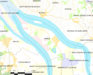
Shares border with regions:


Macau
- commune in Gironde, France
- Country:

- Postal Code: 33460
- Coordinates: 45° 0' 30" N, 0° 36' 50" E


- GPS tracks (wikiloc): [Link]
- Area: 19.56 sq km
- Population: 4048
- Web site: [Link]


Saint-Louis-de-Montferrand
- commune in Gironde, France
- Country:

- Postal Code: 33440
- Coordinates: 44° 57' 9" N, 0° 32' 5" E


- GPS tracks (wikiloc): [Link]
- Area: 10.8 sq km
- Population: 2160
- Web site: [Link]


Ludon-Médoc
- commune in Gironde, France
- Country:

- Postal Code: 33290
- Coordinates: 44° 58' 56" N, 0° 36' 14" E


- GPS tracks (wikiloc): [Link]
- Area: 18.69 sq km
- Population: 4444
- Web site: [Link]


Saint-Vincent-de-Paul
- commune in Gironde, France
- Country:

- Postal Code: 33440
- Coordinates: 44° 57' 15" N, 0° 28' 9" E


- GPS tracks (wikiloc): [Link]
- Area: 13.88 sq km
- Population: 1016


Saint-Seurin-de-Bourg
- commune in Gironde, France
- Country:

- Postal Code: 33710
- Coordinates: 45° 3' 9" N, 0° 34' 46" E


- GPS tracks (wikiloc): [Link]
- Area: 2.47 sq km
- Population: 401


Ambarès-et-Lagrave
- commune in Gironde, France
- Country:

- Postal Code: 33440
- Coordinates: 44° 55' 29" N, 0° 29' 12" E


- GPS tracks (wikiloc): [Link]
- AboveSeaLevel: 7 м m
- Area: 24.76 sq km
- Population: 15881
- Web site: [Link]


Bourg
- commune in Gironde, France
- Country:

- Postal Code: 33710
- Coordinates: 45° 2' 24" N, 0° 33' 26" E


- GPS tracks (wikiloc): [Link]
- AboveSeaLevel: 16 м m
- Area: 10.54 sq km
- Population: 2216
- Web site: [Link]


Bayon-sur-Gironde
- commune in Gironde, France
- Country:

- Postal Code: 33710
- Coordinates: 45° 3' 15" N, 0° 36' 2" E


- GPS tracks (wikiloc): [Link]
- AboveSeaLevel: 47 м m
- Area: 5.7 sq km
- Population: 696


Prignac-et-Marcamps
- commune in Gironde, France
- Country:

- Postal Code: 33710
- Coordinates: 45° 1' 57" N, 0° 29' 36" E


- GPS tracks (wikiloc): [Link]
- AboveSeaLevel: 22 м m
- Area: 9.66 sq km
- Population: 1388
- Web site: [Link]
