Ambronay (Ambronay)

- commune in Ain, France
 Hiking in Ambronay
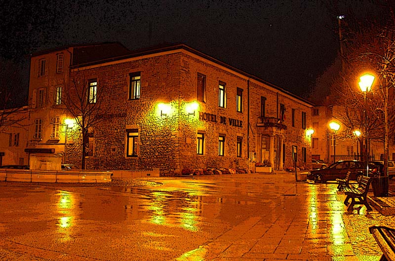
Ambronay is a charming commune located in the Ain department in the Auvergne-Rhône-Alpes region of southeastern France. Nestled near the banks of the Ain River and surrounded by picturesque landscapes, it provides several opportunities for hiking and enjoying nature.
Hiking Trails
-
Local Trails: The area around Ambronay features several marked hiking paths that cater to various skill levels. You can find easy walks suitable for families as well as more challenging hikes for experienced trekkers.
-
Surrounding Nature: The trails often take you through beautiful forests, rolling hills, and vineyards, showcasing the region's natural beauty. Be prepared to encounter local wildlife and various flora along the way.
-
Historical Routes: Some trails might lead to historical landmarks or points of interest, such as the nearby Abbey of Ambronay, a significant cultural site.
Tips for Hiking in Ambronay
-
Maps and Navigation: Obtain a good map of the hiking trails or use reliable GPS apps to stay on track. Local tourist offices can provide useful information regarding trail conditions and maps.
-
Weather Considerations: Check the weather forecast before heading out, as conditions can change quickly in the mountains.
-
Gear Recommendations: Wear appropriate hiking shoes, carry enough water, and pack snacks. Depending on the season, layers may be necessary to adjust to changing temperatures.
-
Leave No Trace: Respect the natural environment by following the Leave No Trace principles, ensuring you carry out all trash and minimize your impact on the wilderness.
Recommendations
-
Best Time to Hike: The ideal time for hiking in Ambronay is during the spring and fall when temperatures are mild, and the scenery is particularly beautiful with blooming flowers and vibrant autumn foliage.
-
Guided Tours: If you prefer exploring with a local expert, consider joining a guided hiking tour. Local guides can offer insights about the flora, fauna, and history of the area.
Whether you're a casual hiker or an experienced trekker, Ambronay offers a peaceful escape with its scenic trails and tranquil environment. Enjoy your hiking adventure!
- Country:

- Postal Code: 01500
- Coordinates: 46° 0' 20" N, 5° 21' 38" E


- GPS tracks (wikiloc): [Link]
- Area: 33.55 sq km
- Population: 2615
- Web site: http://www.ambronay.fr
- Wikipedia en: wiki(en)
- Wikipedia: wiki(fr)
- Wikidata storage: Wikidata: Q193533
- Wikipedia Commons Category: [Link]
- Wikipedia Commons Maps Category: [Link]
- Freebase ID: [/m/07tnny]
- Freebase ID: [/m/07tnny]
- GeoNames ID: Alt: [3037884]
- GeoNames ID: Alt: [3037884]
- SIREN number: [210100079]
- SIREN number: [210100079]
- BnF ID: [119384951]
- BnF ID: [119384951]
- VIAF ID: Alt: [136056522]
- VIAF ID: Alt: [136056522]
- GND ID: Alt: [7591733-6]
- GND ID: Alt: [7591733-6]
- Library of Congress authority ID: Alt: [n81135639]
- Library of Congress authority ID: Alt: [n81135639]
- PACTOLS thesaurus ID: [pcrtTT6sGvSKno]
- PACTOLS thesaurus ID: [pcrtTT6sGvSKno]
- MusicBrainz area ID: [fc45744f-9dcb-4ca5-852c-36fe2682b6ef]
- MusicBrainz area ID: [fc45744f-9dcb-4ca5-852c-36fe2682b6ef]
- INSEE municipality code: 01007
- INSEE municipality code: 01007
Shares border with regions:

Ambérieu-en-Bugey
- commune in Ain, France
Hiking in Ambérieu-en-Bugey
Ambérieu-en-Bugey is a charming commune located in the Ain department of the Auvergne-Rhône-Alpes region in southeastern France. It's surrounded by the beautiful Bugey mountains, making it an excellent destination for hiking enthusiasts. Here are some highlights and tips for hiking in and around Ambérieu-en-Bugey:...
- Country:
- Postal Code: 01500
- Coordinates: 45° 57' 29" N, 5° 21' 28" E
- GPS tracks (wikiloc): [Link]
- AboveSeaLevel: 247 м m
- Area: 24.6 sq km
- Population: 14081
- Web site: [Link]

L'Abergement-de-Varey
- commune in Ain, France
Hiking in L'Abergement-de-Varey
L'Abergement-de-Varey, located in the Auvergne-Rhône-Alpes region of France, is a picturesque village that offers stunning landscapes and various hiking opportunities. Nestled in the foothills of the Alps, it boasts a mix of lush forests, rolling hills, and panoramic views, making it an appealing destination for outdoor enthusiasts....
- Country:
- Postal Code: 01640
- Coordinates: 46° 0' 25" N, 5° 25' 28" E
- GPS tracks (wikiloc): [Link]
- Area: 9.15 sq km
- Population: 241
- Web site: [Link]

Pont-d'Ain
- commune in Ain, France
Hiking in Pont-d'Ain
Pont-d'Ain is a charming town located in the Ain department of the Auvergne-Rhône-Alpes region in France. It offers a variety of hiking opportunities that allow you to explore its natural beauty and picturesque landscapes. Here are some things to consider for hiking in Pont-d'Ain:...
- Country:
- Postal Code: 01160
- Coordinates: 46° 2' 54" N, 5° 20' 11" E
- GPS tracks (wikiloc): [Link]
- Area: 11.22 sq km
- Population: 2867
- Web site: [Link]
Varambon
- commune in Ain, France
Hiking in Varambon
Varambon is a charming commune located in the Auvergne-Rhône-Alpes region of France, known for its picturesque landscapes and proximity to various natural attractions. While Varambon itself is a smaller village, its location makes it ideal for hiking enthusiasts looking to explore the surrounding countryside and mountain ranges, such as the Jura Mountains and the nearby Alps....
- Country:
- Postal Code: 01160
- Coordinates: 46° 2' 25" N, 5° 18' 59" E
- GPS tracks (wikiloc): [Link]
- Area: 7.99 sq km
- Population: 535
- Web site: [Link]

Saint-Jean-le-Vieux
- commune in Ain, France
Hiking in Saint-Jean-le-Vieux
Saint-Jean-le-Vieux, located in the Ain department of France, offers a beautiful setting for hiking enthusiasts. Nestled in the picturesque Bugey region, the area boasts stunning landscapes characterized by rolling hills, rivers, and forested areas....
- Country:
- Postal Code: 01640
- Coordinates: 46° 1' 42" N, 5° 23' 21" E
- GPS tracks (wikiloc): [Link]
- Area: 15.33 sq km
- Population: 1663
- Web site: [Link]

Château-Gaillard
- commune in Ain, France
Hiking in Château-Gaillard
Château-Gaillard, located in the Ain department in the Auvergne-Rhône-Alpes region of France, is a beautiful area known for its stunning landscapes and rich historical significance. Here are some key points about hiking in this picturesque location:...
- Country:
- Postal Code: 01500
- Coordinates: 45° 58' 24" N, 5° 18' 15" E
- GPS tracks (wikiloc): [Link]
- Area: 16.06 sq km
- Population: 2053
- Web site: [Link]

Saint-Rambert-en-Bugey
- commune in Ain, France
Hiking in Saint-Rambert-en-Bugey
Saint-Rambert-en-Bugey is a charming commune located in the Ain department in the Auvergne-Rhône-Alpes region of France. The area is known for its natural beauty, making it a great spot for hiking enthusiasts. Here are some key points about hiking in and around Saint-Rambert-en-Bugey:...
- Country:
- Postal Code: 01230
- Coordinates: 45° 56' 55" N, 5° 26' 17" E
- GPS tracks (wikiloc): [Link]
- Area: 28.55 sq km
- Population: 2311
- Web site: [Link]

Douvres
- commune in Ain, France
Hiking in Douvres
Douvres, also known as Dover, is located in the southeast of England and is famous for its stunning white cliffs, historical significance, and coastal trails. Hiking in this area offers a variety of experiences, from breathtaking views of the English Channel to opportunities to explore historical sites....
- Country:
- Postal Code: 01500
- Coordinates: 45° 59' 20" N, 5° 22' 23" E
- GPS tracks (wikiloc): [Link]
- Area: 5.26 sq km
- Population: 1058
- Web site: [Link]


Priay
- commune in Ain, France
Hiking in Priay
It seems like there might be a typo in your query as "Priay" does not seem to correspond to a well-known hiking destination. If you meant "Priay," it would help to have more context or a specific area in mind....
- Country:
- Postal Code: 01160
- Coordinates: 46° 0' 12" N, 5° 17' 24" E
- GPS tracks (wikiloc): [Link]
- Area: 15.77 sq km
- Population: 1685
- Web site: [Link]