Ancinnes (Ancinnes)

- commune in Sarthe, France
- Country:

- Postal Code: 72610
- Coordinates: 48° 22' 3" N, 0° 10' 35" E


- GPS tracks (wikiloc): [Link]
- Area: 27.21 sq km
- Population: 972
- Wikipedia en: wiki(en)
- Wikipedia: wiki(fr)
- Wikidata storage: Wikidata: Q1171369
- Wikipedia Commons Category: [Link]
- Freebase ID: [/m/02r6vlx]
- GeoNames ID: Alt: [6452499]
- SIREN number: [217200054]
- BnF ID: [15273565b]
- INSEE municipality code: 72005
Shares border with regions:


Bourg-le-Roi
- commune in Sarthe, France
- Country:
- Postal Code: 72610
- Coordinates: 48° 20' 45" N, 0° 7' 56" E
- GPS tracks (wikiloc): [Link]
- Area: 0.36 sq km
- Population: 315


Neufchâtel-en-Saosnois
- commune in Sarthe, France
- Country:
- Postal Code: 72600
- Coordinates: 48° 22' 37" N, 0° 14' 43" E
- GPS tracks (wikiloc): [Link]
- Area: 23.41 sq km
- Population: 1032
Louvigny
- commune in Sarthe, France
- Country:
- Postal Code: 72600
- Coordinates: 48° 20' 19" N, 0° 12' 5" E
- GPS tracks (wikiloc): [Link]
- Area: 8.71 sq km
- Population: 189

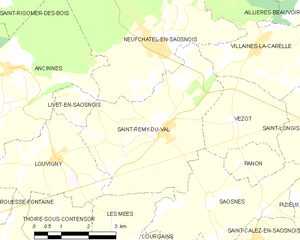
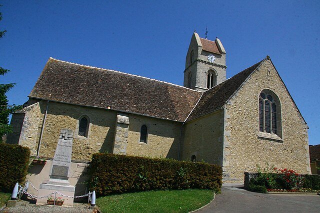
Saint-Rémy-du-Val
- commune in Sarthe, France
- Country:
- Postal Code: 72600
- Coordinates: 48° 20' 59" N, 0° 15' 17" E
- GPS tracks (wikiloc): [Link]
- AboveSeaLevel: 160 м m
- Area: 16.54 sq km
- Population: 531

Saint-Rigomer-des-Bois
- former commune in Sarthe, France
- Country:
- Postal Code: 72610
- Coordinates: 48° 23' 20" N, 0° 10' 18" E
- GPS tracks (wikiloc): [Link]
- Population: 464


Chérisay
- commune in Sarthe, France
- Country:
- Postal Code: 72610
- Coordinates: 48° 21' 18" N, 0° 6' 45" E
- GPS tracks (wikiloc): [Link]
- Area: 7.99 sq km
- Population: 311

Rouessé-Fontaine
- commune in Sarthe, France
- Country:
- Postal Code: 72610
- Coordinates: 48° 19' 21" N, 0° 8' 59" E
- GPS tracks (wikiloc): [Link]
- Area: 12.48 sq km
- Population: 278
Livet-en-Saosnois
- commune in Sarthe, France
- Country:
- Postal Code: 72610
- Coordinates: 48° 21' 35" N, 0° 12' 39" E
- GPS tracks (wikiloc): [Link]
- Area: 1.6 sq km
- Population: 71


Champfleur
- commune in Sarthe, France
- Country:
- Postal Code: 72610
- Coordinates: 48° 23' 10" N, 0° 7' 40" E
- GPS tracks (wikiloc): [Link]
- Area: 13.14 sq km
- Population: 1388