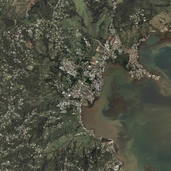
arrondissement of La Trinité (arrondissement de La Trinité)
- arrondissement of France
- Country:

- Capital: La Trinité
- Coordinates: 14° 44' 16" N, 60° 57' 47" E


- GPS tracks (wikiloc): [Link]
- AboveSeaLevel: 61 м m
- Area: 338 sq km
- Population: 79994
- Wikipedia en: wiki(en)
- Wikipedia: wiki(fr)
- Wikidata storage: Wikidata: Q701385
- Freebase ID: [/m/0953r6]
- GeoNames ID: Alt: [3570445]
- INSEE arrondissement code: [9722]
Includes regions:

canton of Le Lorrain
- canton of France
- Country:

- Capital: Le Lorrain
- Coordinates: 14° 49' 0" N, 61° 4' 0" E


- GPS tracks (wikiloc): [Link]
- Area: 50.33 sq km

canton of Gros-Morne
- canton of France
- Country:

- Capital: Gros-Morne
- Coordinates: 14° 42' 22" N, 61° 0' 31" E


- GPS tracks (wikiloc): [Link]
- Area: 54.25 sq km

canton of Basse-Pointe
- canton of France
- Country:

- Capital: Basse-Pointe
- Coordinates: 14° 52' 8" N, 61° 7' 16" E


- GPS tracks (wikiloc): [Link]
- Area: 27.95 sq km

canton of Sainte-Marie-2-Sud
- canton of France
- Country:

- Capital: Sainte-Marie
- Coordinates: 14° 46' 56" N, 60° 59' 55" E


- GPS tracks (wikiloc): [Link]
- Population: 11376
canton of Le Marigot
- canton of France
- Country:

- Capital: Le Marigot
- Coordinates: 14° 49' 0" N, 61° 2' 0" E


- GPS tracks (wikiloc): [Link]
- Area: 21.63 sq km

canton of L'Ajoupa-Bouillon
- canton of France
- Country:

- Capital: L'Ajoupa-Bouillon
- Coordinates: 14° 49' 0" N, 61° 7' 0" E


- GPS tracks (wikiloc): [Link]
- Area: 12.30 sq km

canton of Sainte-Marie-1-Nord
- canton of France
- Country:

- Capital: Sainte-Marie
- Coordinates: 14° 46' 56" N, 60° 59' 55" E


- GPS tracks (wikiloc): [Link]

canton of La Trinité
- canton of France (until March 2015)
- Country:

- Capital: La Trinité
- Coordinates: 14° 44' 0" N, 60° 58' 0" E


- GPS tracks (wikiloc): [Link]
- Area: 45.77 sq km

canton of Macouba
- canton of France (until March 2015)
- Country:

- Capital: Macouba
- Coordinates: 14° 52' 34" N, 61° 8' 25" E


- GPS tracks (wikiloc): [Link]
- Area: 33.53 sq km

