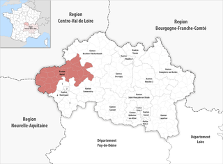
arrondissement of Montluçon (arrondissement de Montluçon)
- arrondissement of France
- Country:

- Capital: Montluçon
- Coordinates: 46° 25' 0" N, 2° 40' 0" E


- GPS tracks (wikiloc): [Link]
- Area: 2328 sq km
- Population: 109558
- Wikipedia en: wiki(en)
- Wikipedia: wiki(fr)
- Wikidata storage: Wikidata: Q701790
- Freebase ID: [/m/095j2q]
- GeoNames ID: Alt: [2992291]
- Library of Congress authority ID: Alt: [n89600842]
- INSEE arrondissement code: [031]
- GNS Unique Feature ID: -1453135
Includes regions:

canton of Montmarault
- canton of France (until March 2015)
- Country:
- Capital: Montmarault
- Coordinates: 46° 19' 6" N, 2° 57' 20" E
- GPS tracks (wikiloc): [Link]


canton of Commentry
- canton of France
- Country:
- Capital: Commentry
- Coordinates: 46° 17' 23" N, 2° 44' 32" E
- GPS tracks (wikiloc): [Link]
- Population: 18580


canton of Marcillat-en-Combraille
- canton of France
- Country:
- Capital: Marcillat-en-Combraille
- Coordinates: 46° 10' 4" N, 2° 38' 3" E
- GPS tracks (wikiloc): [Link]


canton of Huriel
- canton of France
- Country:
- Capital: Huriel
- Coordinates: 46° 22' 26" N, 2° 28' 39" E
- GPS tracks (wikiloc): [Link]
- Population: 16302