arrondissement of Rouen (arrondissement de Rouen)

- arrondissement of France
- Country:

- Capital: Rouen
- Coordinates: 49° 30' 0" N, 1° 0' 0" E


- GPS tracks (wikiloc): [Link]
- Area: 1893 sq km
- Population: 630253
- Wikipedia en: wiki(en)
- Wikipedia: wiki(fr)
- Wikidata storage: Wikidata: Q262723
- Freebase ID: [/m/0954zf]
- GeoNames ID: Alt: [2982651]
- INSEE arrondissement code: [763]
- GNS Unique Feature ID: -1462808
Includes regions:


Ry
- commune in Seine-Maritime, France
- Country:
- Postal Code: 76116
- Coordinates: 49° 28' 17" N, 1° 20' 37" E
- GPS tracks (wikiloc): [Link]
- Area: 5.71 sq km
- Population: 718
- Web site: [Link]

canton of Le Grand-Quevilly
- canton of France
- Country:
- Capital: Le Grand-Quevilly
- Coordinates: 49° 25' 0" N, 1° 2' 0" E
- GPS tracks (wikiloc): [Link]
- Population: 34394

canton of Boos
- canton of France (until March 2015)
- Country:
- Capital: Boos, Seine-Maritime
- Coordinates: 49° 23' 4" N, 1° 11' 0" E
- GPS tracks (wikiloc): [Link]


canton of Elbeuf
- canton of France
- Country:
- Capital: Elbeuf
- Coordinates: 49° 18' 9" N, 0° 59' 28" E
- GPS tracks (wikiloc): [Link]
- Population: 31230


canton of Darnétal
- canton of France
- Country:
- Capital: Darnétal
- Coordinates: 49° 27' 42" N, 1° 15' 19" E
- GPS tracks (wikiloc): [Link]
- Population: 36723

canton of Yvetot
- canton of France
- Country:
- Capital: Yvetot
- Coordinates: 49° 36' 59" N, 0° 44' 5" E
- GPS tracks (wikiloc): [Link]
- Population: 43359

canton of Buchy
- French canton
- Country:
- Capital: Buchy, Seine-Maritime
- Coordinates: 49° 32' 47" N, 1° 20' 35" E
- GPS tracks (wikiloc): [Link]


canton of Caudebec-lès-Elbeuf
- canton of France
- Country:
- Capital: Caudebec-lès-Elbeuf
- Coordinates: 49° 18' 18" N, 1° 4' 3" E
- GPS tracks (wikiloc): [Link]
- Population: 36240


canton of Le Petit-Quevilly
- canton of France
- Country:
- Capital: Le Petit-Quevilly
- Coordinates: 49° 26' 0" N, 1° 2' 0" E
- GPS tracks (wikiloc): [Link]
- Population: 30100


canton of Bois-Guillaume
- canton of France
- Country:
- Capital: Bois-Guillaume
- Coordinates: 49° 28' 19" N, 1° 7' 22" E
- GPS tracks (wikiloc): [Link]
- Population: 43147
canton of Caudebec-en-Caux
- canton of France
- Country:
- Capital: Caudebec-en-Caux
- Coordinates: 49° 31' 25" N, 0° 41' 57" E
- GPS tracks (wikiloc): [Link]


canton of Doudeville
- canton of France
- Country:
- Capital: Doudeville
- Coordinates: 49° 43' 52" N, 0° 49' 46" E
- GPS tracks (wikiloc): [Link]


canton of Mont-Saint-Aignan
- canton of France
- Country:
- Capital: Mont-Saint-Aignan
- Coordinates: 49° 27' 54" N, 1° 4' 12" E
- GPS tracks (wikiloc): [Link]
- Population: 29573


canton of Notre-Dame-de-Bondeville
- canton of France
- Country:
- Capital: Notre-Dame-de-Bondeville
- Coordinates: 49° 30' 13" N, 1° 1' 10" E
- GPS tracks (wikiloc): [Link]
- Population: 42229


canton of Sotteville-lès-Rouen-Est
- canton of France
- Country:
- Capital: Sotteville-lès-Rouen
- Coordinates: 49° 23' 38" N, 1° 5' 51" E
- GPS tracks (wikiloc): [Link]
canton of Sotteville-lès-Rouen-Ouest
- canton of France
- Country:
- Capital: Sotteville-lès-Rouen
- Coordinates: 49° 25' 0" N, 1° 6' 0" E
- GPS tracks (wikiloc): [Link]

canton of Grand-Couronne
- canton of France (until March 2015)
- Country:
- Capital: Grand-Couronne
- Coordinates: 49° 21' 57" N, 0° 58' 24" E
- GPS tracks (wikiloc): [Link]


Rouen
- commune in Seine-Maritime, France
- Country:
- Postal Code: 76000
- Licence Plate Code: 76
- Coordinates: 49° 26' 35" N, 1° 6' 9" E
- GPS tracks (wikiloc): [Link]
- AboveSeaLevel: 10 м m
- Area: 21.38 sq km
- Population: 110169
- Web site: [Link]

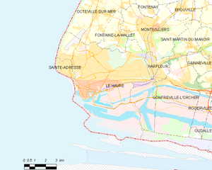
Le Havre
- commune in Seine-Maritime, France
- Country:
- Postal Code: 76600
- Local Dialing Code: 39
- Coordinates: 49° 29' 39" N, 0° 6' 29" E
- GPS tracks (wikiloc): [Link]
- AboveSeaLevel: 2 м m
- Area: 46.95 sq km
- Population: 172366
- Web site: [Link]


canton of Saint-Étienne-du-Rouvray
- canton of France
- Country:
- Capital: Saint-Étienne-du-Rouvray
- Coordinates: 49° 21' 32" N, 1° 5' 53" E
- GPS tracks (wikiloc): [Link]
- Population: 32791