Augé (Augé)

- commune in Deux-Sèvres, France
- Country:

- Postal Code: 79400
- Coordinates: 46° 26' 20" N, 0° 17' 15" E


- GPS tracks (wikiloc): [Link]
- Area: 23.33 sq km
- Population: 944
- Wikipedia en: wiki(en)
- Wikipedia: wiki(fr)
- Wikidata storage: Wikidata: Q580596
- Wikipedia Commons Category: [Link]
- Freebase ID: [/m/03mg1hd]
- GeoNames ID: Alt: [6455268]
- SIREN number: [217900208]
- BnF ID: [152761560]
- INSEE municipality code: 79020
Shares border with regions:


Azay-le-Brûlé
- commune in Deux-Sèvres, France
- Country:
- Postal Code: 79400
- Coordinates: 46° 23' 55" N, 0° 17' 14" E
- GPS tracks (wikiloc): [Link]
- Area: 22.1 sq km
- Population: 1901


La Chapelle-Bâton
- commune in Deux-Sèvres, France
- Country:
- Postal Code: 79220
- Coordinates: 46° 28' 25" N, 0° 19' 46" E
- GPS tracks (wikiloc): [Link]
- AboveSeaLevel: 109 м m
- Area: 16.93 sq km
- Population: 406
Saivres
- commune in Deux-Sèvres, France
- Country:
- Postal Code: 79400
- Coordinates: 46° 25' 54" N, 0° 14' 13" E
- GPS tracks (wikiloc): [Link]
- Area: 21.24 sq km
- Population: 1435
Saint-Georges-de-Noisné
- commune in Deux-Sèvres, France
- Country:
- Postal Code: 79400
- Coordinates: 46° 29' 34" N, 0° 15' 24" E
- GPS tracks (wikiloc): [Link]
- Area: 24.64 sq km
- Population: 720
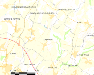
Cherveux
- commune in Deux-Sèvres, France
- Country:
- Postal Code: 79410
- Coordinates: 46° 24' 56" N, 0° 21' 26" E
- GPS tracks (wikiloc): [Link]
- Area: 22.25 sq km
- Population: 1841


Verruyes
- commune in Deux-Sèvres, France
- Country:
- Postal Code: 79310
- Coordinates: 46° 30' 58" N, 0° 17' 22" E
- GPS tracks (wikiloc): [Link]
- Area: 26.24 sq km
- Population: 917