Avrillé (Avrillé)

- commune in Maine-et-Loire, France
- Country:

- Postal Code: 49240
- Coordinates: 47° 30' 25" N, 0° 35' 20" E


- GPS tracks (wikiloc): [Link]
- Area: 15.85 sq km
- Population: 13518
- Web site: http://www.ville-avrille.fr
- Wikipedia en: wiki(en)
- Wikipedia: wiki(fr)
- Wikidata storage: Wikidata: Q791403
- Wikipedia Commons Category: [Link]
- Freebase ID: [/m/03x_sn5]
- Freebase ID: [/m/03x_sn5]
- Freebase ID: [/m/03x_sn5]
- GeoNames ID: Alt: [6458642]
- GeoNames ID: Alt: [6458642]
- GeoNames ID: Alt: [6458642]
- SIREN number: [214900151]
- SIREN number: [214900151]
- SIREN number: [214900151]
- BnF ID: [152616172]
- BnF ID: [152616172]
- BnF ID: [152616172]
- VIAF ID: Alt: [168492720]
- VIAF ID: Alt: [168492720]
- VIAF ID: Alt: [168492720]
- GND ID: Alt: [4419389-0]
- GND ID: Alt: [4419389-0]
- GND ID: Alt: [4419389-0]
- PACTOLS thesaurus ID: [pcrtaLGlxuqGd6]
- PACTOLS thesaurus ID: [pcrtaLGlxuqGd6]
- PACTOLS thesaurus ID: [pcrtaLGlxuqGd6]
- Twitter username: Alt: [avrille49]
- Twitter username: Alt: [avrille49]
- Twitter username: Alt: [avrille49]
- INSEE municipality code: 49015
- INSEE municipality code: 49015
- INSEE municipality code: 49015
Shares border with regions:


Cantenay-Épinard
- commune in Maine-et-Loire, France
- Country:
- Postal Code: 49460
- Coordinates: 47° 32' 0" N, 0° 34' 7" E
- GPS tracks (wikiloc): [Link]
- Area: 16.1 sq km
- Population: 2125
- Web site: [Link]

La Meignanne
- former commune in Maine-et-Loire, France
- Country:
- Postal Code: 49770
- Coordinates: 47° 31' 10" N, 0° 40' 9" E
- GPS tracks (wikiloc): [Link]
- AboveSeaLevel: 35 м m
- Area: 23.39 sq km
- Population: 2317
- Web site: [Link]


Montreuil-Juigné
- commune in Maine-et-Loire, France
- Country:
- Postal Code: 49460
- Coordinates: 47° 31' 42" N, 0° 36' 43" E
- GPS tracks (wikiloc): [Link]
- AboveSeaLevel: 50 м m
- Area: 13.81 sq km
- Population: 7497
- Web site: [Link]

Angers
- commune in Maine-et-Loire, France
- Country:
- Postal Code: 49100; 49000
- Coordinates: 47° 28' 22" N, 0° 33' 20" E
- GPS tracks (wikiloc): [Link]
- AboveSeaLevel: 20 м m
- Area: 42.7 sq km
- Population: 151520
- Web site: [Link]

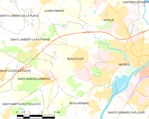
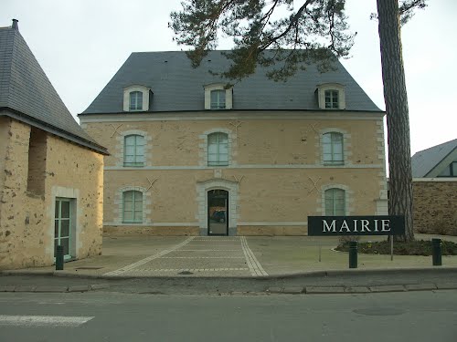
Beaucouzé
- commune in Maine-et-Loire, France
- Country:
- Postal Code: 49070
- Coordinates: 47° 28' 32" N, 0° 37' 58" E
- GPS tracks (wikiloc): [Link]
- AboveSeaLevel: 67 м m
- Area: 19.34 sq km
- Population: 5042
- Web site: [Link]