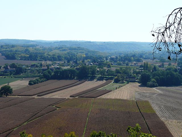
Badefols-sur-Dordogne (Badefols-sur-Dordogne)

- commune in Dordogne, France
- Country:

- Postal Code: 24150
- Coordinates: 44° 50' 36" N, 0° 47' 29" E


- GPS tracks (wikiloc): [Link]
- Area: 6.06 sq km
- Population: 212
- Web site: http://www.badefols-sur-dordogne.fr
- Wikipedia en: wiki(en)
- Wikipedia: wiki(fr)
- Wikidata storage: Wikidata: Q654828
- Wikipedia Commons Category: [Link]
- Freebase ID: [/m/02vmfk_]
- Freebase ID: [/m/02vmfk_]
- GeoNames ID: Alt: [6447752]
- GeoNames ID: Alt: [6447752]
- SIREN number: [212400220]
- SIREN number: [212400220]
- BnF ID: [15251673b]
- BnF ID: [15251673b]
- VIAF ID: Alt: [145543398]
- VIAF ID: Alt: [145543398]
- Library of Congress authority ID: Alt: [n89615682]
- Library of Congress authority ID: Alt: [n89615682]
- Trismegistos Geo ID: [22782]
- Trismegistos Geo ID: [22782]
- INSEE municipality code: 24022
- INSEE municipality code: 24022
Shares border with regions:

Calès
- commune in Dordogne, France
- Country:
- Postal Code: 24150
- Coordinates: 44° 51' 24" N, 0° 48' 45" E
- GPS tracks (wikiloc): [Link]
- Area: 8.02 sq km
- Population: 398


Mauzac-et-Grand-Castang
- commune in Dordogne, France
- Country:
- Postal Code: 24150
- Coordinates: 44° 51' 52" N, 0° 47' 50" E
- GPS tracks (wikiloc): [Link]
- Area: 15.85 sq km
- Population: 887


Lalinde
- commune in Dordogne, France
- Country:
- Postal Code: 24150
- Coordinates: 44° 50' 13" N, 0° 44' 17" E
- GPS tracks (wikiloc): [Link]
- Area: 27.7 sq km
- Population: 2848
- Web site: [Link]

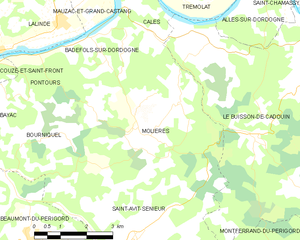
Molières
- commune in Dordogne, France
- Country:
- Postal Code: 24480
- Coordinates: 44° 48' 38" N, 0° 49' 26" E
- GPS tracks (wikiloc): [Link]
- Area: 21.22 sq km
- Population: 326
- Web site: [Link]