Ballots (Ballots)

- commune in Mayenne, France
- Country:

- Postal Code: 53350
- Coordinates: 47° 53' 42" N, 1° 2' 49" E


- GPS tracks (wikiloc): [Link]
- Area: 36.01 sq km
- Population: 1269
- Web site: http://www.ballots.fr
- Wikipedia en: wiki(en)
- Wikipedia: wiki(fr)
- Wikidata storage: Wikidata: Q1066471
- Wikipedia Commons Category: [Link]
- Freebase ID: [/m/0b69xg]
- Freebase ID: [/m/0b69xg]
- GeoNames ID: Alt: [6449636]
- GeoNames ID: Alt: [6449636]
- SIREN number: [215300187]
- SIREN number: [215300187]
- BnF ID: [15263812c]
- BnF ID: [15263812c]
- VIAF ID: Alt: [243255076]
- VIAF ID: Alt: [243255076]
- PACTOLS thesaurus ID: [pcrtSxLIENA2J8]
- PACTOLS thesaurus ID: [pcrtSxLIENA2J8]
- Quora topic ID: [Ballots]
- Quora topic ID: [Ballots]
- INSEE municipality code: 53018
- INSEE municipality code: 53018
Shares border with regions:


Saint-Michel-de-la-Roë
- commune in Mayenne, France
- Country:
- Postal Code: 53350
- Coordinates: 47° 52' 48" N, 1° 7' 39" E
- GPS tracks (wikiloc): [Link]
- Area: 13.22 sq km
- Population: 261
- Web site: [Link]
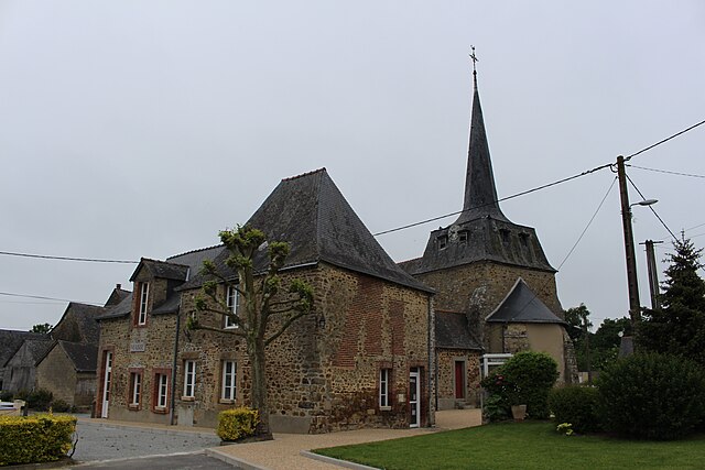
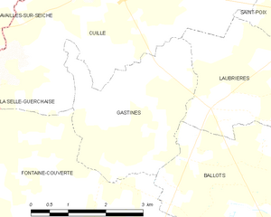
Gastines
- commune in Mayenne, France
- Country:
- Postal Code: 53540
- Coordinates: 47° 57' 7" N, 1° 6' 13" E
- GPS tracks (wikiloc): [Link]
- Area: 8.85 sq km
- Population: 159

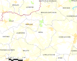
Méral
- commune in Mayenne, France
- Country:
- Postal Code: 53230
- Coordinates: 47° 57' 38" N, 0° 58' 50" E
- GPS tracks (wikiloc): [Link]
- Area: 29.5 sq km
- Population: 1084
- Web site: [Link]


Laubrières
- commune in Mayenne, France
- Country:
- Postal Code: 53540
- Coordinates: 47° 56' 30" N, 1° 5' 3" E
- GPS tracks (wikiloc): [Link]
- Area: 8.31 sq km
- Population: 343


Fontaine-Couverte
- commune in Mayenne, France
- Country:
- Postal Code: 53350
- Coordinates: 47° 54' 30" N, 1° 8' 34" E
- GPS tracks (wikiloc): [Link]
- Area: 21.65 sq km
- Population: 437


La Selle-Craonnaise
- commune in Mayenne, France
- Country:
- Postal Code: 53800
- Coordinates: 47° 50' 34" N, 1° 2' 33" E
- GPS tracks (wikiloc): [Link]
- Area: 29.17 sq km
- Population: 956
- Web site: [Link]


La Roë
- commune in Mayenne, France
- Country:
- Postal Code: 53350
- Coordinates: 47° 53' 42" N, 1° 6' 40" E
- GPS tracks (wikiloc): [Link]
- Area: 8.76 sq km
- Population: 242


Livré-la-Touche
- commune in Mayenne, France
- Country:
- Postal Code: 53400
- Coordinates: 47° 52' 52" N, 0° 58' 52" E
- GPS tracks (wikiloc): [Link]
- Area: 30.08 sq km
- Population: 756
- Web site: [Link]