Banca (Banca)

- commune in Pyrénées-Atlantiques, France
- Country:

- Postal Code: 64430
- Coordinates: 43° 7' 35" N, 1° 22' 27" E


- GPS tracks (wikiloc): [Link]
- Area: 49.6 sq km
- Population: 336
- Wikipedia en: wiki(en)
- Wikipedia: wiki(fr)
- Wikidata storage: Wikidata: Q839427
- Wikipedia Commons Category: [Link]
- Freebase ID: [/m/08f4wv]
- Freebase ID: [/m/08f4wv]
- GeoNames ID: Alt: [6450424]
- GeoNames ID: Alt: [6450424]
- SIREN number: [216400929]
- SIREN number: [216400929]
- BnF ID: [152699154]
- BnF ID: [152699154]
- WOEID: [578004]
- WOEID: [578004]
- INSEE municipality code: 64092
- INSEE municipality code: 64092
Shares border with regions:


Anhaux
- commune in Pyrénées-Atlantiques, France
- Country:
- Postal Code: 64220
- Coordinates: 43° 10' 5" N, 1° 17' 27" E
- GPS tracks (wikiloc): [Link]
- Area: 12.33 sq km
- Population: 400


Lasse
- commune in Pyrénées-Atlantiques, France
- Country:
- Postal Code: 64220
- Coordinates: 43° 9' 26" N, 1° 15' 36" E
- GPS tracks (wikiloc): [Link]
- Area: 14.79 sq km
- Population: 326

Saint-Étienne-de-Baïgorry
- commune in Pyrénées-Atlantiques, France
- Country:
- Postal Code: 64430
- Coordinates: 43° 10' 30" N, 1° 20' 47" E
- GPS tracks (wikiloc): [Link]
- Area: 69.44 sq km
- Population: 1531
- Web site: [Link]


Aldudes
- commune in Pyrénées-Atlantiques, France
- Country:
- Postal Code: 64430
- Coordinates: 43° 5' 46" N, 1° 25' 33" E
- GPS tracks (wikiloc): [Link]
- Area: 23.27 sq km
- Population: 312
- Web site: [Link]
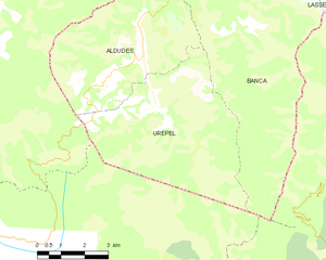
Urepel
- commune in Pyrénées-Atlantiques, France
- Country:
- Postal Code: 64430
- Coordinates: 43° 4' 11" N, 1° 24' 59" E
- GPS tracks (wikiloc): [Link]
- Area: 26.44 sq km
- Population: 292