Bardou (Bardou)

- commune in Dordogne, France
- Country:

- Postal Code: 24560
- Coordinates: 44° 44' 14" N, 0° 41' 4" E


- GPS tracks (wikiloc): [Link]
- Area: 4.76 sq km
- Population: 43
- Wikipedia en: wiki(en)
- Wikipedia: wiki(fr)
- Wikidata storage: Wikidata: Q662313
- Wikipedia Commons Category: [Link]
- Freebase ID: [/m/03mfgs4]
- Freebase ID: [/m/03mfgs4]
- GeoNames ID: Alt: [6447754]
- GeoNames ID: Alt: [6447754]
- SIREN number: [212400246]
- SIREN number: [212400246]
- BnF ID: [152516751]
- BnF ID: [152516751]
- INSEE municipality code: 24024
- INSEE municipality code: 24024
Shares border with regions:


Monsac
- commune in Dordogne, France
- Country:
- Postal Code: 24440
- Coordinates: 44° 46' 45" N, 0° 41' 49" E
- GPS tracks (wikiloc): [Link]
- Area: 10.74 sq km
- Population: 194

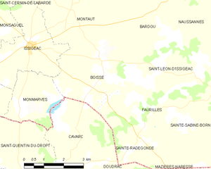
Boisse
- commune in Dordogne, France
- Country:
- Postal Code: 24560
- Coordinates: 44° 42' 57" N, 0° 39' 15" E
- GPS tracks (wikiloc): [Link]
- Area: 16.58 sq km
- Population: 248

Montaut
- commune in Dordogne, France
- Country:
- Postal Code: 24560
- Coordinates: 44° 44' 54" N, 0° 37' 36" E
- GPS tracks (wikiloc): [Link]
- AboveSeaLevel: 150 м m
- Area: 16.16 sq km
- Population: 129


Naussannes
- commune in Dordogne, France
- Country:
- Postal Code: 24440
- Coordinates: 44° 45' 19" N, 0° 43' 31" E
- GPS tracks (wikiloc): [Link]
- Area: 14.82 sq km
- Population: 235