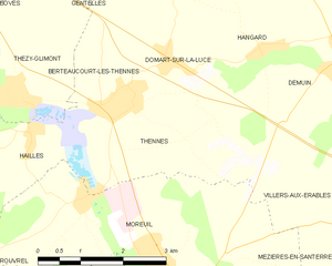
Berteaucourt-lès-Thennes (Berteaucourt-lès-Thennes)
- commune in Somme, France
- Country:

- Postal Code: 80110
- Coordinates: 49° 48' 48" N, 2° 27' 52" E


- GPS tracks (wikiloc): [Link]
- Area: 2.62 sq km
- Population: 439
- Web site: https://lapagelocale.fr/80110-berteaucourt-les-thennes
- Wikipedia en: wiki(en)
- Wikipedia: wiki(fr)
- Wikidata storage: Wikidata: Q925831
- Wikipedia Commons Category: [Link]
- Freebase ID: [/m/03m739l]
- GeoNames ID: Alt: [6451331]
- SIREN number: [218000891]
- BnF ID: [15276578d]
- VIAF ID: Alt: [240022595]
- PACTOLS thesaurus ID: [pcrtX2h6mQtTI0]
- INSEE municipality code: 80094
Shares border with regions:


Gentelles
- commune in Somme, France
- Country:

- Postal Code: 80380
- Coordinates: 49° 50' 43" N, 2° 27' 26" E


- GPS tracks (wikiloc): [Link]
- Area: 5.57 sq km
- Population: 609


Domart-sur-la-Luce
- commune in Somme, France
- Country:

- Postal Code: 80110
- Coordinates: 49° 49' 13" N, 2° 29' 4" E


- GPS tracks (wikiloc): [Link]
- Area: 8.59 sq km
- Population: 437
- Web site: [Link]


Thennes
- commune in Somme, France
- Country:

- Postal Code: 80110
- Coordinates: 49° 48' 39" N, 2° 28' 14" E


- GPS tracks (wikiloc): [Link]
- Area: 8 sq km
- Population: 506

Thézy-Glimont
- commune in Somme, France
- Country:

- Postal Code: 80110
- Coordinates: 49° 48' 46" N, 2° 25' 49" E


- GPS tracks (wikiloc): [Link]
- Area: 6.76 sq km
- Population: 584
- Web site: [Link]
