Beuzeville (Beuzeville)

- commune in Eure, France
- Country:

- Postal Code: 27210
- Coordinates: 49° 20' 41" N, 0° 20' 33" E


- GPS tracks (wikiloc): [Link]
- Area: 23.25 sq km
- Population: 4547
- Web site: http://www.beuzeville.fr
- Wikipedia en: wiki(en)
- Wikipedia: wiki(fr)
- Wikidata storage: Wikidata: Q1011483
- Wikipedia Commons Category: [Link]
- Freebase ID: [/m/048wwq]
- Freebase ID: [/m/048wwq]
- GeoNames ID: Alt: [6455023]
- GeoNames ID: Alt: [6455023]
- SIREN number: [212700652]
- SIREN number: [212700652]
- BnF ID: [15253306v]
- BnF ID: [15253306v]
- VIAF ID: Alt: [245790333]
- VIAF ID: Alt: [245790333]
- PACTOLS thesaurus ID: [pcrtxfhEeJM0EM]
- PACTOLS thesaurus ID: [pcrtxfhEeJM0EM]
- INSEE municipality code: 27065
- INSEE municipality code: 27065
Shares border with regions:


Saint-Benoît-d'Hébertot
- commune in Calvados, France
- Country:
- Postal Code: 14130
- Coordinates: 49° 19' 1" N, 0° 16' 10" E
- GPS tracks (wikiloc): [Link]
- Area: 7.13 sq km
- Population: 423

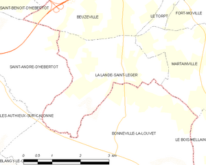
La Lande-Saint-Léger
- commune in Eure, France
- Country:
- Postal Code: 27210
- Coordinates: 49° 17' 58" N, 0° 21' 52" E
- GPS tracks (wikiloc): [Link]
- AboveSeaLevel: 152 м m
- Area: 7.96 sq km
- Population: 344


Manneville-la-Raoult
- commune in Eure, France
- Country:
- Postal Code: 27210
- Coordinates: 49° 22' 25" N, 0° 18' 51" E
- GPS tracks (wikiloc): [Link]
- Area: 7.37 sq km
- Population: 507


Boulleville
- commune in Eure, France
- Country:
- Postal Code: 27210
- Coordinates: 49° 22' 5" N, 0° 23' 32" E
- GPS tracks (wikiloc): [Link]
- Area: 7.17 sq km
- Population: 1140
- Web site: [Link]


Quetteville
- commune in Calvados, France
- Country:
- Postal Code: 14130
- Coordinates: 49° 20' 12" N, 0° 18' 31" E
- GPS tracks (wikiloc): [Link]
- Area: 10.32 sq km
- Population: 375


Saint-André-d'Hébertot
- commune in Calvados, France
- Country:
- Postal Code: 14130
- Coordinates: 49° 18' 47" N, 0° 16' 46" E
- GPS tracks (wikiloc): [Link]
- Area: 9.79 sq km
- Population: 447