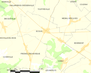
Boisemont (Boisemont)

- commune in Eure, France
- Country:

- Postal Code: 27150
- Coordinates: 49° 17' 10" N, 1° 30' 0" E


- GPS tracks (wikiloc): [Link]
- Area: 13.22 sq km
- Population: 749
- Web site: http://www.boisemont.com
- Wikipedia en: wiki(en)
- Wikipedia: wiki(fr)
- Wikidata storage: Wikidata: Q1009155
- Wikipedia Commons Category: [Link]
- Freebase ID: [/m/03mhqbm]
- Freebase ID: [/m/03mhqbm]
- GeoNames ID: Alt: [6447966]
- GeoNames ID: Alt: [6447966]
- SIREN number: [212700702]
- SIREN number: [212700702]
- BnF ID: [15253311f]
- BnF ID: [15253311f]
- VIAF ID: Alt: [168220187]
- VIAF ID: Alt: [168220187]
- Library of Congress authority ID: Alt: [n93060660]
- Library of Congress authority ID: Alt: [n93060660]
- PACTOLS thesaurus ID: [pcrti2X80P1BOE]
- PACTOLS thesaurus ID: [pcrti2X80P1BOE]
- INSEE municipality code: 27070
- INSEE municipality code: 27070
Shares border with regions:


Harquency
- commune in Eure, France
- Country:
- Postal Code: 27700
- Coordinates: 49° 15' 15" N, 1° 29' 7" E
- GPS tracks (wikiloc): [Link]
- Area: 13.95 sq km
- Population: 263
Corny
- commune in Eure, France
- Country:
- Postal Code: 27700
- Coordinates: 49° 16' 56" N, 1° 27' 28" E
- GPS tracks (wikiloc): [Link]
- Area: 5.26 sq km
- Population: 376
- Web site: [Link]

Écouis
- commune in Eure, France
- Country:
- Postal Code: 27440
- Coordinates: 49° 18' 38" N, 1° 25' 52" E
- GPS tracks (wikiloc): [Link]
- Area: 13.07 sq km
- Population: 828


Mesnil-Verclives
- commune in Eure, France
- Country:
- Postal Code: 27440
- Coordinates: 49° 19' 14" N, 1° 28' 1" E
- GPS tracks (wikiloc): [Link]
- Area: 9.96 sq km
- Population: 281
Farceaux
- commune in Eure, France
- Country:
- Postal Code: 27150
- Coordinates: 49° 17' 21" N, 1° 31' 8" E
- GPS tracks (wikiloc): [Link]
- Area: 7.56 sq km
- Population: 342


Les Andelys
- commune in Eure, France
- Country:
- Postal Code: 27700
- Coordinates: 49° 14' 44" N, 1° 24' 42" E
- GPS tracks (wikiloc): [Link]
- AboveSeaLevel: 23 м m
- Area: 40.62 sq km
- Population: 8141
- Web site: [Link]