Bournoncle-Saint-Pierre (Bournoncle-Saint-Pierre)

- commune in Haute-Loire, France
- Country:

- Postal Code: 43360
- Coordinates: 45° 20' 37" N, 3° 19' 6" E


- GPS tracks (wikiloc): [Link]
- Area: 16.16 sq km
- Population: 1001
- Wikipedia en: wiki(en)
- Wikipedia: wiki(fr)
- Wikidata storage: Wikidata: Q1065741
- Wikipedia Commons Category: [Link]
- Freebase ID: [/m/03ntj67]
- GeoNames ID: Alt: [6449025]
- SIREN number: [214300386]
- BnF ID: [152599435]
- INSEE municipality code: 43038
Shares border with regions:
Cohade
- commune in Haute-Loire, France
- Country:
- Postal Code: 43100
- Coordinates: 45° 20' 15" N, 3° 22' 25" E
- GPS tracks (wikiloc): [Link]
- Area: 9.99 sq km
- Population: 847
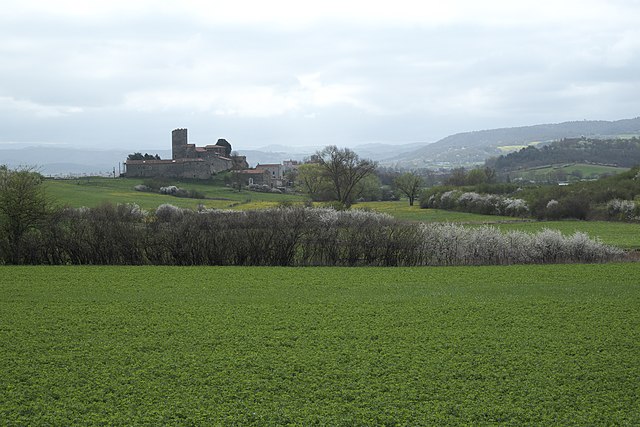
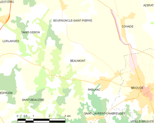
Beaumont
- commune in Haute-Loire, France
- Country:
- Postal Code: 43100
- Coordinates: 45° 18' 48" N, 3° 20' 29" E
- GPS tracks (wikiloc): [Link]
- Area: 12.03 sq km
- Population: 285


Vergongheon
- commune in Haute-Loire, France
- Country:
- Postal Code: 43360
- Coordinates: 45° 22' 16" N, 3° 19' 11" E
- GPS tracks (wikiloc): [Link]
- Area: 12.61 sq km
- Population: 1847


Saint-Géron
- commune in Haute-Loire, France
- Country:
- Postal Code: 43360
- Coordinates: 45° 20' 30" N, 3° 17' 44" E
- GPS tracks (wikiloc): [Link]
- Area: 10.76 sq km
- Population: 256


Lempdes-sur-Allagnon
- commune in Haute-Loire, France
- Country:
- Postal Code: 43410
- Coordinates: 45° 23' 7" N, 3° 16' 12" E
- GPS tracks (wikiloc): [Link]
- Area: 10.4 sq km
- Population: 1329