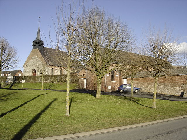
Bousies (Bousies)
- commune in Nord, France
- Country:

- Postal Code: 59222
- Coordinates: 50° 9' 4" N, 3° 36' 57" E


- GPS tracks (wikiloc): [Link]
- Area: 9.88 sq km
- Population: 1730
- Web site: http://www.bousies.fr/
- Wikipedia en: wiki(en)
- Wikipedia: wiki(fr)
- Wikidata storage: Wikidata: Q632387
- Wikipedia Commons Category: [Link]
- Freebase ID: [/m/03mh49v]
- Freebase ID: [/m/03mh49v]
- GeoNames ID: Alt: [3030845]
- GeoNames ID: Alt: [3030845]
- SIREN number: [215900994]
- SIREN number: [215900994]
- BnF ID: [152666743]
- BnF ID: [152666743]
- VIAF ID: Alt: [152637622]
- VIAF ID: Alt: [152637622]
- GND ID: Alt: [4577908-9]
- GND ID: Alt: [4577908-9]
- Library of Congress authority ID: Alt: [n2002033935]
- Library of Congress authority ID: Alt: [n2002033935]
- INSEE municipality code: 59099
- INSEE municipality code: 59099
Shares border with regions:


Croix-Caluyau
- commune in Nord, France
- Country:

- Postal Code: 59222
- Coordinates: 50° 8' 50" N, 3° 34' 51" E


- GPS tracks (wikiloc): [Link]
- Area: 4.01 sq km
- Population: 261


Forest-en-Cambrésis
- commune in Nord, France
- Country:

- Postal Code: 59222
- Coordinates: 50° 8' 27" N, 3° 34' 17" E


- GPS tracks (wikiloc): [Link]
- AboveSeaLevel: 132 м m
- Area: 8.87 sq km
- Population: 544
- Web site: [Link]


Vendegies-au-Bois
- commune in Nord, France
- Country:

- Postal Code: 59218
- Coordinates: 50° 10' 47" N, 3° 34' 43" E


- GPS tracks (wikiloc): [Link]
- Area: 9.98 sq km
- Population: 496


Poix-du-Nord
- commune in Nord, France
- Country:

- Postal Code: 59218
- Coordinates: 50° 11' 20" N, 3° 36' 28" E


- GPS tracks (wikiloc): [Link]
- Area: 8.67 sq km
- Population: 2195


Fontaine-au-Bois
- commune in Nord, France
- Country:

- Postal Code: 59550
- Coordinates: 50° 8' 20" N, 3° 39' 6" E


- GPS tracks (wikiloc): [Link]
- Area: 7.68 sq km
- Population: 700


Robersart
- commune in Nord, France
- Country:

- Postal Code: 59550
- Coordinates: 50° 9' 25" N, 3° 38' 36" E


- GPS tracks (wikiloc): [Link]
- Area: 2.33 sq km
- Population: 181
