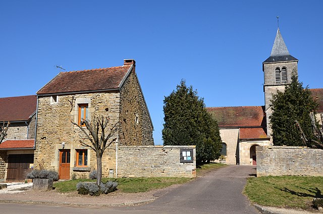
Brain (Brain)

- commune in Côte-d'Or, France
- Country:

- Postal Code: 21350
- Coordinates: 47° 27' 48" N, 4° 30' 23" E


- GPS tracks (wikiloc): [Link]
- Area: 4.13 sq km
- Population: 34
- Wikipedia en: wiki(en)
- Wikipedia: wiki(fr)
- Wikidata storage: Wikidata: Q226387
- Wikipedia Commons Category: [Link]
- Freebase ID: [/m/03mfmqt]
- GeoNames ID: Alt: [3030606]
- SIREN number: [212101000]
- BnF ID: [15250387z]
- INSEE municipality code: 21100
Shares border with regions:


Arnay-sous-Vitteaux
- commune in Côte-d'Or, France
- Country:
- Postal Code: 21350
- Coordinates: 47° 26' 46" N, 4° 29' 51" E
- GPS tracks (wikiloc): [Link]
- Area: 12.14 sq km
- Population: 109

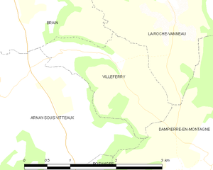
Villeferry
- commune in Côte-d'Or, France
- Country:
- Postal Code: 21350
- Coordinates: 47° 27' 19" N, 4° 30' 54" E
- GPS tracks (wikiloc): [Link]
- Area: 3.3 sq km
- Population: 30
La Roche-Vanneau
- commune in Côte-d'Or, France
- Country:
- Postal Code: 21150
- Coordinates: 47° 28' 24" N, 4° 31' 35" E
- GPS tracks (wikiloc): [Link]
- Area: 13.19 sq km
- Population: 149

Marigny-le-Cahouët
- commune in Côte-d'Or, France
- Country:
- Postal Code: 21150
- Coordinates: 47° 27' 50" N, 4° 27' 37" E
- GPS tracks (wikiloc): [Link]
- Area: 19.28 sq km
- Population: 313