
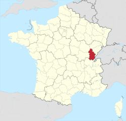
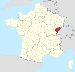
Bourgogne-Franche-Comté (Bourgogne-Franche-Comté)


- region of France
 Hiking in Bourgogne-Franche-Comté
Bourgogne-Franche-Comté, located in east-central France, is a region rich in natural beauty, history, and diverse landscapes, making it an excellent destination for hiking enthusiasts. Here are some highlights to consider when planning your hiking adventures in the area:
Diverse Landscapes
-
Vineyards and Rolling Hills: The Burgundy Wine Route offers scenic trails that meander through picturesque vineyards and charming villages. Hiking in this area allows you to taste renowned wines while taking in the stunning countryside views.
-
Jurassic Mountains: The Jura mountain range is known for its dramatic landscapes, including limestone cliffs, deep valleys, and dense forests. Trails like the GR 59, which runs through the Jura, provide a mix of challenging and moderate hikes.
-
Natural Parks:
- Haut-Jura Regional Nature Park: This park features a variety of trails, ranging from easy walks to more challenging hikes. The region is characterized by its waterfalls, pastures, and stunning viewpoints.
- Morvan Regional Natural Park: Known for its rugged terrain and lakes, Morvan offers numerous hiking paths, including those leading to the highest peak in the region, the Haut Folin.
Historical Sites
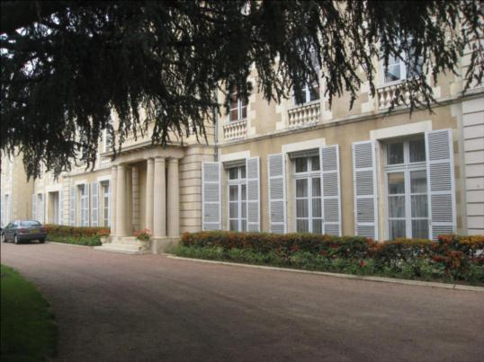
- Many hiking trails also provide access to historical sites, such as ancient castles, Roman ruins, and traditional Burgundy architecture. The Circuit des 5 Châteaux, for instance, takes you through some of the region's striking châteaux.
Trail Markings
- The hiking trails in Bourgogne-Franche-Comté are well-marked, with the GR (Grande Randonnée) network offering long-distance routes. Local trails often have signposts indicating distances and points of interest. Always carry a map or GPS for navigation.
Best Times to Hike
- The best time for hiking in Bourgogne-Franche-Comté is typically from late spring (May) through early autumn (September) when the weather is mild, and the landscapes are lush and vibrant. Autumn also offers stunning foliage, especially in the vineyard areas.
Preparation Tips
- Gear: Ensure you have proper hiking boots, clothing appropriate for the weather, and a backpack with essentials like water, snacks, a first-aid kit, and a map.
- Weather: The weather can be unpredictable, especially in the mountains, so it’s wise to check the forecast before heading out.
- Local Advice: Don’t hesitate to ask locals for recommendations on hiking routes, as they can provide insights on lesser-known trails.
Conclusion
Hiking in Bourgogne-Franche-Comté allows you to experience a blend of nature, culture, and history. Whether you prefer leisurely strolls through vineyards or more challenging adventures in the mountains, this region has something for everyone. Enjoy the breathtaking scenery, discover local heritage, and relish the peace of the great outdoors!
- Country:

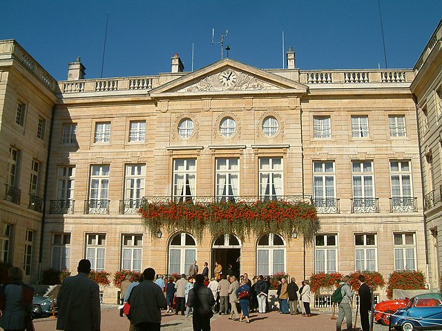
- Capital: Dijon
- Coordinates: 47° 14' 4" N, 6° 1' 50" E


- GPS tracks (wikiloc): [Link]
- Area: 47784 sq km
- Population: 2820940
- Web site: https://www.bourgognefranchecomte.fr/
- Wikipedia en: wiki(en)
- Wikipedia: wiki(fr)
- Wikidata storage: Wikidata: Q18578267
- Wikipedia Commons Gallery: [Link]
- Wikipedia Commons Category: [Link]
- Wikipedia Commons Maps Category: [Link]
- Freebase ID: [/m/012ng8y4]
- GeoNames ID: Alt: [11071619]
- SIREN number: [200053726]
- OSM relation ID: [3792878]
- archINFORM location ID: [3278]
- MusicBrainz area ID: [0522dc27-bc97-4cf1-af64-47993bce7bad]
- Encyclopædia Universalis ID: [bourgogne-franche-comte-region-administrative]
- NKCR AUT ID: [ge1005292]
- data.gouv.fr org ID: [region-bourgogne-franche-comte]
- INSEE region code: [27]
- ISO 3166-2 code: FR-BFC
Includes regions:

Nièvre
- French department
- Country:
- Capital: Nevers
- Coordinates: 47° 5' 0" N, 3° 30' 0" E
- GPS tracks (wikiloc): [Link]
- Area: 6817 sq km
- Population: 211747
- Web site: [Link]


Haute-Saône
- French department
Hiking in Haute-Saône
Haute-Saône, located in the Bourgogne-Franche-Comté region of eastern France, offers a variety of beautiful hiking opportunities thanks to its diverse landscapes, which include rolling hills, forests, rivers, and charming villages. Here are some highlights of hiking in Haute-Saône:...
- Country:
- Capital: Vesoul
- Coordinates: 47° 35' 0" N, 6° 0' 0" E
- GPS tracks (wikiloc): [Link]
- Area: 5360 sq km
- Population: 237706
- Web site: [Link]


Saône-et-Loire
- French department
Hiking in Saône-et-Loire
Saône-et-Loire is a beautiful department in the Bourgogne-Franche-Comté region of France, known for its rich history, stunning landscapes, and diverse trails suitable for all levels of hikers. Here’s what you can expect when hiking in this picturesque region:...
- Country:
- Capital: Mâcon
- Coordinates: 46° 40' 0" N, 4° 42' 0" E
- GPS tracks (wikiloc): [Link]
- Area: 8575 sq km
- Population: 555408
- Web site: [Link]

Territoire de Belfort
- French department
Hiking in Territoire de Belfort
The Territoire de Belfort, located in the Bourgogne-Franche-Comté region of eastern France, offers a variety of hiking opportunities amidst its diverse landscapes. Here are some key aspects of hiking in this area:...
- Country:
- Capital: Belfort
- Coordinates: 47° 45' 0" N, 7° 0' 0" E
- GPS tracks (wikiloc): [Link]
- Area: 609.4 sq km
- Population: 144483
- Web site: [Link]

Yonne
- French department
- Country:
- Capital: Auxerre
- Coordinates: 47° 48' 0" N, 3° 34' 0" E
- GPS tracks (wikiloc): [Link]
- Area: 7427 sq km
- Population: 340903
- Web site: [Link]

Jura
- French department
Hiking in Jura
Hiking in the Jura department, located in the Bourgogne-Franche-Comté region of eastern France, presents a remarkable opportunity to explore stunning natural landscapes, rich biodiversity, and charming villages. The Jura mountain range, characterized by its rolling hills, dense forests, and picturesque lakes, offers diverse hiking trails suitable for all levels of hikers....
- Country:
- Capital: Lons-le-Saunier
- Coordinates: 46° 40' 31" N, 5° 33' 16" E
- GPS tracks (wikiloc): [Link]
- Area: 4999 sq km
- Population: 260587
- Web site: [Link]

Côte-d’Or
- French department
- Country:
- Capital: Dijon
- Coordinates: 47° 25' 0" N, 4° 50' 0" E
- GPS tracks (wikiloc): [Link]
- Area: 8763 sq km
- Population: 533147
- Web site: [Link]

Doubs
- French department with 3 arrondissements
Hiking in Doubs
Hiking in the Doubs region, located in eastern France, offers stunning landscapes and a rich natural heritage. The Doubs department is known for its rugged terrain, deep valleys, and diverse ecosystems, making it a wonderful destination for outdoor enthusiasts. Here are some highlights and recommendations for hiking in the area:...
- Country:
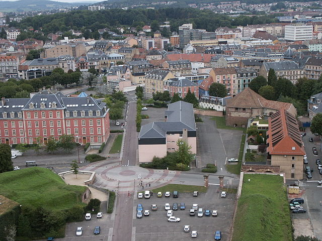
- Capital: Besançon
- Coordinates: 47° 10' 0" N, 6° 25' 0" E
- GPS tracks (wikiloc): [Link]
- Area: 5234 sq km
- Population: 536959
- Web site: [Link]
Shares border with regions:

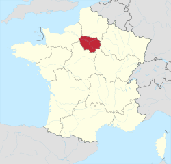
Île-de-France
- region in France where the French capital Paris is located
- Country:
- Capital: Paris
- Local Dialing Code: 01
- Coordinates: 48° 51' 8" N, 2° 19' 3" E
- GPS tracks (wikiloc): [Link]
- Area: 12012 sq km
- Population: 12082144
- Web site: [Link]


Centre-Val de Loire
- region in France
- Country:
- Capital: Orléans
- Coordinates: 47° 30' 0" N, 1° 45' 0" E
- GPS tracks (wikiloc): [Link]
- Area: 39151 sq km
- Population: 2578592
- Web site: [Link]


Auvergne-Rhône-Alpes
- administrative region of France
Hiking in Auvergne-Rhône-Alpes
Auvergne-Rhône-Alpes is a stunning region in southeastern France known for its diverse landscapes, which include mountains, lakes, and volcanic formations. It offers a wealth of hiking opportunities for all levels of experience. Here are some highlights and notable areas for hiking in this beautiful region:...
- Country:
- Capital: Lyon
- Local Dialing Code: 04
- Coordinates: 45° 44' 25" N, 4° 49' 10" E
- GPS tracks (wikiloc): [Link]
- Area: 69711 sq km
- Population: 7877698
- Web site: [Link]

Grand Est
- administrative region of France
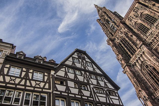
Hiking in Grand Est
Grand Est, a beautiful region in northeastern France, offers a diverse array of hiking opportunities. The region is characterized by a mix of picturesque landscapes, including rolling hills, vineyards, dense forests, and the stunning Vosges Mountains. Here are some key points about hiking in Grand Est:...
- Country:
- Capital: Strasbourg
- Coordinates: 48° 35' 56" N, 7° 45' 36" E
- GPS tracks (wikiloc): [Link]
- Area: 57433 sq km
- Population: 5555186
- Web site: [Link]