Bran (Bran)

- commune in Charente-Maritime, France
- Country:

- Postal Code: 17210
- Coordinates: 45° 20' 57" N, 0° 15' 48" E


- GPS tracks (wikiloc): [Link]
- Area: 4.14 sq km
- Population: 126
- Wikipedia en: wiki(en)
- Wikipedia: wiki(fr)
- Wikidata storage: Wikidata: Q1079430
- Wikipedia Commons Category: [Link]
- Freebase ID: [/m/03mcg5q]
- GeoNames ID: Alt: [6612968]
- SIREN number: [211700612]
- BnF ID: [152489233]
- VIAF ID: Alt: [248503739]
- INSEE municipality code: 17061
Shares border with regions:

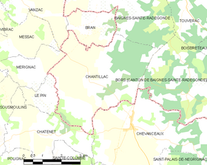
Chantillac
- commune in Charente, France
- Country:
- Postal Code: 16360
- Coordinates: 45° 19' 21" N, 0° 15' 20" E
- GPS tracks (wikiloc): [Link]
- Area: 18.05 sq km
- Population: 320


Vanzac
- commune in Charente-Maritime, France
- Country:
- Postal Code: 17500
- Coordinates: 45° 21' 26" N, 0° 18' 18" E
- GPS tracks (wikiloc): [Link]
- Area: 6.39 sq km
- Population: 153


Baignes-Sainte-Radegonde
- commune in Charente, France
- Country:
- Postal Code: 16360
- Coordinates: 45° 23' 2" N, 0° 14' 11" E
- GPS tracks (wikiloc): [Link]
- AboveSeaLevel: 75 м m
- Area: 31.22 sq km
- Population: 1294
- Web site: [Link]