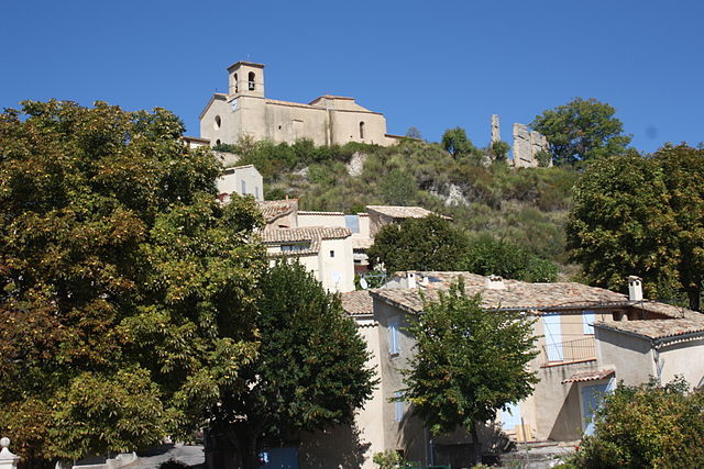
Bras-d'Asse (Bras-d'Asse)
- commune in Alpes-de-Haute-Provence, France
Bras-d'Asse is a charming small village located in the Alpes-de-Haute-Provence region of France. It's nestled in a scenic area known for its stunning natural landscapes, which makes it a lovely destination for hiking enthusiasts. Here are some key points to consider if you're planning a hiking trip to Bras-d'Asse:
Trails and Terrain
-
Variety of Trails: The region offers a range of hiking trails suitable for various skill levels, from leisurely walks to more challenging hikes. Trails can take you through picturesque valleys, forests, and along rivers.
-
Stunning Landscape: The hikes often feature beautiful views of the surrounding mountains, the Verdon Gorge, and the lavender fields that Provence is famous for.
-
Nature and Wildlife: As you hike, you'll have the opportunity to see diverse flora and fauna, including some unique species native to the region.
Popular Hikes
-
Sentier des Lavandes: This trail takes you through fields of lavender and offers breathtaking views of the surrounding countryside, especially during the summer months when the lavender is in bloom.
-
Les Gorges du Verdon: Although a bit farther, this iconic canyon offers some of the best hiking in the region, with trails ranging from easy to difficult and affording stunning views of turquoise waters.
-
Local Circuit Trails: Explore shorter, local trails that loop around Bras-d'Asse, often leading up to viewpoints or along the Asse River.
Practical Tips
-
Best Time to Visit: The ideal time for hiking in this region is during the spring (April to June) and early autumn (September to October) when temperatures are mild, and the landscapes are lush.
-
What to Bring: Be sure to carry plenty of water, snacks, a suitable map or GPS device, sunscreen, and wear appropriate footwear. A hat and layered clothing are also recommended, as temperatures can vary.
-
Local Amenities: While Bras-d'Asse is small, it may have limited facilities. Plan accordingly; consider packing a picnic or checking out local shops for supplies before heading out onto the trails.
-
Guided Tours: If you prefer a more structured experience, consider joining a local hiking guide who can provide insights into the area’s natural and cultural history.
Conclusion
Hiking in and around Bras-d'Asse offers a great opportunity to connect with nature and enjoy the peaceful surroundings of the Provence region. Whether you're interested in leisurely walks or more adventurous trails, you're sure to find something that suits your interests and abilities. Enjoy your hiking adventure!
- Country:

- Postal Code: 04270
- Coordinates: 43° 55' 32" N, 6° 7' 32" E


- GPS tracks (wikiloc): [Link]
- AboveSeaLevel: 633 м m
- Area: 26.1 sq km
- Population: 580
- Web site: http://www.mairie-brasdasse-labegude.fr/default
- Wikipedia en: wiki(en)
- Wikipedia: wiki(fr)
- Wikidata storage: Wikidata: Q865143
- Wikipedia Commons Category: [Link]
- Freebase ID: [/m/03m7w3y]
- Freebase ID: [/m/03m7w3y]
- GeoNames ID: Alt: [6446587]
- GeoNames ID: Alt: [6446587]
- SIREN number: [210400313]
- SIREN number: [210400313]
- INSEE municipality code: 04031
- INSEE municipality code: 04031
Shares border with regions:

Saint-Julien-d'Asse
- commune in Alpes-de-Haute-Provence, France
Saint-Julien-d'Asse is a charming commune in the Alpes-de-Haute-Provence region of southeastern France. It's surrounded by picturesque landscapes, offering a variety of hiking opportunities for outdoor enthusiasts. Here are some key points to consider if you're planning to hike in this area:...
- Country:

- Postal Code: 04270
- Coordinates: 43° 55' 2" N, 6° 5' 39" E


- GPS tracks (wikiloc): [Link]
- Area: 25.6 sq km
- Population: 196


Saint-Jeannet
- commune in Alpes-de-Haute-Provence, France
Saint-Jeannet is a charming village located in the Alpes-de-Haute-Provence region of southeastern France. This area is known for its stunning natural landscapes, making it an excellent destination for hiking enthusiasts. Here’s what you can expect when hiking around Saint-Jeannet:...
- Country:

- Postal Code: 04270
- Coordinates: 43° 57' 46" N, 6° 7' 37" E


- GPS tracks (wikiloc): [Link]
- Area: 21.14 sq km
- Population: 63

Puimoisson
- commune in Alpes-de-Haute-Provence, France
Puimoisson is a small commune located in the Alpes-de-Haute-Provence department in southeastern France. Nestled in the picturesque landscape of Provence, it offers stunning views, diverse terrain, and a rich natural environment, making it a great destination for hiking enthusiasts....
- Country:

- Postal Code: 04410
- Coordinates: 43° 51' 46" N, 6° 7' 38" E


- GPS tracks (wikiloc): [Link]
- Area: 35.44 sq km
- Population: 748

Saint-Jurs
- commune in Alpes-de-Haute-Provence, France
Saint-Jurs, a small village in the Alpes-de-Haute-Provence region of France, offers a variety of hiking opportunities for outdoor enthusiasts. Nestled in a picturesque setting, the area is characterized by stunning landscapes, rolling hills, and scenic views of the surrounding mountains....
- Country:

- Postal Code: 04410
- Coordinates: 43° 53' 55" N, 6° 11' 59" E


- GPS tracks (wikiloc): [Link]
- AboveSeaLevel: 925 м m
- Area: 33.59 sq km
- Population: 139

Estoublon
- commune in Alpes-de-Haute-Provence, France
Estoublon is a charming village located in the Alpes-de-Haute-Provence region of southeastern France. Its picturesque landscapes and proximity to the Verdon Gorge make it a great destination for hiking enthusiasts. Here are some things to consider when planning hikes in the Estoublon area:...
- Country:

- Postal Code: 04270
- Coordinates: 43° 56' 33" N, 6° 10' 17" E


- GPS tracks (wikiloc): [Link]
- Area: 33.85 sq km
- Population: 480
