
Alpes-de-Haute-Provence (Alpes-de-Haute-Provence)

- French department
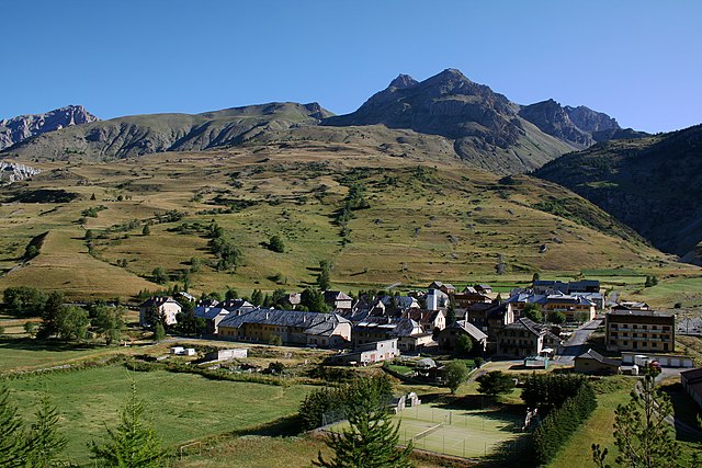
 Hiking in Alpes-de-Haute-Provence
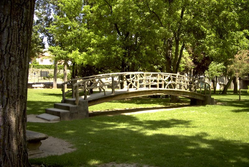
Hiking in the Alpes-de-Haute-Provence region of southeastern France offers a unique blend of stunning landscapes, diverse ecosystems, and charming villages. Here are some key points to consider if you’re planning a hiking trip in this area:
Natural Beauty
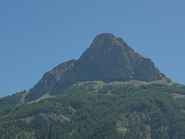
- Diverse Landscapes: The region is characterized by a mix of mountains, valleys, and plateaus, with the stunning backdrop of the Southern Alps. You can expect to see lavender fields, rocky cliffs, deep gorges, and lush forests.
- Gorges du Verdon: Known as one of Europe’s most beautiful river canyons, the Gorges du Verdon offers incredible views and various hiking paths, ranging from easy strolls to challenging treks along the rim.
Popular Hiking Areas
- Luberon Regional Park: Famous for its scenic beauty, you can explore various trails that showcase the iconic Provençal landscapes, including vineyards and picturesque hilltop villages.
- Mercantour National Park: This is one of France’s oldest national parks, offering high-altitude hikes with breathtaking views, diverse wildlife, and unique flora. Trails cater to various skill levels.
- Mount Ventoux: While technically in the Vaucluse department, it is often included in hiking discussions about the region due to its proximity and prominence. The hike to the summit provides panoramic views of the surrounding countryside.
Trail Information
- Diverse Trail Options: The area offers a wide range of trails, from well-marked paths suitable for families to more challenging routes for experienced hikers. Ensure you check trail conditions and maps before heading out.
- Signage: Many trails are clearly marked with colors indicating the difficulty level (GR routes for long-distance hiking, PR for shorter paths).
Best Times to Hike
- Spring and Fall: These seasons are often considered the best for hiking due to mild temperatures and the stunning blooms or autumn foliage.
- Summer: While it's a popular time to hike, some trails can get crowded, and temperatures can be high, especially at lower elevations.
Practical Tips
- Safety: Always carry enough water, wear appropriate footwear, and check the weather forecast before your hike.
- Local Regulations: Be aware of local wildlife and plant regulations; some areas may require permits or have restricted access to preserve their natural beauty.
- Accessibility: Many villages in the Alpes-de-Haute-Provence serve as great starting points for hikes, offering access to trailheads and local amenities, such as accommodations and restaurants.
Conclusion
Whether you are looking for a leisurely stroll through picturesque villages, an adventurous ascent in the mountains, or dramatic views of gorges, hiking in Alpes-de-Haute-Provence has something for every outdoor enthusiast. Always respect nature and practice Leave No Trace principles to ensure that this beautiful region remains pristine for future generations.
- Country:

- Capital: Digne-les-Bains
- Coordinates: 44° 5' 43" N, 6° 14' 24" E


- GPS tracks (wikiloc): [Link]
- Area: 6925 sq km
- Population: 161799
- Web site: http://www.alpes-de-haute-provence.pref.gouv.fr/
- Wikipedia en: wiki(en)
- Wikipedia: wiki(fr)
- Wikidata storage: Wikidata: Q3131
- Wikipedia Commons Gallery: [Link]
- Wikipedia Commons Category: [Link]
- Wikipedia Commons Maps Category: [Link]
- Freebase ID: [/m/0mc_t]
- GeoNames ID: Alt: [3038050]
- SIREN number: [220400014]
- BnF ID: [11862236z]
- VIAF ID: Alt: [139090781]
- OSM relation ID: [7380]
- GND ID: Alt: [4084997-1]
- archINFORM location ID: [38]
- Library of Congress authority ID: Alt: [n81036014]
- PACTOLS thesaurus ID: [pcrtqBdX4vGn5j]
- TGN ID: [7017065]
- SUDOC authorities ID: [026359014]
- Encyclopædia Britannica Online ID: [place/Alpes-de-Haute-Provence]
- Gran Enciclopèdia Catalana ID: [0002957]
- National Library of Israel ID: [000984405]
- NUTS code: [FR821]
- INSEE department code: [04]
- ISO 3166-2 code: FR-04
Includes regions:

Mézel
- commune in Alpes-de-Haute-Provence, France
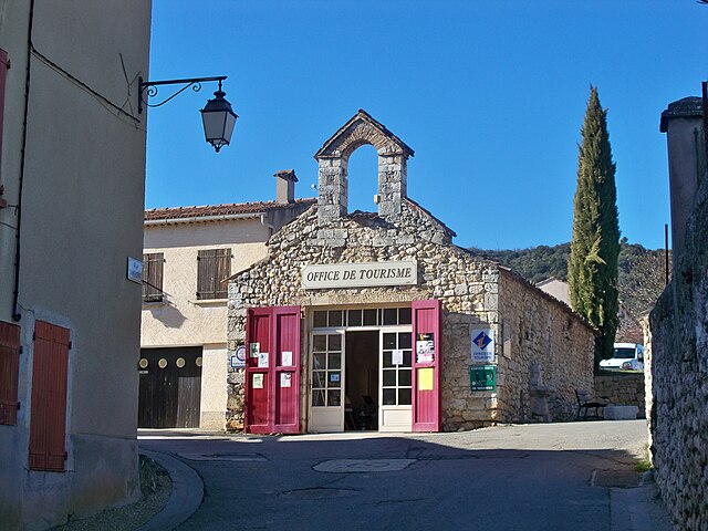
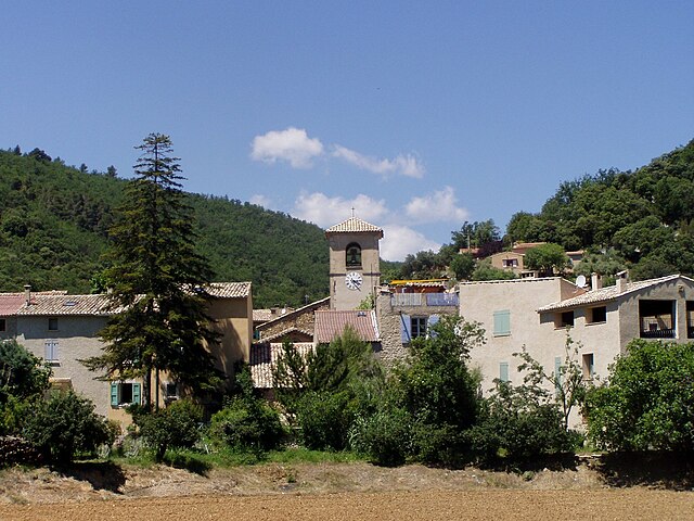
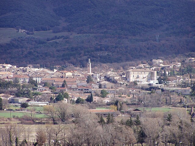
Hiking in Mézel
Mézel is a picturesque village located in the Provence-Alpes-Côte d'Azur region of France, surrounded by beautiful landscapes and offering a variety of hiking opportunities. The area is characterized by its scenic trails, rolling hills, and diverse flora and fauna....
- Country:
- Postal Code: 04270
- Coordinates: 43° 59' 47" N, 6° 11' 46" E
- GPS tracks (wikiloc): [Link]
- Area: 21.36 sq km
- Population: 662

Reillanne
- commune in Alpes-de-Haute-Provence, France
Hiking in Reillanne
Reillanne, a charming village in the Luberon region of Provence, France, offers a delightful hiking experience set against a backdrop of stunning landscapes, vineyards, and olive groves. Here are some highlights and tips for hiking in and around Reillanne:...
- Country:
- Postal Code: 04110
- Coordinates: 43° 52' 45" N, 5° 39' 33" E
- GPS tracks (wikiloc): [Link]
- Area: 38.55 sq km
- Population: 1621

Corbières
- commune in Alpes-de-Haute-Provence, France
Hiking in Corbières
Corbières-en-Provence, located in the stunning Vaucluse region of southern France, offers a unique blend of picturesque landscapes, wine country, and rich cultural heritage, making it a fantastic destination for hiking enthusiasts....
- Country:
- Postal Code: 04220
- Coordinates: 43° 45' 40" N, 5° 45' 5" E
- GPS tracks (wikiloc): [Link]
- Area: 19.06 sq km
- Population: 1161

Saint-Étienne-les-Orgues
- commune in Alpes-de-Haute-Provence, France
Hiking in Saint-Étienne-les-Orgues
Saint-Étienne-les-Orgues is a picturesque village located in the Alpes-de-Haute-Provence region of southern France. It lies in a beautiful natural setting, surrounded by diverse landscapes, which makes it a great destination for hiking enthusiasts. Here are some key points about hiking in this area:...
- Country:
- Postal Code: 04230
- Coordinates: 44° 2' 46" N, 5° 46' 49" E
- GPS tracks (wikiloc): [Link]
- Area: 48.42 sq km
- Population: 1249
- Web site: [Link]

Saint-Geniez
- commune in Alpes-de-Haute-Provence, France
Hiking in Saint-Geniez
Saint-Geniez is a charming village located in the heart of the Aveyron department in southern France. The area is known for its stunning landscapes, rich history, and excellent hiking opportunities. Here are some things you can expect when hiking in and around Saint-Geniez:...
- Country:
- Postal Code: 04200
- Coordinates: 44° 14' 43" N, 6° 3' 11" E
- GPS tracks (wikiloc): [Link]
- Area: 38.94 sq km
- Population: 95
Sainte-Tulle
- commune in Alpes-de-Haute-Provence, France
Hiking in Sainte-Tulle
Sainte-Tulle is a charming village located in the Alpes-de-Haute-Provence region of France, and it offers some beautiful hiking opportunities for outdoor enthusiasts. Here are some key points to consider if you're planning to hike in and around Sainte-Tulle:...
- Country:
- Postal Code: 04220
- Coordinates: 43° 47' 10" N, 5° 45' 55" E
- GPS tracks (wikiloc): [Link]
- Area: 17.07 sq km
- Population: 3449
- Web site: [Link]

Saint-Julien-d'Asse
- commune in Alpes-de-Haute-Provence, France
Hiking in Saint-Julien-d'Asse
Saint-Julien-d'Asse is a charming commune in the Alpes-de-Haute-Provence region of southeastern France. It's surrounded by picturesque landscapes, offering a variety of hiking opportunities for outdoor enthusiasts. Here are some key points to consider if you're planning to hike in this area:...
- Country:
- Postal Code: 04270
- Coordinates: 43° 55' 2" N, 6° 5' 39" E
- GPS tracks (wikiloc): [Link]
- Area: 25.6 sq km
- Population: 196

Tartonne
- commune in Alpes-de-Haute-Provence, France
Hiking in Tartonne
Tartonne is a charming village located in the Alpes-de-Haute-Provence region of southeastern France. It's an excellent starting point for various hiking adventures due to its stunning natural landscapes and proximity to the Mercantour National Park. Here are some key points to consider for hiking in Tartonne:...
- Country:
- Postal Code: 04330
- Coordinates: 44° 4' 12" N, 6° 23' 17" E
- GPS tracks (wikiloc): [Link]
- Area: 44.88 sq km
- Population: 138
- Web site: [Link]

Saint-Martin-lès-Seyne
- commune in Alpes-de-Haute-Provence, France
Hiking in Saint-Martin-lès-Seyne
Saint-Martin-lès-Seyne is a charming village located in the Alpes-de-Haute-Provence region of France. The area surrounding the village offers a range of hiking opportunities, characterized by its stunning natural landscapes including mountains, forests, and rivers....
- Country:
- Postal Code: 04140
- Coordinates: 44° 23' 8" N, 6° 15' 24" E
- GPS tracks (wikiloc): [Link]
- Area: 12.27 sq km
- Population: 13

Sausses
- commune in Alpes-de-Haute-Provence, France
Hiking in Sausses
Sausse is a picturesque village located in the Alpes-Maritimes region of France. It offers stunning landscapes, fresh mountain air, and a variety of hiking opportunities suitable for different skill levels. Here are some highlights and tips for hiking in the Sausses area:...
- Country:
- Postal Code: 04320
- Coordinates: 44° 0' 31" N, 6° 46' 55" E
- GPS tracks (wikiloc): [Link]
- Area: 14.68 sq km
- Population: 123

Villemus
- commune in Alpes-de-Haute-Provence, France
Hiking in Villemus
Villemus, a small commune in the Provence-Alpes-Côte d'Azur region of France, is known for its stunning landscapes and beautiful natural surroundings, making it a great destination for hiking enthusiasts. Here are some aspects to consider for hiking in and around Villemus:...
- Country:
- Postal Code: 04110
- Coordinates: 43° 51' 33" N, 5° 42' 3" E
- GPS tracks (wikiloc): [Link]
- AboveSeaLevel: 436 м m
- Area: 9.59 sq km
- Population: 181

Thoard
- commune in Alpes-de-Haute-Provence, France
Hiking in Thoard
Thoard is a picturesque village located in the Alpes-de-Haute-Provence region of France. It offers a selection of hiking opportunities that allow you to explore the stunning natural beauty of the surrounding area. Here are some key points about hiking in Thoard:...
- Country:
- Postal Code: 04380
- Coordinates: 44° 8' 59" N, 6° 8' 54" E
- GPS tracks (wikiloc): [Link]
- Area: 43.69 sq km
- Population: 723

Saint-Julien-du-Verdon
- commune in Alpes-de-Haute-Provence, France
Hiking in Saint-Julien-du-Verdon
Saint-Julien-du-Verdon is a charming village located in the Alpes-de-Haute-Provence region of southern France, offering stunning natural beauty and a variety of hiking opportunities. Nestled on a plateau overlooking the Verdon River, the area is characterized by picturesque landscapes, including lush valleys, dramatic cliffs, and serene lakes....
- Country:
- Postal Code: 04170
- Coordinates: 43° 54' 47" N, 6° 32' 25" E
- GPS tracks (wikiloc): [Link]
- Area: 6.19 sq km
- Population: 150

Saint-Michel-l'Observatoire
- commune in Alpes-de-Haute-Provence, France
Hiking in Saint-Michel-l'Observatoire
Saint-Michel-l'Observatoire, located in the Alpes-de-Haute-Provence region of France, offers a unique blend of natural beauty and cultural significance, making it a fantastic destination for hiking enthusiasts. Here are some highlights and tips for hiking in this area:...
- Country:
- Postal Code: 04870
- Coordinates: 43° 54' 35" N, 5° 42' 58" E
- GPS tracks (wikiloc): [Link]
- Area: 27.78 sq km
- Population: 1240

Ubraye
- commune in Alpes-de-Haute-Provence, France
Hiking in Ubraye
Ubraye is a charming village located in the Alpes-de-Haute-Provence region of France, known for its stunning landscapes, rugged terrain, and beautiful trails. It offers a variety of hiking opportunities suitable for different skill levels and interests. Here’s an overview of what to expect when hiking in Ubraye:...
- Country:
- Postal Code: 04240
- Coordinates: 43° 54' 31" N, 6° 41' 49" E
- GPS tracks (wikiloc): [Link]
- Area: 35.65 sq km
- Population: 88

Saint-Lions
- commune in Alpes-de-Haute-Provence, France
Hiking in Saint-Lions
Saint-Lions is a charming commune in the Var department in the Provence-Alpes-Côte d'Azur region of France. It is known for its beautiful landscapes, rolling hills, and outdoor activities, making it an excellent destination for hiking enthusiasts. Here are some highlights about hiking in Saint-Lions:...
- Country:
- Postal Code: 04330
- Coordinates: 43° 59' 6" N, 6° 23' 59" E
- GPS tracks (wikiloc): [Link]
- Area: 11.55 sq km
- Population: 51

Saint-Laurent-du-Verdon
- commune in Alpes-de-Haute-Provence, France
Hiking in Saint-Laurent-du-Verdon
Saint-Laurent-du-Verdon is a picturesque village located in the Provence-Alpes-Côte d'Azur region of France, near the Verdon Gorge, which is renowned for its stunning landscapes and outdoor activities. The area offers excellent hiking opportunities for both beginners and experienced hikers. Here are some key points about hiking in and around Saint-Laurent-du-Verdon:...
- Country:
- Postal Code: 04500
- Coordinates: 43° 43' 27" N, 6° 4' 5" E
- GPS tracks (wikiloc): [Link]
- Area: 8.89 sq km
- Population: 94

Les Thuiles
- commune in Alpes-de-Haute-Provence, France
Hiking in Les Thuiles
Les Thuiles is a picturesque village located in the French region of Provence-Alpes-Côte d'Azur, specifically in the Alpes-de-Haute-Provence department. Hiking in this area offers a wonderful experience, as it is surrounded by stunning natural landscapes, including mountains, valleys, and forests....
- Country:
- Postal Code: 04400
- Coordinates: 44° 23' 35" N, 6° 34' 16" E
- GPS tracks (wikiloc): [Link]
- Area: 32.8 sq km
- Population: 398
Uvernet-Fours
- commune in Alpes-de-Haute-Provence, France
Hiking in Uvernet-Fours
Uvernet-Fours is a charming destination in the French Alpes-de-Haute-Provence region, known for its beautiful landscapes and outdoor recreational opportunities, including hiking. Here are some details to help you plan your hiking experience in this area:...
- Country:
- Postal Code: 04400
- Coordinates: 44° 21' 40" N, 6° 37' 34" E
- GPS tracks (wikiloc): [Link]
- Area: 135.44 sq km
- Population: 583

Saint-Martin-de-Brômes
- commune in Alpes-de-Haute-Provence, France
Hiking in Saint-Martin-de-Brômes
Saint-Martin-de-Brômes is a charming village located in the Alpes-de-Haute-Provence region of southeastern France. Surrounded by stunning natural landscapes, it offers a variety of hiking opportunities for both beginners and experienced hikers....
- Country:
- Postal Code: 04800
- Coordinates: 43° 46' 12" N, 5° 56' 44" E
- GPS tracks (wikiloc): [Link]
- Area: 21.09 sq km
- Population: 577
La Motte-du-Caire
- commune in Alpes-de-Haute-Provence, France
Hiking in La Motte-du-Caire
La Motte-du-Caire is a charming village located in the Alpes-de-Haute-Provence region of southeastern France. It's a great area for hiking, offering beautiful landscapes, diverse flora and fauna, and various trails that cater to different skill levels. Here are some key points to consider if you're planning a hiking trip in La Motte-du-Caire:...
- Country:
- Postal Code: 04250
- Coordinates: 44° 20' 38" N, 6° 1' 42" E
- GPS tracks (wikiloc): [Link]
- Area: 27.27 sq km
- Population: 554

Volx
- commune in Alpes-de-Haute-Provence, France
Hiking in Volx
Volx is a charming commune in the Alpes-de-Haute-Provence department in southeastern France. Nestled in a picturesque landscape, it's an excellent spot for hiking enthusiasts. Here are some details about hiking in and around Volx:...
- Country:
- Postal Code: 04130
- Coordinates: 43° 52' 40" N, 5° 50' 30" E
- GPS tracks (wikiloc): [Link]
- Area: 19.52 sq km
- Population: 3144

Sainte-Croix-du-Verdon
- commune in Alpes-de-Haute-Provence, France
Hiking in Sainte-Croix-du-Verdon
Sainte-Croix-du-Verdon is a picturesque village located in the Provence-Alpes-Côte d'Azur region of France, nestled near the stunning Lake Sainte-Croix. This area is renowned for its beautiful landscapes, offering a range of hiking opportunities that showcase both natural and cultural attractions. Here are some highlights for hiking in and around Sainte-Croix-du-Verdon:...
- Country:
- Postal Code: 04500
- Coordinates: 43° 45' 32" N, 6° 9' 5" E
- GPS tracks (wikiloc): [Link]
- Area: 13.7 sq km
- Population: 120

Valernes
- commune in Alpes-de-Haute-Provence, France
Hiking in Valernes
Valernes is a lesser-known yet charming destination for hiking enthusiasts, located in the Alpes-de-Haute-Provence region of France. Surrounded by picturesque landscapes, Valernes offers a variety of trails suitable for different skill levels, allowing hikers to immerse themselves in the stunning natural beauty of the area....
- Country:
- Postal Code: 04200
- Coordinates: 44° 15' 44" N, 5° 57' 29" E
- GPS tracks (wikiloc): [Link]
- Area: 28.49 sq km
- Population: 253

Soleilhas
- commune in Alpes-de-Haute-Provence, France
Hiking in Soleilhas
Soleilhas is a charming village located in the Alpes-Maritimes region of France, nestled in the heart of the Pre-Alps. It's a great starting point for hiking enthusiasts, offering a variety of trails with stunning views, diverse landscapes, and opportunities to connect with nature....
- Country:
- Postal Code: 04120
- Coordinates: 43° 51' 26" N, 6° 38' 57" E
- GPS tracks (wikiloc): [Link]
- Area: 34.53 sq km
- Population: 120

Valavoire
- commune in Alpes-de-Haute-Provence, France
Hiking in Valavoire
Valavoire, located in the beautiful region of the French Alps, offers stunning landscapes and a variety of hiking trails suitable for different skill levels. Here’s what you should know about hiking in Valavoire:...
- Country:
- Postal Code: 04250
- Coordinates: 44° 16' 45" N, 6° 3' 59" E
- GPS tracks (wikiloc): [Link]
- Area: 16.81 sq km
- Population: 43

Le Vernet
- commune in Alpes-de-Haute-Provence, France
Hiking in Le Vernet
Le Vernet, located in the Alpes-de-Haute-Provence region of France, offers a beautiful setting for hiking enthusiasts. This area is characterized by its stunning alpine landscapes, diverse flora and fauna, and a variety of trails that cater to different skill levels....
- Country:
- Postal Code: 04140
- Coordinates: 44° 16' 34" N, 6° 23' 27" E
- GPS tracks (wikiloc): [Link]
- Area: 23.05 sq km
- Population: 130

Saint-Martin-les-Eaux
- commune in Alpes-de-Haute-Provence, France
Hiking in Saint-Martin-les-Eaux
Saint-Martin-les-Eaux, located in the picturesque region of France, offers a variety of hiking opportunities for both novice and experienced hikers. This small commune is surrounded by natural beauty, characterized by rolling hills, lush forests, and scenic views....
- Country:
- Postal Code: 04300
- Coordinates: 43° 52' 28" N, 5° 44' 7" E
- GPS tracks (wikiloc): [Link]
- Area: 9.15 sq km
- Population: 120
Saint-Pierre
- commune in Alpes-de-Haute-Provence, France
Hiking in Saint-Pierre
Saint-Pierre, located in the Alpes-de-Haute-Provence region of southeastern France, is a fantastic destination for hiking enthusiasts. The surrounding area offers a variety of trails that cater to different skill levels, from leisurely walks to challenging treks....
- Country:
- Postal Code: 06260
- Coordinates: 43° 54' 43" N, 6° 55' 28" E
- GPS tracks (wikiloc): [Link]
- Area: 5.62 sq km
- Population: 97


Saint-Jeannet
- commune in Alpes-de-Haute-Provence, France
Hiking in Saint-Jeannet
Saint-Jeannet is a charming village located in the Alpes-de-Haute-Provence region of southeastern France. This area is known for its stunning natural landscapes, making it an excellent destination for hiking enthusiasts. Here’s what you can expect when hiking around Saint-Jeannet:...
- Country:
- Postal Code: 04270
- Coordinates: 43° 57' 46" N, 6° 7' 37" E
- GPS tracks (wikiloc): [Link]
- Area: 21.14 sq km
- Population: 63

Saint-Vincent-sur-Jabron
- commune in Alpes-de-Haute-Provence, France
Hiking in Saint-Vincent-sur-Jabron
Saint-Vincent-sur-Jabron is a charming village situated in the Provence-Alpes-Côte d'Azur region of France. The area is known for its stunning natural scenery, including rolling hills, vineyards, and the nearby Jabron River, making it a great destination for hiking enthusiasts....
- Country:
- Postal Code: 04200
- Coordinates: 44° 10' 15" N, 5° 44' 31" E
- GPS tracks (wikiloc): [Link]
- Area: 30.2 sq km
- Population: 199

Valbelle
- commune in Alpes-de-Haute-Provence, France
Hiking in Valbelle
Valbelle, located in France, is known for its natural beauty and scenic hiking trails. While it may not be one of the most famous hiking destinations, it offers a variety of experiences for hikers of all levels....
- Country:
- Postal Code: 04200
- Coordinates: 44° 8' 52" N, 5° 52' 54" E
- GPS tracks (wikiloc): [Link]
- AboveSeaLevel: 580 м m
- Area: 32.99 sq km
- Population: 271

Saint-Benoît
- commune in Alpes-de-Haute-Provence, France
Hiking in Saint-Benoît
Saint-Benoît, located in the Alpes-de-Haute-Provence region of southeastern France, offers an array of hiking opportunities amidst stunning natural scenery. The area is characterized by its picturesque landscapes, which include mountains, valleys, and rivers....
- Country:
- Postal Code: 04240
- Coordinates: 43° 58' 2" N, 6° 43' 32" E
- GPS tracks (wikiloc): [Link]
- Area: 21.03 sq km
- Population: 145

Saint-Pons
- commune in Alpes-de-Haute-Provence, France
Hiking in Saint-Pons
Saint-Pons, located in the Alpes-de-Haute-Provence region of France, is a fantastic destination for hiking enthusiasts. Known for its stunning natural scenery, diverse landscapes, and relatively mild climate, it offers a variety of trails suitable for different skill levels. Here are some key features and tips for hiking in this area:...
- Country:
- Postal Code: 04400
- Coordinates: 44° 23' 32" N, 6° 37' 40" E
- GPS tracks (wikiloc): [Link]
- Area: 32.06 sq km
- Population: 647
- Web site: [Link]

Thorame-Haute
- commune in Alpes-de-Haute-Provence, France
Hiking in Thorame-Haute
Thorame-Haute is a picturesque village located in the Alpes-de-Haute-Provence region of France. It is surrounded by stunning natural landscapes, including mountain ranges, valleys, and forests, making it an excellent destination for hiking enthusiasts. Here are some highlights of hiking in Thorame-Haute:...
- Country:
- Postal Code: 04170
- Coordinates: 44° 5' 49" N, 6° 33' 20" E
- GPS tracks (wikiloc): [Link]
- Area: 108.35 sq km
- Population: 233
- Web site: [Link]

Revest-Saint-Martin
- commune in Alpes-de-Haute-Provence, France
Hiking in Revest-Saint-Martin
Revest-Saint-Martin, located in the Provence-Alpes-Côte d'Azur region of southeastern France, offers beautiful hiking opportunities amid stunning natural landscapes. The area is characterized by its diverse topography, including hills, forests, and panoramic views of the surrounding mountains and valleys....
- Country:
- Postal Code: 04230
- Coordinates: 44° 0' 41" N, 5° 49' 36" E
- GPS tracks (wikiloc): [Link]
- Area: 7.56 sq km
- Population: 69
Pierrevert
- commune in Alpes-de-Haute-Provence, France
Hiking in Pierrevert
Pierrevert, located in the picturesque region of Provence-Alpes-Côte d'Azur in France, offers a variety of hiking opportunities set against the backdrop of beautiful landscapes, rolling hills, and Mediterranean vegetation. Here are some key highlights for hiking in Pierrevert:...
- Country:
- Postal Code: 04860
- Coordinates: 43° 48' 41" N, 5° 44' 58" E
- GPS tracks (wikiloc): [Link]
- Area: 27.9 sq km
- Population: 3672
- Web site: [Link]

Puimichel
- commune in Alpes-de-Haute-Provence, France
Hiking in Puimichel
Puimichel is a picturesque village located in the Provence-Alpes-Côte d'Azur region of southeastern France. It is known for its natural beauty, charming landscapes, and opportunities for outdoor activities such as hiking. Here’s what you can expect when hiking in and around Puimichel:...
- Country:
- Postal Code: 04700
- Coordinates: 43° 58' 26" N, 6° 1' 14" E
- GPS tracks (wikiloc): [Link]
- Area: 36.81 sq km
- Population: 218
- Web site: [Link]

La Rochette
- commune in Alpes-de-Haute-Provence, France
Hiking in La Rochette
La Rochette is a quaint village located in the Alpes-de-Haute-Provence region of southeastern France. It is surrounded by stunning natural landscapes, making it a great destination for hiking enthusiasts....
- Country:
- Postal Code: 06260
- Coordinates: 43° 54' 54" N, 6° 53' 26" E
- GPS tracks (wikiloc): [Link]
- Area: 18.8 sq km
- Population: 66

Puimoisson
- commune in Alpes-de-Haute-Provence, France
Hiking in Puimoisson
Puimoisson is a small commune located in the Alpes-de-Haute-Provence department in southeastern France. Nestled in the picturesque landscape of Provence, it offers stunning views, diverse terrain, and a rich natural environment, making it a great destination for hiking enthusiasts....
- Country:
- Postal Code: 04410
- Coordinates: 43° 51' 46" N, 6° 7' 38" E
- GPS tracks (wikiloc): [Link]
- Area: 35.44 sq km
- Population: 748
Quinson
- commune in Alpes-de-Haute-Provence, France
Hiking in Quinson
Quinson, a charming village located in the Provence-Alpes-Côte d'Azur region of France, offers an array of hiking opportunities that showcase the stunning natural beauty of the area. Here are some key points to consider when planning a hiking trip in Quinson:...
- Country:
- Postal Code: 04500
- Coordinates: 43° 42' 8" N, 6° 2' 23" E
- GPS tracks (wikiloc): [Link]
- Area: 28.11 sq km
- Population: 437
- Web site: [Link]

Nibles
- commune in Alpes-de-Haute-Provence, France
Hiking in Nibles
It seems there might be a small misunderstanding—there isn't a widely recognized hiking destination specifically called "Nibles." However, if you're referring to a particular place or a lesser-known trail, please provide more context or correct the name, and I'd be happy to help!...
- Country:
- Postal Code: 04250
- Coordinates: 44° 16' 53" N, 6° 1' 9" E
- GPS tracks (wikiloc): [Link]
- Area: 12.31 sq km
- Population: 43

Sainte-Croix-à-Lauze
- commune in Alpes-de-Haute-Provence, France
Hiking in Sainte-Croix-à-Lauze
Sainte-Croix-à-Lauze is a charming small commune located in the Alpes-de-Haute-Provence region of France. It is surrounded by beautiful natural landscapes, making it an appealing destination for hikers and outdoor enthusiasts....
- Country:
- Postal Code: 04110
- Coordinates: 43° 54' 31" N, 5° 37' 2" E
- GPS tracks (wikiloc): [Link]
- Area: 8.65 sq km
- Population: 84

Peyroules
- commune in Alpes-de-Haute-Provence, France
Hiking in Peyroules
Peyroules is a small village located in the Alpes-de-Haute-Provence region of southeastern France. The area is known for its stunning natural landscapes and offers a variety of hiking opportunities that cater to different skill levels. Here's what you can expect when hiking in and around Peyroules:...
- Country:
- Postal Code: 04120
- Coordinates: 43° 48' 55" N, 6° 38' 33" E
- GPS tracks (wikiloc): [Link]
- AboveSeaLevel: 1406.5 м m
- Area: 33.34 sq km
- Population: 229

Moriez
- commune in Alpes-de-Haute-Provence, France
Hiking in Moriez
Moriez is a charming village located in the Provence-Alpes-Côte d'Azur region of France. Nestled in the scenic landscape, it offers opportunities for various outdoor activities, including hiking. Here are some key points about hiking in and around Moriez:...
- Country:
- Postal Code: 04170
- Coordinates: 43° 57' 42" N, 6° 28' 15" E
- GPS tracks (wikiloc): [Link]
- Area: 37.18 sq km
- Population: 225
Malijai
- commune in Alpes-de-Haute-Provence, France
Hiking in Malijai
Malijai is a small commune in the Alpes-de-Haute-Provence department in southeastern France. It's nestled in a picturesque landscape, making it a great location for hiking enthusiasts. While it may not be as well-known as larger national parks or hiking regions in France, it offers several opportunities for outdoor activities....
- Country:
- Postal Code: 04510
- Coordinates: 44° 2' 45" N, 6° 1' 49" E
- GPS tracks (wikiloc): [Link]
- Area: 26.56 sq km
- Population: 1987

Méailles
- commune in Alpes-de-Haute-Provence, France
Hiking in Méailles
Méailles is a quaint mountain village located in the Alpes-de-Haute-Provence region of France, known for its stunning natural beauty and its proximity to the Mercantour National Park. Hiking in this area offers a range of trails suitable for various skill levels, with breathtaking views of the surrounding mountains, valleys, and forests....
- Country:
- Postal Code: 04240
- Coordinates: 44° 1' 24" N, 6° 37' 54" E
- GPS tracks (wikiloc): [Link]
- Area: 32.74 sq km
- Population: 111

Marcoux
- commune in Alpes-de-Haute-Provence, France
Hiking in Marcoux
Marcoux, located in the Alpes-de-Haute-Provence region of France, is a hidden gem for hikers looking to explore a beautiful and varied landscape. This picturesque area is known for its stunning mountain scenery, rich flora and fauna, and charming Provencal villages....
- Country:
- Postal Code: 04420
- Coordinates: 44° 7' 42" N, 6° 16' 37" E
- GPS tracks (wikiloc): [Link]
- AboveSeaLevel: 957.5 м m
- Area: 32.17 sq km
- Population: 499
Revest-du-Bion
- commune in Alpes-de-Haute-Provence, France
Hiking in Revest-du-Bion
Revest-du-Bion, located in the Provence-Alpes-Côte d'Azur region of France, offers a beautiful setting for hiking enthusiasts. Surrounded by natural beauty, this charming village is nestled in the foothills of the Lure Mountains, providing a variety of trails suitable for all skill levels....
- Country:
- Postal Code: 04150
- Coordinates: 44° 4' 58" N, 5° 32' 54" E
- GPS tracks (wikiloc): [Link]
- Area: 43.45 sq km
- Population: 573

Revest-des-Brousses
- commune in Alpes-de-Haute-Provence, France
Hiking in Revest-des-Brousses
Revest-des-Brousses is a charming commune located in the Alpes-de-Haute-Provence region of southeastern France. This area offers a variety of beautiful hiking opportunities, surrounded by stunning landscapes of hills, forests, and rural vistas....
- Country:
- Postal Code: 04150
- Coordinates: 43° 58' 19" N, 5° 40' 18" E
- GPS tracks (wikiloc): [Link]
- Area: 22.95 sq km
- Population: 271

La Rochegiron
- commune in Alpes-de-Haute-Provence, France
Hiking in La Rochegiron
La Rochegiron, located in the Auvergne region of France, is a wonderful destination for hiking enthusiasts. With its picturesque landscapes, scenic views, and a variety of trails, it caters to both novice and experienced hikers. Here’s a bit more information about what you can expect when hiking in the area:...
- Country:
- Postal Code: 04150
- Coordinates: 44° 4' 39" N, 5° 39' 20" E
- GPS tracks (wikiloc): [Link]
- Area: 30.11 sq km
- Population: 93

Entrepierres
- commune in Alpes-de-Haute-Provence, France
Hiking in Entrepierres
Entrepierres is a picturesque village located in the Alpes-de-Haute-Provence region of southeastern France. The area is known for its stunning natural landscapes, including the nearby Durance River and the surrounding mountains, which provide a beautiful backdrop for hiking enthusiasts....
- Country:
- Postal Code: 04200
- Coordinates: 44° 11' 13" N, 5° 59' 38" E
- GPS tracks (wikiloc): [Link]
- Area: 47.79 sq km
- Population: 386

Curbans
- commune in Alpes-de-Haute-Provence, France
Hiking in Curbans
Curbans is a charming village located in the Alpes-de-Haute-Provence region of France, known for its beautiful landscapes and outdoor recreational opportunities. While it may not be as well-known as other hiking destinations in the region, it offers several hiking trails that allow you to explore the gorgeous scenery of the area....
- Country:
- Postal Code: 05110
- Coordinates: 44° 25' 41" N, 6° 2' 16" E
- GPS tracks (wikiloc): [Link]
- Area: 28.88 sq km
- Population: 538
- Web site: [Link]

Enchastrayes
- commune in Alpes-de-Haute-Provence, France
Hiking in Enchastrayes
Enchastrayes is a stunning area located in the French Alps, near the town of Barcelonnette in the Alpes-de-Haute-Provence region. This area is known for its beautiful landscapes, diverse flora and fauna, and a variety of hiking trails suitable for different skill levels....
- Country:
- Postal Code: 04400
- Coordinates: 44° 22' 3" N, 6° 41' 43" E
- GPS tracks (wikiloc): [Link]
- Area: 44.19 sq km
- Population: 391

Les Omergues
- commune in Alpes-de-Haute-Provence, France
Hiking in Les Omergues
Les Omergues is a charming village located in the Provence-Alpes-Côte d'Azur region of southeastern France. It's surrounded by scenic landscapes that offer excellent hiking opportunities, making it a great destination for outdoor enthusiasts....
- Country:
- Postal Code: 04200
- Coordinates: 44° 10' 18" N, 5° 36' 28" E
- GPS tracks (wikiloc): [Link]
- Area: 34.22 sq km
- Population: 132
Val-de-Chalvagne
- commune in Alpes-de-Haute-Provence, France
Hiking in Val-de-Chalvagne
Val-de-Chalvagne, located in the Alpes-de-Haute-Provence region of France, offers a variety of beautiful hiking opportunities. The area is characterized by stunning natural landscapes, including scenic valleys, mountains, and rivers, making it a great destination for outdoor enthusiasts....
- Country:
- Postal Code: 04320
- Coordinates: 43° 54' 51" N, 6° 48' 28" E
- GPS tracks (wikiloc): [Link]
- AboveSeaLevel: 900 м m
- Area: 32.57 sq km
- Population: 88
- Web site: [Link]

Meyronnes
- former commune in Alpes-de-Haute-Provence, France
Hiking in Meyronnes
Meyronnes is a picturesque village located in the Alpes-de-Haute-Provence region of southeastern France. Nestled in the Mercantour National Park, it offers a range of hiking opportunities that cater to different skill levels, making it an excellent destination for nature lovers and outdoor enthusiasts....
- Country:
- Postal Code: 04530
- Coordinates: 44° 28' 35" N, 6° 47' 57" E
- GPS tracks (wikiloc): [Link]
- Area: 40.59 sq km
- Population: 60

Faucon-du-Caire
- commune in Alpes-de-Haute-Provence, France
Hiking in Faucon-du-Caire
Faucon-du-Caire is a charming village located in the Provence-Alpes-Côte d'Azur region of southeastern France. It's an excellent destination for hiking enthusiasts, offering a variety of trails that showcase the stunning natural beauty of the area. Here are some highlights of hiking in and around Faucon-du-Caire:...
- Country:
- Postal Code: 04250
- Coordinates: 44° 23' 50" N, 6° 5' 29" E
- GPS tracks (wikiloc): [Link]
- Area: 19.93 sq km
- Population: 51
Larche
- former commune in Alpes-de-Haute-Provence, France
Hiking in Larche
L'Arche, located in the Alpes-de-Haute-Provence region of France, is a fantastic destination for hiking enthusiasts. The area is characterized by its stunning landscapes, varied terrain, and the rich natural beauty of the French Alps. Here are some key highlights about hiking in Larche:...
- Country:
- Postal Code: 04540
- Coordinates: 44° 27' 5" N, 6° 50' 48" E
- GPS tracks (wikiloc): [Link]
- Area: 68.86 sq km
- Population: 55

Mallefougasse-Augès
- commune in Alpes-de-Haute-Provence, France
Hiking in Mallefougasse-Augès
Mallefougasse-Augès is a charming village located in the Provence-Alpes-Côte d'Azur region of southeastern France. It's situated near the Luberon Regional Natural Park, which offers excellent opportunities for hiking, thanks to its diverse landscapes, picturesque villages, and rich flora and fauna....
- Country:
- Postal Code: 04230
- Coordinates: 44° 3' 58" N, 5° 53' 52" E
- GPS tracks (wikiloc): [Link]
- AboveSeaLevel: 700 м m
- Area: 19.71 sq km
- Population: 326

Mallemoisson
- commune in Alpes-de-Haute-Provence, France
Hiking in Mallemoisson
Mallemoisson is a picturesque commune located in the Alpes-de-Haute-Provence department in southeastern France. It's known for its stunning natural beauty, which makes it an appealing destination for hikers and outdoor enthusiasts....
- Country:
- Postal Code: 04510
- Coordinates: 44° 2' 31" N, 6° 7' 31" E
- GPS tracks (wikiloc): [Link]
- Area: 6.04 sq km
- Population: 1044
Montfuron
- commune in Alpes-de-Haute-Provence, France
Hiking in Montfuron
Montfuron is a charming village located in the Vaucluse department of southeastern France, nestled in the heart of the Provence region. The area around Montfuron offers beautiful landscapes, making it an attractive destination for hikers and nature enthusiasts....
- Country:
- Postal Code: 04110
- Coordinates: 43° 50' 9" N, 5° 41' 38" E
- GPS tracks (wikiloc): [Link]
- Area: 18.88 sq km
- Population: 214

Méolans-Revel
- commune in Alpes-de-Haute-Provence, France
Hiking in Méolans-Revel
Méolans-Revel is a charming commune located in the Alpes-de-Haute-Provence region of southeastern France, known for its beautiful landscapes and outdoor recreational opportunities. Here’s an overview of hiking in this area:...
- Country:
- Postal Code: 04340
- Coordinates: 44° 24' 5" N, 6° 30' 42" E
- GPS tracks (wikiloc): [Link]
- AboveSeaLevel: 1040 м m
- Area: 127.74 sq km
- Population: 337

Montagnac-Montpezat
- commune in Alpes-de-Haute-Provence, France
Hiking in Montagnac-Montpezat
Montagnac-Montpezat is a charming commune located in the Alpes-de-Haute-Provence department in southeastern France. The area is known for its stunning natural beauty, characterized by rolling hills, vineyards, and picturesque landscapes. Hiking in Montagnac-Montpezat offers a great opportunity to explore this scenic region, whether you're a beginner or an experienced hiker....
- Country:
- Postal Code: 04500
- Coordinates: 43° 46' 45" N, 6° 5' 44" E
- GPS tracks (wikiloc): [Link]
- AboveSeaLevel: 600 м m
- Area: 34.18 sq km
- Population: 422
- Web site: [Link]

Mirabeau
- commune in Alpes-de-Haute-Provence, France
Hiking in Mirabeau
Mirabeau, located in the Alpes-de-Haute-Provence region of southeastern France, offers a variety of hiking opportunities that showcase the stunning natural beauty of the area. The region is characterized by its picturesque landscapes, including rolling hills, charming villages, and diverse flora and fauna....
- Country:
- Postal Code: 04510
- Coordinates: 44° 3' 46" N, 6° 5' 25" E
- GPS tracks (wikiloc): [Link]
- Area: 18.22 sq km
- Population: 510
- Web site: [Link]

Rougon
- commune in Alpes-de-Haute-Provence, France
Hiking in Rougon
Rougon is a picturesque village located in the Alpes-de-Haute-Provence region of France, particularly notable for its stunning scenery and proximity to the Verdon Gorge (Gorges du Verdon), which is one of Europe's most beautiful canyons. The area is a great destination for hiking enthusiasts, offering a range of trails suitable for various experience levels....
- Country:
- Postal Code: 04120
- Coordinates: 43° 47' 54" N, 6° 24' 7" E
- GPS tracks (wikiloc): [Link]
- Area: 35.83 sq km
- Population: 104
La Palud-sur-Verdon
- commune in Alpes-de-Haute-Provence, France
Hiking in La Palud-sur-Verdon
La Palud-sur-Verdon is a charming village located in the Provence-Alpes-Côte d'Azur region of France, and it serves as a gateway to the stunning Gorges du Verdon, which is often referred to as the "Grand Canyon of Europe." This area is renowned for its breathtaking landscapes, crystal-clear turquoise waters, and rugged cliffs, making it a fantastic destination for hiking enthusiasts....
- Country:
- Postal Code: 04120
- Coordinates: 43° 46' 48" N, 6° 20' 30" E
- GPS tracks (wikiloc): [Link]
- Area: 81.26 sq km
- Population: 340
Prads-Haute-Bléone
- commune in Alpes-de-Haute-Provence, France
Hiking in Prads-Haute-Bléone
Prads-Haute-Bléone, located in the Alpes-de-Haute-Provence region of France, is a beautiful area for hiking enthusiasts, offering a diverse range of landscapes, from lush valleys to stunning mountain vistas. Here are some highlights and tips for hiking in this region:...
- Country:
- Postal Code: 04390
- Coordinates: 44° 13' 12" N, 6° 26' 36" E
- GPS tracks (wikiloc): [Link]
- Area: 165.64 sq km
- Population: 186
- Web site: [Link]

Lambruisse
- commune in Alpes-de-Haute-Provence, France
Hiking in Lambruisse
Lambruisse, often referred to in relation to its breathtaking natural landscapes and diverse hiking trails, is located in the French Alps, specifically in the Savoie region of France. This area is known for its stunning views, alpine meadows, and rich biodiversity. Here’s what you need to know about hiking in Lambruisse:...
- Country:
- Postal Code: 04170
- Coordinates: 44° 2' 53" N, 6° 26' 33" E
- GPS tracks (wikiloc): [Link]
- Area: 21.78 sq km
- Population: 98
- Web site: [Link]

La Garde
- commune in Alpes-de-Haute-Provence, France
Hiking in La Garde
La Garde, located in the Alpes-de-Haute-Provence region of France, is a wonderful destination for hiking enthusiasts. This area is known for its stunning natural landscapes, diverse flora and fauna, and the beautiful surroundings of the Provence Alps....
- Country:
- Postal Code: 04120
- Coordinates: 43° 49' 49" N, 6° 33' 26" E
- GPS tracks (wikiloc): [Link]
- Area: 16.63 sq km
- Population: 77

Entrages
- commune in Alpes-de-Haute-Provence, France
Hiking in Entrages
Entrages, a quaint village located in the Alpes-de-Haute-Provence region of southeastern France, offers a picturesque setting for hiking enthusiasts. The area is characterized by its stunning natural landscapes, including mountains, valleys, and diverse flora and fauna, making it an ideal location for both casual hikers and serious trekkers....
- Country:
- Postal Code: 04000
- Coordinates: 44° 2' 46" N, 6° 15' 58" E
- GPS tracks (wikiloc): [Link]
- Area: 22.61 sq km
- Population: 108

Montsalier
- commune in Alpes-de-Haute-Provence, France
Hiking in Montsalier
Montsalier is a wonderful destination for hiking enthusiasts, located in the beautiful region of Provence-Alpes-Côte d'Azur in southeastern France. The area offers a variety of trails that cater to different skill levels, from leisurely walks to more challenging hikes. Here are some key points to consider:...
- Country:
- Postal Code: 04150
- Coordinates: 44° 0' 44" N, 5° 36' 33" E
- GPS tracks (wikiloc): [Link]
- AboveSeaLevel: 630 м m
- Area: 23.81 sq km
- Population: 127

Majastres
- commune in Alpes-de-Haute-Provence, France
Hiking in Majastres
Majastres is a small village located in the Alpes-de-Haute-Provence region of France, known for its stunning natural beauty and outdoor activities, including hiking. Nestled in the scenic landscapes of the Southern Alps, it offers various trails that cater to different skill levels, making it a great destination for both novice and experienced hikers....
- Country:
- Postal Code: 04270
- Coordinates: 43° 54' 48" N, 6° 17' 20" E
- GPS tracks (wikiloc): [Link]
- Area: 29.85 sq km
- Population: 3

Lurs
- commune in Alpes-de-Haute-Provence, France
Hiking in Lurs
Lurs, located in the Alpes-de-Haute-Provence region of France, offers a unique and picturesque setting for hiking enthusiasts. This charming village is perched on a hill and is surrounded by beautiful landscapes, including rolling hills, olive groves, and views of the lavender fields that the region is famous for....
- Country:
- Postal Code: 04700
- Coordinates: 43° 58' 10" N, 5° 53' 21" E
- GPS tracks (wikiloc): [Link]
- Area: 22.48 sq km
- Population: 377

La Mure-Argens
- commune in Alpes-de-Haute-Provence, France
Hiking in La Mure-Argens
La Mure-Argens, situated in the Alpes-de-Haute-Provence region of southeastern France, offers a variety of hiking opportunities for outdoor enthusiasts. The area is characterized by its beautiful landscapes, including rugged terrains, forests, rivers, and picturesque mountain views....
- Country:
- Postal Code: 04170
- Coordinates: 43° 58' 46" N, 6° 31' 14" E
- GPS tracks (wikiloc): [Link]
- AboveSeaLevel: 918 м m
- Area: 34.73 sq km
- Population: 336
- Web site: [Link]


La Bréole
- former commune in Alpes-de-Haute-Provence, France
Hiking in La Bréole
La Bréole is a picturesque village located in the Alpes-de-Haute-Provence region of southeastern France. It sits at an altitude of approximately 1,100 meters and offers a variety of hiking opportunities that cater to different skill levels....
- Country:
- Postal Code: 04340
- Coordinates: 44° 27' 24" N, 6° 17' 40" E
- GPS tracks (wikiloc): [Link]
- Area: 39.66 sq km
- Population: 358
- Web site: [Link]

Ganagobie
- commune in Alpes-de-Haute-Provence, France
Hiking in Ganagobie
Ganagobie is a beautiful region located in the Alpes-de-Haute-Provence department of southeastern France. It is known for its stunning landscapes, rich biodiversity, and the historic Saint-Marie de Ganagobie Monastery, which sits on a hill overlooking the countryside. Here are some highlights about hiking in Ganagobie:...
- Country:
- Postal Code: 04310
- Coordinates: 44° 0' 32" N, 5° 54' 59" E
- GPS tracks (wikiloc): [Link]
- Area: 10.5 sq km
- Population: 85
Forcalquier
- commune in Alpes-de-Haute-Provence, France
Hiking in Forcalquier
Forcalquier is a charming town located in the Alpes-de-Haute-Provence region of southeastern France. It is surrounded by stunning natural landscapes, making it a great destination for hiking enthusiasts....
- Country:
- Postal Code: 04300
- Coordinates: 43° 57' 33" N, 5° 46' 47" E
- GPS tracks (wikiloc): [Link]
- Area: 42.76 sq km
- Population: 4981
- Web site: [Link]

Barras
- commune in Alpes-de-Haute-Provence, France
Hiking in Barras
Barras, located in the Alpes-de-Haute-Provence region of France, is a charming village that serves as a great base for hiking enthusiasts looking to explore the stunning landscapes of the French Alps. The area is known for its natural beauty, offering a range of hiking trails suitable for different skill levels....
- Country:
- Postal Code: 04380
- Coordinates: 44° 6' 18" N, 6° 6' 47" E
- GPS tracks (wikiloc): [Link]
- Area: 20.8 sq km
- Population: 135

Curel
- commune in Alpes-de-Haute-Provence, France
Hiking in Curel
Curel, located in the Alpes-de-Haute-Provence region of France, offers a serene and picturesque hiking experience. This area is characterized by its beautiful landscapes, rolling hills, and unique geological features, making it a great destination for hikers of all levels....
- Country:
- Postal Code: 04200
- Coordinates: 44° 10' 37" N, 5° 39' 42" E
- GPS tracks (wikiloc): [Link]
- Area: 10.45 sq km
- Population: 60
- Web site: [Link]
Le Castellet
- commune in Alpes-de-Haute-Provence, France
Hiking in Le Castellet
Le Castellet, located in the Alpes-de-Haute-Provence region of France, offers a variety of beautiful hiking opportunities amidst stunning landscapes and rich natural beauty. Here are some key points to consider when hiking in this area:...
- Country:
- Postal Code: 04700
- Coordinates: 43° 56' 19" N, 5° 58' 48" E
- GPS tracks (wikiloc): [Link]
- Area: 18.87 sq km
- Population: 292
- Web site: [Link]

Venterol
- commune in Alpes-de-Haute-Provence, France
Hiking in Venterol
Venterol is a charming village located in the Alpes-de-Haute-Provence region of southeastern France. Surrounded by stunning natural landscapes, it offers a variety of hiking opportunities that cater to different levels of experience and fitness....
- Country:
- Postal Code: 05130
- Coordinates: 44° 26' 42" N, 6° 5' 56" E
- GPS tracks (wikiloc): [Link]
- Area: 22.75 sq km
- Population: 251

Pierrerue
- commune in Alpes-de-Haute-Provence, France
Hiking in Pierrerue
Pierrerue, located in the Alpes-de-Haute-Provence region of southeastern France, offers a wonderful natural setting for hiking enthusiasts. The area is characterized by stunning landscapes, rolling hills, and a unique blend of Mediterranean and alpine flora. Here are some highlights and tips for hiking in and around Pierrerue:...
- Country:
- Postal Code: 04300
- Coordinates: 43° 57' 22" N, 5° 49' 58" E
- GPS tracks (wikiloc): [Link]
- Area: 10.86 sq km
- Population: 488
- Web site: [Link]

Montclar
- commune in Alpes-de-Haute-Provence, France
Hiking in Montclar
Montclar, located in the Alpes-de-Haute-Provence region of France, offers a variety of hiking opportunities for outdoor enthusiasts. This area is known for its stunning landscapes, picturesque mountains, and diverse flora and fauna, making it a fantastic destination for both casual walkers and experienced hikers....
- Country:
- Postal Code: 04140
- Coordinates: 44° 23' 49" N, 6° 20' 15" E
- GPS tracks (wikiloc): [Link]
- Area: 23.38 sq km
- Population: 414

Saumane
- commune in Alpes-de-Haute-Provence, France
Hiking in Saumane
Saumane, located in the Alpes-de-Haute-Provence region of southeastern France, offers a beautiful and diverse landscape for hiking enthusiasts. This area is characterized by its beautiful scenery, rolling hills, and a variety of trails suitable for all skill levels. Here are some key points to consider for hiking in Saumane:...
- Country:
- Postal Code: 04150
- Coordinates: 44° 5' 26" N, 5° 41' 26" E
- GPS tracks (wikiloc): [Link]
- Area: 3.21 sq km
- Population: 111

Saint-Vincent-les-Forts
- former commune in Alpes-de-Haute-Provence, France
Hiking in Saint-Vincent-les-Forts
Saint-Vincent-les-Forts is a charming village located in the Alpes-de-Haute-Provence region of France, known for its breathtaking scenery and outdoor activities, making it an excellent destination for hiking enthusiasts. Here are some highlights about hiking in the area:...
- Country:
- Postal Code: 04340
- Coordinates: 44° 26' 42" N, 6° 22' 24" E
- GPS tracks (wikiloc): [Link]
- AboveSeaLevel: 1300 м m
- Area: 22.82 sq km
- Population: 363

Piégut
- commune in Alpes-de-Haute-Provence, France
Hiking in Piégut
Piégut is a charming commune in the Dordogne department of southwestern France, known for its beautiful natural landscapes and rural charm. Hiking in this region can be a delightful experience for outdoor enthusiasts....
- Country:
- Postal Code: 05130
- Coordinates: 44° 27' 7" N, 6° 7' 41" E
- GPS tracks (wikiloc): [Link]
- Area: 11.12 sq km
- Population: 169
Montjustin
- commune in Alpes-de-Haute-Provence, France
Hiking in Montjustin
Montjustin is a charming village in the Provence-Alpes-Côte d'Azur region of France, nestled in the picturesque landscapes of the Luberon area. The region is known for its stunning natural beauty, quaint villages, and rich history, making it a wonderful destination for hiking enthusiasts....
- Country:
- Postal Code: 04110
- Coordinates: 43° 50' 57" N, 5° 38' 5" E
- GPS tracks (wikiloc): [Link]
- Area: 10.15 sq km
- Population: 56

Vaumeilh
- commune in Alpes-de-Haute-Provence, France
Hiking in Vaumeilh
Vaumeilh is a charming village located in the Alpes-de-Haute-Provence region of France, nestled in the foothills of the French Alps. The area is well-known for its picturesque landscapes, and it offers a variety of hiking opportunities suitable for different skill levels, from leisurely walks to more challenging hikes....
- Country:
- Postal Code: 04200
- Coordinates: 44° 17' 18" N, 5° 57' 33" E
- GPS tracks (wikiloc): [Link]
- Area: 25.52 sq km
- Population: 259

Ongles
- commune in Alpes-de-Haute-Provence, France
Hiking in Ongles
Ongles, located in the Alpes-de-Haute-Provence region of France, offers a unique hiking experience characterized by stunning landscapes, charming rustic villages, and a rich natural environment. Whether you're an experienced hiker or a beginner, you'll find various trails that cater to different skill levels....
- Country:
- Postal Code: 04230
- Coordinates: 44° 1' 40" N, 5° 44' 1" E
- GPS tracks (wikiloc): [Link]
- Area: 31.46 sq km
- Population: 363

Sigonce
- commune in Alpes-de-Haute-Provence, France
Hiking in Sigonce
Sigonce, a picturesque village located in the Provence-Alpes-Côte d'Azur region of France, is a hidden gem for outdoor enthusiasts. The surrounding landscape features rolling hills, dense forests, and stunning views that make it an ideal destination for hiking. Here are some highlights and tips for hiking in Sigonce:...
- Country:
- Postal Code: 04300
- Coordinates: 43° 59' 49" N, 5° 50' 25" E
- GPS tracks (wikiloc): [Link]
- Area: 19.97 sq km
- Population: 429

Selonnet
- commune in Alpes-de-Haute-Provence, France
Hiking in Selonnet
Selonnet, located in the French Alps, is a beautiful destination for hiking enthusiasts. Nestled in the mountainous terrain, the area offers stunning views, a variety of trails, and an opportunity to immerse yourself in nature....
- Country:
- Postal Code: 04140
- Coordinates: 44° 22' 16" N, 6° 18' 40" E
- GPS tracks (wikiloc): [Link]
- Area: 29.55 sq km
- Population: 429
- Web site: [Link]

Faucon-de-Barcelonnette
- commune in Alpes-de-Haute-Provence, France
Hiking in Faucon-de-Barcelonnette
Faucon-de-Barcelonnette is a charming village located in the Alpes-de-Haute-Provence region of France, surrounded by stunning landscapes that are perfect for hiking enthusiasts. The area features a variety of trails suitable for different skill levels, ranging from easy walks to more challenging treks, making it an excellent destination for hikers of all experiences....
- Country:
- Postal Code: 04400
- Coordinates: 44° 23' 37" N, 6° 40' 42" E
- GPS tracks (wikiloc): [Link]
- Area: 17.42 sq km
- Population: 303
- Web site: [Link]

Thèze
- commune in Alpes-de-Haute-Provence, France
Hiking in Thèze
Thèze, located in the Alpes-de-Haute-Provence region of France, is a charming village that offers a variety of hiking opportunities amidst breathtaking natural scenery. Here are some highlights about hiking in and around Thèze:...
- Country:
- Postal Code: 04200
- Coordinates: 44° 19' 6" N, 5° 55' 16" E
- GPS tracks (wikiloc): [Link]
- Area: 11.17 sq km
- Population: 230

Auzet
- commune in Alpes-de-Haute-Provence, France
Hiking in Auzet
Auzet is a charming village in the Alpes-de-Haute-Provence region of southeastern France. It’s a great spot for hiking enthusiasts, offering stunning landscapes, serene nature, and a variety of trails suitable for different skill levels. Here are some highlights and tips for hiking in Auzet:...
- Country:
- Postal Code: 04140
- Coordinates: 44° 17' 39" N, 6° 19' 1" E
- GPS tracks (wikiloc): [Link]
- Area: 34.53 sq km
- Population: 98
- Web site: [Link]

Pontis
- commune in Alpes-de-Haute-Provence, France
Hiking in Pontis
Pontis, located in the Alpes-de-Haute-Provence region of France, is a hidden gem for hiking enthusiasts. This picturesque village is surrounded by stunning natural landscapes, offering a range of trails for all levels of hikers....
- Country:
- Postal Code: 05160
- Coordinates: 44° 30' 15" N, 6° 21' 28" E
- GPS tracks (wikiloc): [Link]
- Area: 14.11 sq km
- Population: 85
- Web site: [Link]

La Robine-sur-Galabre
- commune in Alpes-de-Haute-Provence, France
Hiking in La Robine-sur-Galabre
La Robine-sur-Galabre is a charming commune located in the Alpes-de-Haute-Provence region of southeastern France. It's situated near the Vérdon Gorge, offering stunning landscapes and plenty of opportunities for outdoor activities, including hiking....
- Country:
- Postal Code: 04000
- Coordinates: 44° 10' 13" N, 6° 13' 3" E
- GPS tracks (wikiloc): [Link]
- Area: 45.91 sq km
- Population: 312
- Web site: [Link]

Annot
- commune in Alpes-de-Haute-Provence, France
Hiking in Annot
Annot is a beautiful village located in the Alpes-de-Haute-Provence region of France, known for its stunning natural landscapes and fascinating geological formations. This area offers a variety of hiking opportunities that cater to different skill levels, making it an excellent destination for both beginners and experienced hikers. Here are some key points about hiking in and around Annot:...
- Country:
- Postal Code: 04240
- Coordinates: 43° 57' 55" N, 6° 40' 7" E
- GPS tracks (wikiloc): [Link]
- Area: 29.8 sq km
- Population: 1049
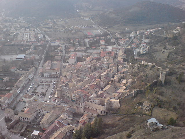
Castellane
- commune in Alpes-de-Haute-Provence, France
Hiking in Castellane
Castellane is a picturesque village located in the Provence-Alpes-Côte d'Azur region of southeastern France, and it's an excellent base for hiking enthusiasts. The surrounding area is characterized by stunning landscapes, including the Verdon Gorge, one of Europe's deepest canyons, and the dramatic limestone cliffs that frame the region. Here are some key points about hiking in and around Castellane:...
- Country:
- Postal Code: 04120
- Coordinates: 43° 50' 48" N, 6° 30' 48" E
- GPS tracks (wikiloc): [Link]
- Area: 117.79 sq km
- Population: 1543
- Web site: [Link]

Barcelonnette
- commune in Alpes-de-Haute-Provence, France
Hiking in Barcelonnette
Barcelonnette, nestled in the Ubaye Valley in the French Alps, is known for its stunning landscapes, charming architecture, and vibrant outdoor activities, including hiking. Here’s a guide to hiking in this beautiful area:...
- Country:
- Postal Code: 04400
- Coordinates: 44° 23' 9" N, 6° 39' 9" E
- GPS tracks (wikiloc): [Link]
- Area: 16.42 sq km
- Population: 2622
- Web site: [Link]

Jausiers
- commune in Alpes-de-Haute-Provence, France
Hiking in Jausiers
Jausiers is a charming village located in the Alpes-de-Haute-Provence region of France. It's nestled in the heart of the French Alps and offers attractive hiking opportunities for outdoor enthusiasts. Here are some highlights about hiking in and around Jausiers:...
- Country:
- Postal Code: 04850
- Coordinates: 44° 25' 4" N, 6° 43' 50" E
- GPS tracks (wikiloc): [Link]
- Area: 107.73 sq km
- Population: 1133
- Web site: [Link]

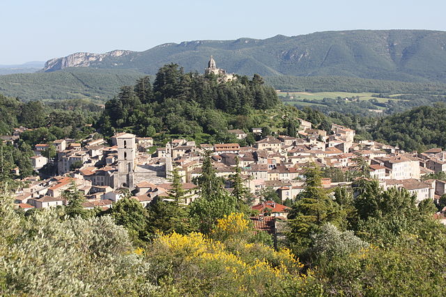
Moustiers-Sainte-Marie
- commune in Alpes-de-Haute-Provence, France
Hiking in Moustiers-Sainte-Marie
Moustiers-Sainte-Marie is a beautiful village in the Provence-Alpes-Côte d'Azur region of southeastern France, known for its stunning scenery and outdoor activities, particularly hiking. It’s nestled near the Gorges du Verdon, often referred to as the Grand Canyon of Europe, which offers a plethora of hiking trails ranging from easy strolls to more challenging treks....
- Country:
- Postal Code: 04360
- Coordinates: 43° 50' 51" N, 6° 13' 16" E
- GPS tracks (wikiloc): [Link]
- AboveSeaLevel: 1729 м m
- Area: 87.97 sq km
- Population: 693
- Web site: [Link]

Salignac
- commune in Alpes-de-Haute-Provence, France
Hiking in Salignac
Salignac, located in the Alpes-de-Haute-Provence region of France, offers a beautiful setting for hiking enthusiasts. The region is known for its stunning landscapes, picturesque villages, and diverse natural environments, which include mountains, forests, and rivers....
- Country:
- Postal Code: 04290
- Coordinates: 44° 9' 26" N, 5° 58' 58" E
- GPS tracks (wikiloc): [Link]
- Area: 14.42 sq km
- Population: 633

arrondissement of Forcalquier
- arrondissement of France
Hiking in arrondissement of Forcalquier
The Arrondissement of Forcalquier, located in the Alpes-de-Haute-Provence department in southeastern France, is a fantastic hiking destination known for its stunning landscapes, rich history, and diverse ecosystems. Here are some key points to consider if you're planning to hike in this area:...
- Country:
- Capital: Forcalquier
- Coordinates: 44° 5' 0" N, 5° 50' 0" E
- GPS tracks (wikiloc): [Link]
- Area: 2112 sq km
- Population: 95312

Château-Arnoux-Saint-Auban
- commune in Alpes-de-Haute-Provence, France
Hiking in Château-Arnoux-Saint-Auban
Château-Arnoux-Saint-Auban, located in the Alpes-de-Haute-Provence region of southeastern France, offers a picturesque backdrop for hiking enthusiasts. The area is characterized by beautiful landscapes, including rolling hills, rocky outcrops, and lush greenery....
- Country:
- Postal Code: 04160
- Coordinates: 44° 5' 36" N, 6° 0' 30" E
- GPS tracks (wikiloc): [Link]
- Area: 18.34 sq km
- Population: 5184
Draix
- commune in Alpes-de-Haute-Provence, France
Hiking in Draix
Draix, a charming village in the Alpes-de-Haute-Provence region of France, offers a variety of hiking opportunities set against stunning natural backdrops. The area's mountainous terrain and lush surroundings make it an attractive destination for both novice and experienced hikers....
- Country:
- Postal Code: 04420
- Coordinates: 44° 8' 4" N, 6° 20' 35" E
- GPS tracks (wikiloc): [Link]
- Area: 23.04 sq km
- Population: 113

Aubignosc
- commune in Alpes-de-Haute-Provence, France
Hiking in Aubignosc
Aubignosc is a charming village located in the Provence-Alpes-Côte d'Azur region of southeastern France. Surrounded by scenic landscapes, it offers a variety of hiking opportunities that cater to different skill levels. Here are some highlights for hiking in and around Aubignosc:...
- Country:
- Postal Code: 04200
- Coordinates: 44° 7' 47" N, 5° 58' 8" E
- GPS tracks (wikiloc): [Link]
- Area: 14.74 sq km
- Population: 556

Volonne
- commune in Alpes-de-Haute-Provence, France
Hiking in Volonne
Volonne is a charming village located in the Alpes-de-Haute-Provence region of southeastern France. Set against the backdrop of beautiful landscapes and rolling hills, it offers a variety of hiking opportunities for both beginners and seasoned hikers. Here are some key highlights and tips for hiking in and around Volonne:...
- Country:
- Postal Code: 04290
- Coordinates: 44° 6' 39" N, 6° 0' 52" E
- GPS tracks (wikiloc): [Link]
- Area: 24.61 sq km
- Population: 1659
- Web site: [Link]
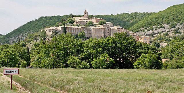
Banon
- commune in Alpes-de-Haute-Provence, France
Hiking in Banon
Banon, situated in the Alpes-de-Haute-Provence region of France, is a charming village known for its picturesque landscapes, rich history, and excellent hiking opportunities. Here's a guide to hiking in and around Banon:...
- Country:
- Postal Code: 04150
- Coordinates: 44° 2' 17" N, 5° 37' 41" E
- GPS tracks (wikiloc): [Link]
- Area: 39.81 sq km
- Population: 966
- Web site: [Link]

Peyruis
- commune in Alpes-de-Haute-Provence, France
Hiking in Peyruis
Peyruis, located in the Alpes-de-Haute-Provence region of France, offers some charming hiking opportunities that attract nature enthusiasts. The area is characterized by its picturesque landscapes, rolling hills, and scenic views of the surrounding alpine environment. Here are some key points to consider when hiking in and around Peyruis:...
- Country:
- Postal Code: 04310
- Coordinates: 44° 1' 44" N, 5° 56' 25" E
- GPS tracks (wikiloc): [Link]
- Area: 23.23 sq km
- Population: 2849
Montlaux
- commune in Alpes-de-Haute-Provence, France
Hiking in Montlaux
Montlaux is a charming destination for hiking enthusiasts, located in the Provence-Alpes-Côte d'Azur region of France. Nestled in the picturesque Verdon region, it offers a variety of trails that cater to different levels of hikers, from beginners to experienced trekkers....
- Country:
- Postal Code: 04230
- Coordinates: 44° 2' 49" N, 5° 50' 40" E
- GPS tracks (wikiloc): [Link]
- AboveSeaLevel: 550 м m
- Area: 19.75 sq km
- Population: 143

Peipin
- commune in Alpes-de-Haute-Provence, France
Hiking in Peipin
Peipin, a location in the Huainan area of China, is not as widely known for hiking as some other regions, but it offers unique opportunities. The landscape is characterized by beautiful hills, forests, and rivers, making it a scenic spot for outdoor enthusiasts....
- Country:
- Postal Code: 04200
- Coordinates: 44° 8' 13" N, 5° 57' 24" E
- GPS tracks (wikiloc): [Link]
- Area: 13.15 sq km
- Population: 1476

L'Escale
- commune in Alpes-de-Haute-Provence, France
Hiking in L'Escale
L'Escale, located in the French region of Provence-Alpes-Côte d'Azur, offers a variety of hiking opportunities for outdoor enthusiasts. The region is known for its stunning landscapes, including rugged mountains, scenic valleys, and picturesque villages. Here are some key points to consider when hiking in L'Escale:...
- Country:
- Postal Code: 04160
- Coordinates: 44° 5' 7" N, 6° 1' 23" E
- GPS tracks (wikiloc): [Link]
- Area: 20.36 sq km
- Population: 1408

Aiglun
- commune in Alpes-de-Haute-Provence, France
Hiking in Aiglun
Aiglun, located in the Alpes-de-Haute-Provence region of France, offers a range of hiking opportunities set against a stunning backdrop of natural beauty. This area is characterized by its mountainous landscapes, rugged terrain, and picturesque villages, making it a great destination for outdoor enthusiasts....
- Country:
- Postal Code: 04510
- Coordinates: 44° 3' 13" N, 6° 8' 26" E
- GPS tracks (wikiloc): [Link]
- Area: 14.89 sq km
- Population: 1384
- Web site: [Link]

Esparron-de-Verdon
- commune in Alpes-de-Haute-Provence, France
Hiking in Esparron-de-Verdon
Esparron-de-Verdon is a picturesque village located near the Verdon Gorge in the Provence-Alpes-Côte d’Azur region of France. It’s an excellent destination for hiking enthusiasts, thanks to its stunning landscapes, diverse terrain, and beautiful views of the Verdon River....
- Country:
- Postal Code: 04800
- Coordinates: 43° 44' 20" N, 5° 58' 19" E
- GPS tracks (wikiloc): [Link]
- Area: 34.2 sq km
- Population: 414
- Web site: [Link]

Gréoux-les-Bains
- commune in Alpes-de-Haute-Provence, France
Hiking in Gréoux-les-Bains
Gréoux-les-Bains is a charming village located in the Provence-Alpes-Côte d'Azur region of southeastern France. Known primarily for its thermal springs, it also offers a variety of hiking opportunities that allow you to explore the beautiful surrounding landscapes, including the stunning Verdon Gorge and the lush countryside....
- Country:
- Postal Code: 04800
- Coordinates: 43° 45' 30" N, 5° 53' 1" E
- GPS tracks (wikiloc): [Link]
- Area: 69.46 sq km
- Population: 2628

Le Lauzet-Ubaye
- commune in Alpes-de-Haute-Provence, France
Hiking in Le Lauzet-Ubaye
Le Lauzet-Ubaye is a beautiful destination located in the Alpes-de-Haute-Provence region of southeastern France. Situated along the Ubaye River, this picturesque area offers stunning landscapes, rich biodiversity, and a variety of hiking trails suitable for different skill levels. Here are some highlights and tips for hiking in Le Lauzet-Ubaye:...
- Country:
- Postal Code: 04340
- Coordinates: 44° 25' 48" N, 6° 25' 56" E
- GPS tracks (wikiloc): [Link]
- Area: 66.26 sq km
- Population: 211

Riez
- commune in Alpes-de-Haute-Provence, France
Hiking in Riez
Riez, a charming village in the Alpes-de-Haute-Provence region of southeastern France, offers a variety of hiking opportunities that showcase the natural beauty and historical significance of the area. Here are some details and tips for hiking in and around Riez:...
- Country:
- Postal Code: 04500
- Coordinates: 43° 49' 5" N, 6° 5' 34" E
- GPS tracks (wikiloc): [Link]
- Area: 40 sq km
- Population: 1828
- Web site: [Link]
Colmars
- commune in Alpes-de-Haute-Provence, France
Hiking in Colmars
Colmars is a charming village located in the Alpes-de-Haute-Provence region of France. It's an excellent destination for hiking enthusiasts, offering stunning landscapes, rich biodiversity, and a taste of the local culture. Here are some highlights regarding hiking in Colmars:...
- Country:
- Postal Code: 04370
- Coordinates: 44° 10' 52" N, 6° 37' 36" E
- GPS tracks (wikiloc): [Link]
- Area: 81.82 sq km
- Population: 431

Valensole
- commune in Alpes-de-Haute-Provence, France
Hiking in Valensole
Valensole, located in the Alpes-de-Haute-Provence region of southeastern France, is renowned for its stunning landscapes, especially its vast lavender fields that bloom in the summer months, creating a vibrant purple carpet across the rolling hills. Hiking in Valensole can be a truly rewarding experience, offering breathtaking views and a chance to connect with nature....
- Country:
- Postal Code: 04210
- Coordinates: 43° 50' 17" N, 5° 59' 2" E
- GPS tracks (wikiloc): [Link]
- Area: 127.77 sq km
- Population: 3169
- Web site: [Link]

Les Mées
- commune in Alpes-de-Haute-Provence, France
Hiking in Les Mées
Les Mées, located in the Alpes-de-Haute-Provence region of France, is known for its stunning landscapes, diverse trails, and the unique geological formations that characterize the area. Here’s what you can expect when hiking in Les Mées:...
- Country:
- Postal Code: 04190
- Coordinates: 44° 1' 46" N, 5° 58' 35" E
- GPS tracks (wikiloc): [Link]
- Area: 65.4 sq km
- Population: 3664
- Web site: [Link]

Beaujeu
- commune in Alpes-de-Haute-Provence, France
Hiking in Beaujeu
Beaujeu, located in the Alpes-de-Haute-Provence region of southeastern France, is a lesser-known gem for hiking enthusiasts. The area is characterized by its stunning natural beauty, including rolling hills, rocky outcrops, and diverse landscapes that range from lush forests to arid terrain. Here are some highlights of hiking in Beaujeu:...
- Country:
- Postal Code: 04420
- Coordinates: 44° 12' 12" N, 6° 22' 18" E
- GPS tracks (wikiloc): [Link]
- Area: 45.68 sq km
- Population: 137

Allemagne-en-Provence
- commune in Alpes-de-Haute-Provence, France
Hiking in Allemagne-en-Provence
Allemagne-en-Provence, located in the Provence region of southeastern France, is a wonderful destination for hiking enthusiasts. The area is characterized by its stunning landscapes, rolling hills, and picturesque villages, making it an ideal spot for both casual walkers and serious trekkers....
- Country:
- Postal Code: 04500
- Coordinates: 43° 46' 56" N, 6° 0' 25" E
- GPS tracks (wikiloc): [Link]
- Area: 32.99 sq km
- Population: 527

Dauphin
- commune in Alpes-de-Haute-Provence, France
Hiking in Dauphin
Dauphin, located in the Alpes-de-Haute-Provence region of southeastern France, is a charming village surrounded by stunning natural scenery. Hiking in this area offers a variety of trails that cater to different skill levels and preferences, allowing you to experience the beauty of the Provençal landscape....
- Country:
- Postal Code: 04300
- Coordinates: 43° 53' 54" N, 5° 46' 59" E
- GPS tracks (wikiloc): [Link]
- Area: 9.71 sq km
- Population: 823
- Web site: [Link]

Vergons
- commune in Alpes-de-Haute-Provence, France
Hiking in Vergons
Vergons is a charming village located in the Alpes-de-Haute-Provence region of France, offering stunning natural beauty and a variety of hiking opportunities. Here are some key points about hiking in and around Vergons:...
- Country:
- Postal Code: 04170
- Coordinates: 43° 54' 51" N, 6° 35' 14" E
- GPS tracks (wikiloc): [Link]
- Area: 45.73 sq km
- Population: 114
Oppedette
- commune in Alpes-de-Haute-Provence, France
Hiking in Oppedette
Oppedette is a beautiful area located in the Provence region of France, known for its stunning natural landscapes and rich geological features. The region offers great hiking opportunities, making it an excellent destination for outdoor enthusiasts. Here are some highlights of hiking in Oppedette:...
- Country:
- Postal Code: 04110
- Coordinates: 43° 56' 3" N, 5° 35' 25" E
- GPS tracks (wikiloc): [Link]
- Area: 8.49 sq km
- Population: 53
Oraison
- commune in Alpes-de-Haute-Provence, France
Hiking in Oraison
Oraison, a charming village in the Alpes-de-Haute-Provence region of France, offers a variety of hiking opportunities suitable for different skill levels. The surrounding landscape features rolling hills, lavender fields, and stunning views of the nearby Lure Mountain. Here are some highlights for hiking in and around Oraison:...
- Country:
- Postal Code: 04700
- Coordinates: 43° 55' 2" N, 5° 55' 7" E
- GPS tracks (wikiloc): [Link]
- Area: 38.42 sq km
- Population: 5854
- Web site: [Link]

Verdaches
- commune in Alpes-de-Haute-Provence, France
Hiking in Verdaches
Verdaches is a lesser-known but beautiful destination for hiking enthusiasts, located in the southern French Alps. The region is characterized by stunning landscapes, diverse flora and fauna, and tranquil environments, making it a great spot for both casual and experienced hikers....
- Country:
- Postal Code: 04140
- Coordinates: 44° 15' 48" N, 6° 20' 32" E
- GPS tracks (wikiloc): [Link]
- Area: 22.92 sq km
- Population: 63
- Web site: [Link]

Villeneuve
- commune in Alpes-de-Haute-Provence, France
Hiking in Villeneuve
Villeneuve, located in the Alpes-de-Haute-Provence region of France, offers beautiful hiking opportunities that showcase the stunning natural landscapes of the area. The region is characterized by its diverse terrains, which include hills, mountains, river valleys, and lush forests, making it an attractive destination for hikers of all skill levels....
- Country:
- Postal Code: 04180
- Coordinates: 43° 53' 39" N, 5° 51' 47" E
- GPS tracks (wikiloc): [Link]
- Area: 25.55 sq km
- Population: 4094
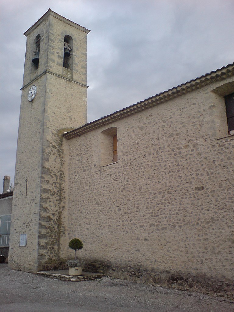
Niozelles
- commune in Alpes-de-Haute-Provence, France
Hiking in Niozelles
Niozelles is a picturesque village located in the Alpes-de-Haute-Provence region of southeastern France. It offers a charming rural landscape, steeped in tranquility and natural beauty, making it a great spot for hiking enthusiasts....
- Country:
- Postal Code: 04300
- Coordinates: 43° 56' 10" N, 5° 50' 15" E
- GPS tracks (wikiloc): [Link]
- Area: 10.47 sq km
- Population: 275
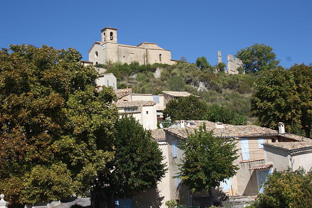
Saint-Jurs
- commune in Alpes-de-Haute-Provence, France
Hiking in Saint-Jurs
Saint-Jurs, a small village in the Alpes-de-Haute-Provence region of France, offers a variety of hiking opportunities for outdoor enthusiasts. Nestled in a picturesque setting, the area is characterized by stunning landscapes, rolling hills, and scenic views of the surrounding mountains....
- Country:
- Postal Code: 04410
- Coordinates: 43° 53' 55" N, 6° 11' 59" E
- GPS tracks (wikiloc): [Link]
- AboveSeaLevel: 925 м m
- Area: 33.59 sq km
- Population: 139

Limans
- commune in Alpes-de-Haute-Provence, France
Hiking in Limans
Hiking in Limans, or coastal areas and wetlands, can be a unique and rewarding experience. However, it seems you might be referring to a specific region, as "Limans" could pertain to various geographical features depending on the context. Here are a few general tips and highlights for hiking in coastal or wetland regions that could be relevant:...
- Country:
- Postal Code: 04300
- Coordinates: 43° 59' 6" N, 5° 43' 50" E
- GPS tracks (wikiloc): [Link]
- Area: 20.97 sq km
- Population: 365
Sourribes
- commune in Alpes-de-Haute-Provence, France
Hiking in Sourribes
Sourribes is a picturesque region known for its impressive natural landscapes and scenic hiking trails. Located in the French Alps, it offers a variety of hiking experiences suitable for different skill levels, from leisurely walks to challenging treks....
- Country:
- Postal Code: 04290
- Coordinates: 44° 8' 55" N, 6° 0' 57" E
- GPS tracks (wikiloc): [Link]
- Area: 19.75 sq km
- Population: 180

Redortiers
- commune in Alpes-de-Haute-Provence, France
Hiking in Redortiers
Redortiers is a picturesque village located in the Drôme department of southeastern France, nestled in the beautiful landscape of the Provence region. The area is surrounded by stunning natural scenery, making it an excellent destination for hiking enthusiasts....
- Country:
- Postal Code: 04150
- Coordinates: 44° 6' 17" N, 5° 37' 6" E
- GPS tracks (wikiloc): [Link]
- Area: 45.77 sq km
- Population: 73

Roumoules
- commune in Alpes-de-Haute-Provence, France
Hiking in Roumoules
Roumoules is a charming village located in the Alpes-de-Haute-Provence region of France. It serves as a great base for outdoor enthusiasts looking to explore the stunning landscapes of this part of Provence....
- Country:
- Postal Code: 04500
- Coordinates: 43° 49' 32" N, 6° 7' 48" E
- GPS tracks (wikiloc): [Link]
- Area: 26.04 sq km
- Population: 746

Mane
- commune in Alpes-de-Haute-Provence, France
Hiking in Mane
Mane, located in the Alpes-de-Haute-Provence region of France, offers a picturesque setting for hiking enthusiasts. Nestled in the foothills of the Luberon mountains and surrounded by lush landscapes, it provides a variety of trails suitable for all levels of hikers....
- Country:
- Postal Code: 04300
- Coordinates: 43° 56' 18" N, 5° 46' 3" E
- GPS tracks (wikiloc): [Link]
- Area: 22 sq km
- Population: 1367
- Web site: [Link]

L'Hospitalet
- commune in Alpes-de-Haute-Provence, France
Hiking in L'Hospitalet
L'Hospitalet, located in the Alpes-de-Haute-Provence region of France, is known for its stunning natural landscapes, making it an excellent destination for hiking enthusiasts. Here are some details about hiking in this area:...
- Country:
- Postal Code: 04150
- Coordinates: 44° 5' 13" N, 5° 41' 54" E
- GPS tracks (wikiloc): [Link]
- Area: 19.35 sq km
- Population: 89

Melve
- commune in Alpes-de-Haute-Provence, France
Hiking in Melve
Melve is a delightful location for hiking enthusiasts, nestled in nature with various trails and landscapes. While Melve may not be one of the most famous hiking spots, its charm lies in the scenic routes that offer a peaceful hiking experience away from the crowds. Here are some general tips and information if you're considering hiking in Melve:...
- Country:
- Postal Code: 04250
- Coordinates: 44° 21' 17" N, 5° 59' 23" E
- GPS tracks (wikiloc): [Link]
- Area: 14.11 sq km
- Population: 110

Senez
- commune in Alpes-de-Haute-Provence, France
Hiking in Senez
Senez is a charming commune located in the Alpes-de-Haute-Provence region of southeastern France. It is surrounded by natural beauty, making it a great destination for hiking enthusiasts. Here’s an overview of what you can expect when hiking in the Senez area:...
- Country:
- Postal Code: 04270
- Coordinates: 43° 54' 49" N, 6° 24' 25" E
- GPS tracks (wikiloc): [Link]
- Area: 70.27 sq km
- Population: 166
Le Brusquet
- commune in Alpes-de-Haute-Provence, France
Hiking in Le Brusquet
Le Brusquet is a charming village located in the Alpes-de-Haute-Provence region of France, nestled in a picturesque setting that offers plenty of opportunities for hiking and outdoor activities. Here’s what you should know about hiking in and around Le Brusquet:...
- Country:
- Postal Code: 04420
- Coordinates: 44° 9' 40" N, 6° 18' 35" E
- GPS tracks (wikiloc): [Link]
- Area: 22.25 sq km
- Population: 966

Saint-Maime
- commune in Alpes-de-Haute-Provence, France
Hiking in Saint-Maime
Saint-Maime, located in the Alpes-de-Haute-Provence region of southeastern France, is a great location for hiking enthusiasts. The area is characterized by its stunning landscapes, which include rolling hills, rocky terrain, and picturesque views of the surrounding Provencal countryside....
- Country:
- Postal Code: 04300
- Coordinates: 43° 54' 14" N, 5° 47' 34" E
- GPS tracks (wikiloc): [Link]
- Area: 7.51 sq km
- Population: 835
- Web site: [Link]
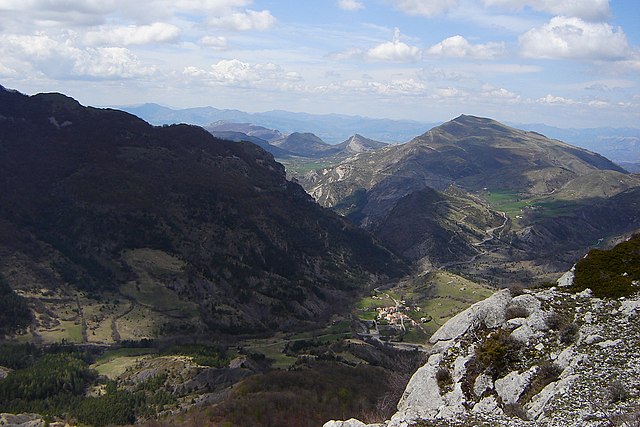
Authon
- commune in Alpes-de-Haute-Provence, France
Hiking in Authon
Authon, located in the Alpes-de-Haute-Provence region of France, offers a charming setting for outdoor enthusiasts and hikers. The area is characterized by its stunning landscapes, comprising rolling hills, rocky ridges, and fields dotted with wildflowers. The natural beauty of the region is complemented by its mild climate, making it a pleasant destination for hiking....
- Country:
- Postal Code: 04200
- Coordinates: 44° 14' 18" N, 6° 7' 35" E
- GPS tracks (wikiloc): [Link]
- Area: 40.16 sq km
- Population: 53

arrondissement of Barcelonnette
- arrondissement of France
Hiking in arrondissement of Barcelonnette
The Arrondissement of Barcelonnette, located in the Alpes-de-Haute-Provence department in the Provence-Alpes-Côte d'Azur region of southeastern France, is a fantastic destination for hiking enthusiasts. The area is characterized by stunning landscapes, including the majestic Alps, deep valleys, and charming villages....
- Country:
- Capital: Barcelonnette
- Coordinates: 44° 25' 0" N, 6° 40' 0" E
- GPS tracks (wikiloc): [Link]
- Population: 7918


arrondissement of Castellane
- arrondissement of France
Hiking in arrondissement of Castellane
The Arrondissement of Castellane, located in the Alpes-de-Haute-Provence region of southeastern France, is an excellent destination for hiking enthusiasts. This area is known for its breathtaking natural landscapes, including dramatic gorges, rugged mountains, and serene lakes. Here are some highlights and tips for hiking in this region:...
- Country:
- Capital: Castellane
- Coordinates: 43° 51' 0" N, 6° 31' 0" E
- GPS tracks (wikiloc): [Link]
- Population: 11267


arrondissement of Digne-les-Bains
- arrondissement of France
Hiking in arrondissement of Digne-les-Bains
The Arrondissement of Digne-les-Bains, located in the Alpes-de-Haute-Provence department in southeastern France, offers a diverse range of hiking opportunities. This region is known for its stunning natural landscapes, including mountains, valleys, and stunning geological formations. Here are some highlights and tips for hiking in the area:...
- Country:
- Capital: Digne-les-Bains
- Coordinates: 44° 6' 0" N, 6° 14' 0" E
- GPS tracks (wikiloc): [Link]
- Population: 47302

Thorame-Basse
- commune in Alpes-de-Haute-Provence, France
Hiking in Thorame-Basse
Thorame-Basse is a charming village located in the Alpes-de-Haute-Provence region of France. Nestled in the foothills of the Alps, it offers a variety of hiking opportunities that cater to different skill levels....
- Country:
- Postal Code: 04170
- Coordinates: 44° 5' 29" N, 6° 30' 4" E
- GPS tracks (wikiloc): [Link]
- Area: 97.72 sq km
- Population: 221
- Web site: [Link]

Entrevennes
- commune in Alpes-de-Haute-Provence, France
Hiking in Entrevennes
Entrevennes is a charming village located in the Alpes-de-Haute-Provence department in southeastern France. It's surrounded by beautiful natural landscapes, making it an excellent destination for hiking enthusiasts. Here are some key points to consider if you're planning to hike in and around Entrevennes:...
- Country:
- Postal Code: 04700
- Coordinates: 43° 56' 16" N, 6° 1' 24" E
- GPS tracks (wikiloc): [Link]
- Area: 29.81 sq km
- Population: 163
- Web site: [Link]

Turriers
- commune in Alpes-de-Haute-Provence, France
Hiking in Turriers
Turriers is a small village located in the Alpes-de-Haute-Provence department in southeastern France. The region offers beautiful landscapes, with opportunities for hiking through picturesque trails that showcase the natural beauty of the area, including mountains, forests, and valleys....
- Country:
- Postal Code: 04250
- Coordinates: 44° 24' 5" N, 6° 10' 8" E
- GPS tracks (wikiloc): [Link]
- Area: 19.86 sq km
- Population: 325

Villars-Colmars
- commune in Alpes-de-Haute-Provence, France
Hiking in Villars-Colmars
Villars-Colmars is a beautiful destination located in the French Alps, specifically in the Haute-Alpes region. It's known for its stunning landscapes, diverse wildlife, and a variety of hiking trails suitable for all levels of experience. Here are some highlights about hiking in this area:...
- Country:
- Postal Code: 04370
- Coordinates: 44° 10' 0" N, 6° 36' 16" E
- GPS tracks (wikiloc): [Link]
- Area: 40.59 sq km
- Population: 256

Barrême
- commune in Alpes-de-Haute-Provence, France
Hiking in Barrême
Barrême, located in the Alpes-de-Haute-Provence region of France, is a charming village surrounded by stunning natural landscapes that offer a variety of hiking opportunities. The area is renowned for its scenic views, diverse terrain, and rich flora and fauna, making it an excellent destination for hikers of all levels....
- Country:
- Postal Code: 04330
- Coordinates: 43° 57' 13" N, 6° 22' 4" E
- GPS tracks (wikiloc): [Link]
- Area: 37.05 sq km
- Population: 436
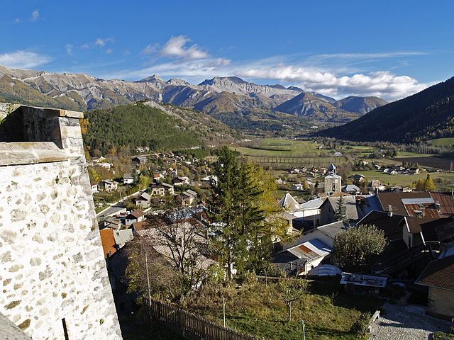
Seyne
- commune in Alpes-de-Haute-Provence, France
Hiking in Seyne
Seyne is a delightful town located in the Alpes-de-Haute-Provence region of France, and it offers a variety of hiking opportunities for outdoor enthusiasts. The surrounding landscape is characterized by stunning mountains, lush valleys, and picturesque views, making it an excellent destination for hikers of all skill levels....
- Country:
- Postal Code: 04140
- Coordinates: 44° 21' 2" N, 6° 21' 23" E
- GPS tracks (wikiloc): [Link]
- Area: 84.27 sq km
- Population: 1360
- Web site: [Link]
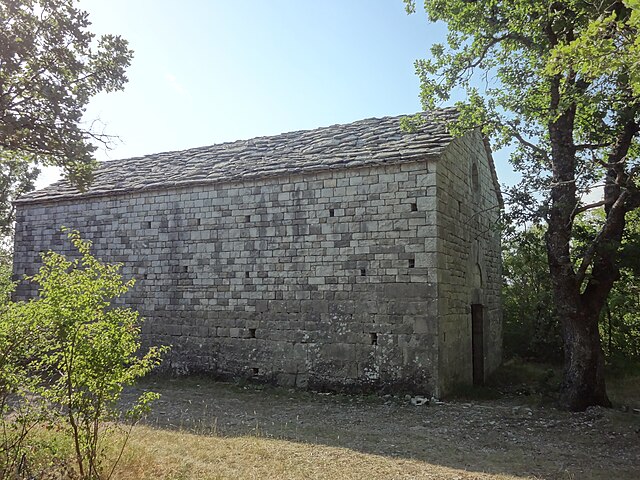
Châteauneuf-Val-Saint-Donat
- commune in Alpes-de-Haute-Provence, France
Hiking in Châteauneuf-Val-Saint-Donat
Châteauneuf-Val-Saint-Donat, located in the Alpes-de-Haute-Provence region of France, offers a range of beautiful hiking opportunities that showcase the picturesque landscapes of the area. Here are some aspects of hiking in this region:...
- Country:
- Postal Code: 04200
- Coordinates: 44° 5' 39" N, 5° 56' 58" E
- GPS tracks (wikiloc): [Link]
- Area: 21.1 sq km
- Population: 503

Demandolx
- commune in Alpes-de-Haute-Provence, France
Hiking in Demandolx
Demandolx, located in the Alpes-Maritimes region of France, is a lesser-known but beautiful area for hiking enthusiasts. The region is characterized by its stunning natural landscapes, including mountains, valleys, and picturesque views. Here are some key points to consider if you're planning a hiking trip to Demandolx:...
- Country:
- Postal Code: 04120
- Coordinates: 43° 52' 11" N, 6° 34' 43" E
- GPS tracks (wikiloc): [Link]
- Area: 20.37 sq km
- Population: 130

Hautes-Duyes
- commune in Alpes-de-Haute-Provence, France
Hiking in Hautes-Duyes
Hautes-Duyes is a beautiful area located in the Alpes-de-Haute-Provence region of France, characterized by its stunning landscapes, diverse ecosystems, and charming villages. When hiking in Hautes-Duyes, you can expect picturesque views of rolling hills, valleys, and the typical Mediterranean flora and fauna....
- Country:
- Postal Code: 04380
- Coordinates: 44° 10' 48" N, 6° 9' 28" E
- GPS tracks (wikiloc): [Link]
- Area: 22.84 sq km
- Population: 42
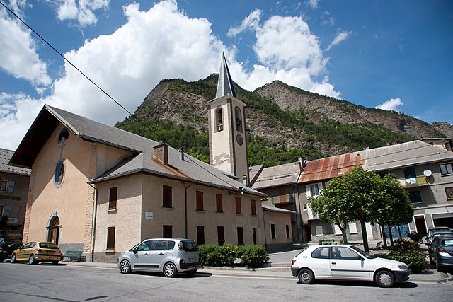
La Condamine-Châtelard
- commune in Alpes-de-Haute-Provence, France
Hiking in La Condamine-Châtelard
La Condamine-Châtelard is a picturesque village located in the Alpes-Maritimes region of France, near the Italian border. It's a part of the larger area of the French Alps, known for its stunning natural landscapes and outdoor recreational opportunities, including hiking....
- Country:
- Postal Code: 04530
- Coordinates: 44° 27' 29" N, 6° 44' 45" E
- GPS tracks (wikiloc): [Link]
- AboveSeaLevel: 1305 м m
- Area: 56.08 sq km
- Population: 172
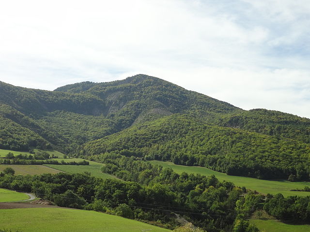
Gigors
- commune in Alpes-de-Haute-Provence, France
Hiking in Gigors
Gigors is a charming village located in the Provence-Alpes-Côte d'Azur region of France, near the picturesque Vercors Massif. While it may not be as widely known as some larger hiking destinations, it offers a range of scenic trails and beautiful landscapes that make it an appealing spot for hiking enthusiasts....
- Country:
- Postal Code: 04250
- Coordinates: 44° 25' 9" N, 6° 9' 34" E
- GPS tracks (wikiloc): [Link]
- Area: 13.69 sq km
- Population: 58

Bras-d'Asse
- commune in Alpes-de-Haute-Provence, France
Hiking in Bras-d'Asse
Bras-d'Asse is a charming small village located in the Alpes-de-Haute-Provence region of France. It's nestled in a scenic area known for its stunning natural landscapes, which makes it a lovely destination for hiking enthusiasts. Here are some key points to consider if you're planning a hiking trip to Bras-d'Asse:...
- Country:
- Postal Code: 04270
- Coordinates: 43° 55' 32" N, 6° 7' 32" E
- GPS tracks (wikiloc): [Link]
- AboveSeaLevel: 633 м m
- Area: 26.1 sq km
- Population: 580
- Web site: [Link]

Brunet
- commune in Alpes-de-Haute-Provence, France
Hiking in Brunet
Brunet, located in the Alpes-de-Haute-Provence region of France, offers a unique hiking experience with its stunning landscapes and diverse natural features. Here are some highlights and tips for hiking in this beautiful area:...
- Country:
- Postal Code: 04210
- Coordinates: 43° 53' 29" N, 6° 1' 49" E
- GPS tracks (wikiloc): [Link]
- Area: 28.47 sq km
- Population: 255

Estoublon
- commune in Alpes-de-Haute-Provence, France
Hiking in Estoublon
Estoublon is a charming village located in the Alpes-de-Haute-Provence region of southeastern France. Its picturesque landscapes and proximity to the Verdon Gorge make it a great destination for hiking enthusiasts. Here are some things to consider when planning hikes in the Estoublon area:...
- Country:
- Postal Code: 04270
- Coordinates: 43° 56' 33" N, 6° 10' 17" E
- GPS tracks (wikiloc): [Link]
- Area: 33.85 sq km
- Population: 480

Le Castellard-Mélan
- commune in Alpes-de-Haute-Provence, France
Hiking in Le Castellard-Mélan
Le Castellard-Mélan is a charming commune located in the Alpes-de-Haute-Provence region of France. Nestled in a beautiful mountainous landscape, it offers a variety of hiking opportunities suitable for different skill levels. Here are some key points to consider if you're planning a hiking trip to this area:...
- Country:
- Postal Code: 04380
- Coordinates: 44° 11' 14" N, 6° 7' 29" E
- GPS tracks (wikiloc): [Link]
- Area: 25.74 sq km
- Population: 65

Barles
- commune in Alpes-de-Haute-Provence, France
Hiking in Barles
Barles is a small village located in the Alpes-de-Haute-Provence region of southern France, known for its beautiful natural scenery and opportunities for outdoor activities, including hiking. The region boasts diverse landscapes, including mountains, forests, and rivers, making it an excellent destination for hikers of all levels....
- Country:
- Postal Code: 04140
- Coordinates: 44° 15' 49" N, 6° 16' 5" E
- GPS tracks (wikiloc): [Link]
- Area: 59.05 sq km
- Population: 138

Archail
- commune in Alpes-de-Haute-Provence, France
Hiking in Archail
Archail is not a widely recognized hiking destination, so information about it might be limited or could refer to a lesser-known area or a specific locality. It’s possible you may be referring to a region in France, India, or another country with a similar-sounding name....
- Country:
- Postal Code: 04420
- Coordinates: 44° 7' 17" N, 6° 20' 3" E
- GPS tracks (wikiloc): [Link]
- Area: 12.99 sq km
- Population: 16

Châteauneuf-Miravail
- commune in Alpes-de-Haute-Provence, France
Hiking in Châteauneuf-Miravail
Châteauneuf-Miravail is a picturesque village located in the Auvergne-Rhône-Alpes region of France, surrounded by beautiful natural landscapes, including hills and forests that offer excellent hiking opportunities. Here’s what you need to know about hiking in and around Châteauneuf-Miravail:...
- Country:
- Postal Code: 04200
- Coordinates: 44° 9' 44" N, 5° 43' 36" E
- GPS tracks (wikiloc): [Link]
- Area: 19.7 sq km
- Population: 72

Cruis
- commune in Alpes-de-Haute-Provence, France
Hiking in Cruis
Cruis, a picturesque village located in the Provence-Alpes-Côte d'Azur region of France, offers a charming landscape for hiking enthusiasts. The area boasts rolling hills, olive groves, and scenic views characteristic of southern France. Here are some highlights regarding hiking in and around Cruis:...
- Country:
- Postal Code: 04230
- Coordinates: 44° 3' 45" N, 5° 50' 9" E
- GPS tracks (wikiloc): [Link]
- Area: 36.47 sq km
- Population: 645

Saint-André-les-Alpes
- commune in Alpes-de-Haute-Provence, France
Hiking in Saint-André-les-Alpes
Saint-André-les-Alpes is a charming village located in the Alpes-de-Haute-Provence region of France. Known for its stunning natural landscapes and outdoor activities, it's an excellent destination for hikers of all levels. Here are some key highlights about hiking in the area:...
- Country:
- Postal Code: 04170
- Coordinates: 43° 58' 5" N, 6° 30' 28" E
- GPS tracks (wikiloc): [Link]
- Area: 47.46 sq km
- Population: 983

Allons
- commune in Alpes-de-Haute-Provence, France
Hiking in Allons
Allons, located in the Alpes-de-Haute-Provence region of southeastern France, offers a variety of hiking opportunities amidst stunning natural landscapes. This area is characterized by its diverse terrain, including rocky hills, lush forests, and picturesque valleys, making it ideal for both casual walkers and more experienced hikers....
- Country:
- Postal Code: 04170
- Coordinates: 43° 58' 39" N, 6° 35' 42" E
- GPS tracks (wikiloc): [Link]
- Area: 41.71 sq km
- Population: 154
- Web site: [Link]

Champtercier
- commune in Alpes-de-Haute-Provence, France
Hiking in Champtercier
Champtercier, located in the Alpes-de-Haute-Provence region of France, is a beautiful destination for hiking enthusiasts. The area is characterized by its stunning landscapes, picturesque villages, and diverse terrain, making it a great choice for both novice and experienced hikers....
- Country:
- Postal Code: 04660
- Coordinates: 44° 5' 43" N, 6° 9' 48" E
- GPS tracks (wikiloc): [Link]
- Area: 18.31 sq km
- Population: 792

Braux
- commune in Alpes-de-Haute-Provence, France
Hiking in Braux
Braux, located in the Alpes-de-Haute-Provence region of France, is an excellent area for hiking enthusiasts looking for stunning landscapes and serene natural environments. The region is characterized by its mountainous terrain, picturesque valleys, and charming villages....
- Country:
- Postal Code: 04240
- Coordinates: 43° 59' 9" N, 6° 42' 1" E
- GPS tracks (wikiloc): [Link]
- Area: 11.67 sq km
- Population: 122

Le Fugeret
- commune in Alpes-de-Haute-Provence, France
Hiking in Le Fugeret
Le Fugeret, located in the Alpes-de-Haute-Provence department in southeastern France, offers a variety of hiking opportunities that showcase the stunning natural beauty of the region. Here are some highlights and tips for hiking in Le Fugeret:...
- Country:
- Postal Code: 04240
- Coordinates: 44° 0' 13" N, 6° 38' 31" E
- GPS tracks (wikiloc): [Link]
- Area: 28.38 sq km
- Population: 189

Céreste
- commune in Alpes-de-Haute-Provence, France
Hiking in Céreste
Céreste is a charming village located in the Provence region of southeastern France, nestled in the Luberon mountains. It offers a variety of hiking opportunities that showcase the stunning natural beauty and rich cultural heritage of the area....
- Country:
- Postal Code: 04280
- Coordinates: 43° 51' 21" N, 5° 35' 14" E
- GPS tracks (wikiloc): [Link]
- Area: 32.54 sq km
- Population: 1194

Bellaffaire
- commune in Alpes-de-Haute-Provence, France
Hiking in Bellaffaire
It seems there may be a misunderstanding regarding the location "Bellaffaire." There isn't a widely recognized hiking area or national park by that name that I am aware of as of my last training cut-off in October 2023. It's possible that it could be a lesser-known local area, a private property, or perhaps a misspelling of a nearby location....
- Country:
- Postal Code: 04250
- Coordinates: 44° 25' 10" N, 6° 10' 36" E
- GPS tracks (wikiloc): [Link]
- Area: 13.12 sq km
- Population: 149
- Web site: [Link]

Angles
- commune in Alpes-de-Haute-Provence, France
Hiking in Angles
Angles, located in the Alpes-de-Haute-Provence region of France, is a wonderful destination for hiking enthusiasts. Nestled in the stunning natural landscapes of the southern French Alps, this area offers a variety of trails for all levels of hikers, from family-friendly walks to challenging mountain treks....
- Country:
- Postal Code: 04170
- Coordinates: 43° 56' 34" N, 6° 33' 29" E
- GPS tracks (wikiloc): [Link]
- Area: 9.83 sq km
- Population: 64

Beynes
- commune in Alpes-de-Haute-Provence, France
Hiking in Beynes
Beynes is a charming village located in the Alpes-de-Haute-Provence region of France, surrounded by stunning natural landscapes that are ideal for hiking enthusiasts. The area is characterized by its rugged terrain, picturesque valleys, and panoramic views of the mountains, making it a great destination for outdoor activities....
- Country:
- Postal Code: 04270
- Coordinates: 43° 59' 35" N, 6° 12' 8" E
- GPS tracks (wikiloc): [Link]
- Area: 41.24 sq km
- Population: 126

Allos
- commune in Alpes-de-Haute-Provence, France
Hiking in Allos
Allos is a fantastic destination for hiking, situated in the Alpes-de-Haute-Provence region of France. Known for its stunning natural landscapes and diverse terrain, Allos offers a variety of trails suitable for hikers of all levels. Here are some highlights of hiking in the Allos area:...
- Country:
- Postal Code: 04260
- Coordinates: 44° 14' 25" N, 6° 37' 41" E
- GPS tracks (wikiloc): [Link]
- Area: 116.65 sq km
- Population: 697

Aubenas-les-Alpes
- commune in Alpes-de-Haute-Provence, France
Hiking in Aubenas-les-Alpes
Aubenas-les-Alpes is a charming village located in the Alpes-de-Haute-Provence region in southeastern France. It's surrounded by stunning landscapes that make it a great location for hiking enthusiasts. Here are some key points to consider if you're planning a hike in the area:...
- Country:
- Postal Code: 04110
- Coordinates: 43° 55' 52" N, 5° 40' 50" E
- GPS tracks (wikiloc): [Link]
- Area: 7.93 sq km
- Population: 103

Chaudon-Norante
- commune in Alpes-de-Haute-Provence, France
Hiking in Chaudon-Norante
Chaudon-Norante is a picturesque village located in the Alpes-de-Haute-Provence region of France, known for its stunning natural surroundings and hiking opportunities. Nestled in the Verdon regional park, it offers access to a variety of trails that cater to different skill levels....
- Country:
- Postal Code: 04330
- Coordinates: 43° 58' 46" N, 6° 18' 44" E
- GPS tracks (wikiloc): [Link]
- Area: 37.48 sq km
- Population: 185

Castellet-lès-Sausses
- commune in Alpes-de-Haute-Provence, France
Hiking in Castellet-lès-Sausses
Castellet-lès-Sausses is a small village located in the Alpes-de-Haute-Provence region of France, and it offers a range of hiking opportunities that showcase the beautiful natural scenery of the area. This region is characterized by its rugged terrain, lush landscapes, and stunning views of the surrounding mountains and valleys....
- Country:
- Postal Code: 04320
- Coordinates: 43° 59' 40" N, 6° 45' 48" E
- GPS tracks (wikiloc): [Link]
- Area: 53.91 sq km
- Population: 132

Châteauredon
- commune in Alpes-de-Haute-Provence, France
Hiking in Châteauredon
Châteauredon is a charming village located in the Alpes-de-Haute-Provence region of France, surrounded by stunning natural landscapes that are ideal for hiking enthusiasts. Here are some details about hiking in and around Châteauredon:...
- Country:
- Postal Code: 04270
- Coordinates: 44° 0' 52" N, 6° 12' 53" E
- GPS tracks (wikiloc): [Link]
- Area: 10.53 sq km
- Population: 71

Bevons
- commune in Alpes-de-Haute-Provence, France
Hiking in Bevons
Bevons is a beautiful area for hiking, known for its stunning natural landscapes, diverse trails, and captivating views. Here are some key highlights you might find useful if you're planning to hike in Bevons:...
- Country:
- Postal Code: 04200
- Coordinates: 44° 10' 21" N, 5° 53' 26" E
- GPS tracks (wikiloc): [Link]
- Area: 11.26 sq km
- Population: 238

Beauvezer
- commune in Alpes-de-Haute-Provence, France
Hiking in Beauvezer
Beauvezer is a charming village located in the Alpes-de-Haute-Provence region of France, known for its stunning landscapes, picturesque surroundings, and outdoor recreational opportunities, particularly hiking. Here are some key points about hiking in Beauvezer:...
- Country:
- Postal Code: 04370
- Coordinates: 44° 8' 37" N, 6° 35' 29" E
- GPS tracks (wikiloc): [Link]
- Area: 26.98 sq km
- Population: 372

Clumanc
- commune in Alpes-de-Haute-Provence, France
Hiking in Clumanc
Clumanc, a picturesque village located in the Alpes-de-Haute-Provence department in southeastern France, is surrounded by stunning natural landscapes that offer various hiking opportunities. Hiking in this region provides a chance to enjoy scenic views, diverse flora and fauna, and the serenity of the French countryside....
- Country:
- Postal Code: 04330
- Coordinates: 44° 1' 25" N, 6° 22' 59" E
- GPS tracks (wikiloc): [Link]
- Area: 53.68 sq km
- Population: 204

Montfort
- commune in Alpes-de-Haute-Provence, France
Hiking in Montfort
Montfort is a charming village in the Alpes-de-Haute-Provence region of France, surrounded by stunning natural landscapes that are perfect for hiking enthusiasts. The area is characterized by its picturesque scenery, including rolling hills, lush forests, and the nearby Verdon River, which offers a variety of hiking trails suitable for different skill levels....
- Country:
- Postal Code: 04600
- Coordinates: 44° 3' 49" N, 5° 58' 22" E
- GPS tracks (wikiloc): [Link]
- Area: 12.08 sq km
- Population: 346
- Web site: [Link]

Clamensane
- commune in Alpes-de-Haute-Provence, France
Hiking in Clamensane
Clamensane is a picturesque commune in the Alpes-de-Haute-Provence department of southeastern France. It offers beautiful hiking opportunities, particularly for those who enjoy mountainous terrain and stunning landscapes....
- Country:
- Postal Code: 04250
- Coordinates: 44° 19' 19" N, 6° 4' 5" E
- GPS tracks (wikiloc): [Link]
- Area: 23.73 sq km
- Population: 176

Le Chaffaut-Saint-Jurson
- commune in Alpes-de-Haute-Provence, France
Hiking in Le Chaffaut-Saint-Jurson
Le Chaffaut-Saint-Jurson is a charming commune located in the Alpes-de-Haute-Provence department in southeastern France. The region is characterized by its stunning natural landscapes, including the proximity to the Verdon Gorge and the picturesque countryside of Provence. Here are some key points about hiking in and around Le Chaffaut-Saint-Jurson:...
- Country:
- Postal Code: 04510
- Coordinates: 44° 2' 17" N, 6° 9' 1" E
- GPS tracks (wikiloc): [Link]
- Area: 36.2 sq km
- Population: 693

Claret
- commune in Alpes-de-Haute-Provence, France
Hiking in Claret
Claret, located in the Alpes-de-Haute-Provence region of France, offers a picturesque setting for hiking enthusiasts. Nestled in the heart of the French Alps, this area boasts stunning landscapes, gentle hills, and more challenging mountain trails, catering to a variety of skill levels....
- Country:
- Postal Code: 05110
- Coordinates: 44° 22' 20" N, 5° 57' 20" E
- GPS tracks (wikiloc): [Link]
- Area: 21.04 sq km
- Population: 262

Bayons
- commune in Alpes-de-Haute-Provence, France
Hiking in Bayons
Bayons is a picturesque village located in the Hautes-Alpes region of southeastern France, known for its stunning natural landscapes and hiking opportunities. Here are some highlights about hiking in and around Bayons:...
- Country:
- Postal Code: 04250
- Coordinates: 44° 20' 20" N, 6° 9' 49" E
- GPS tracks (wikiloc): [Link]
- Area: 125.75 sq km
- Population: 183
Le Caire
- commune in Alpes-de-Haute-Provence, France
Hiking in Le Caire
Hiking in and around Cairo (Le Caire), Egypt, offers a unique blend of cultural exploration and natural beauty. While the city itself is primarily urban, there are several nearby areas where you can enjoy hiking and outdoor activities:...
- Country:
- Postal Code: 04250
- Coordinates: 44° 22' 10" N, 6° 3' 35" E
- GPS tracks (wikiloc): [Link]
- Area: 17.63 sq km
- Population: 64
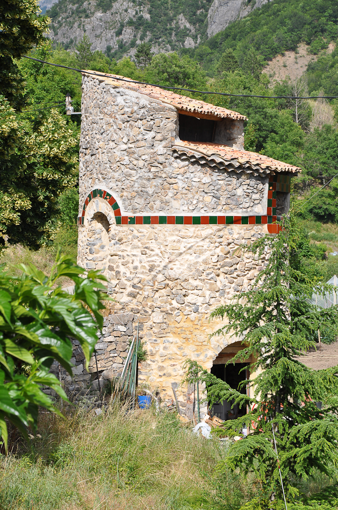
Châteaufort
- commune in Alpes-de-Haute-Provence, France
Hiking in Châteaufort
Châteaufort, located in the Alpes-de-Haute-Provence region of France, is known for its stunning landscapes and rich natural beauty, making it an excellent destination for hiking enthusiasts. Here are some key points to consider if you're planning a hiking trip in the area:...
- Country:
- Postal Code: 04250
- Coordinates: 44° 16' 27" N, 6° 0' 58" E
- GPS tracks (wikiloc): [Link]
- Area: 13.73 sq km
- Population: 28

Blieux
- commune in Alpes-de-Haute-Provence, France
Hiking in Blieux
Blieux is a charming commune located in the Alpes-de-Haute-Provence region of southeastern France. Nestled in a mountainous area, it offers a variety of hiking opportunities that allow you to explore the stunning landscapes of the Provençal Alps. Here are some points of interest regarding hiking in Blieux:...
- Country:
- Postal Code: 04330
- Coordinates: 43° 52' 21" N, 6° 22' 16" E
- GPS tracks (wikiloc): [Link]
- Area: 56.8 sq km
- Population: 60

Saint-Jacques
- commune in Alpes-de-Haute-Provence, France
Hiking in Saint-Jacques
Saint-Jacques, located in the Alpes-de-Haute-Provence region of France, offers stunning landscapes and a variety of hiking opportunities that cater to different skill levels. The area is characterized by its picturesque rolling hills, rocky terrain, and beautiful views of surrounding valleys and mountains....
- Country:
- Postal Code: 04330
- Coordinates: 43° 58' 10" N, 6° 22' 30" E
- GPS tracks (wikiloc): [Link]
- Area: 4.66 sq km
- Population: 63

Vachères
- commune in Alpes-de-Haute-Provence, France
Hiking in Vachères
Vachères is a charming village located in the Provence-Alpes-Côte d'Azur region of southeastern France. Nestled in the heart of the Luberon area, it offers stunning natural landscapes, picturesque views, and a variety of hiking trails suited for all skill levels. Here are some highlights of hiking in Vachères:...
- Country:
- Postal Code: 04110
- Coordinates: 43° 55' 53" N, 5° 38' 18" E
- GPS tracks (wikiloc): [Link]
- Area: 23.42 sq km
- Population: 264

Saint-Paul-sur-Ubaye
- commune in Alpes-de-Haute-Provence, France
Hiking in Saint-Paul-sur-Ubaye
Saint-Paul-sur-Ubaye is a charming commune in the Alpes-de-Haute-Provence region of France, nestled in the Ubaye Valley. It's an excellent destination for hiking enthusiasts due to its stunning natural landscapes, alpine scenery, and rich biodiversity. Here’s what you can expect when hiking in this area:...
- Country:
- Postal Code: 04530
- Coordinates: 44° 31' 0" N, 6° 45' 0" E
- GPS tracks (wikiloc): [Link]
- Area: 205.55 sq km
- Population: 200
- Web site: [Link]

Fontienne
- commune in Alpes-de-Haute-Provence, France
Hiking in Fontienne
Fontienne is not a widely known hiking destination, so it's possible that you're referring to a specific area or a local trail that has not gained significant recognition outside its immediate region. Here are some general guidelines and tips for hiking in lesser-known areas that may apply to hiking in Fontienne or similar locations:...
- Country:
- Postal Code: 04230
- Coordinates: 44° 0' 32" N, 5° 47' 36" E
- GPS tracks (wikiloc): [Link]
- Area: 8.18 sq km
- Population: 129

Mison
- commune in Alpes-de-Haute-Provence, France
Hiking in Mison
Mison, located in South Korea, is known for its beautiful landscapes and hiking opportunities, particularly in the vicinity of the Jiri Mountain range. While it may not be as widely recognized as some of the more famous hiking destinations in South Korea, it offers a unique experience for those looking to explore less crowded trails....
- Country:
- Postal Code: 04200
- Coordinates: 44° 16' 3" N, 5° 51' 33" E
- GPS tracks (wikiloc): [Link]
- Area: 31.72 sq km
- Population: 1106
- Web site: [Link]
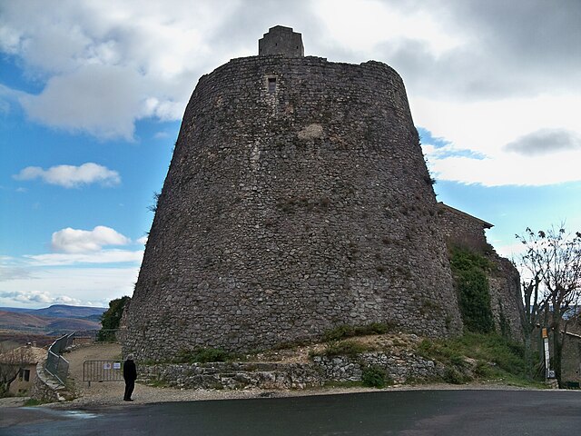
Simiane-la-Rotonde
- commune in Alpes-de-Haute-Provence, France
Hiking in Simiane-la-Rotonde
Simiane-la-Rotonde is a charming village located in the Provence-Alpes-Côte d'Azur region of southeastern France, known for its picturesque landscapes and rich history. It's an excellent destination for hiking enthusiasts looking to explore the beautiful natural surroundings of the Luberon region....
- Country:
- Postal Code: 04150
- Coordinates: 43° 58' 50" N, 5° 33' 46" E
- GPS tracks (wikiloc): [Link]
- Area: 67.86 sq km
- Population: 592
- Web site: [Link]
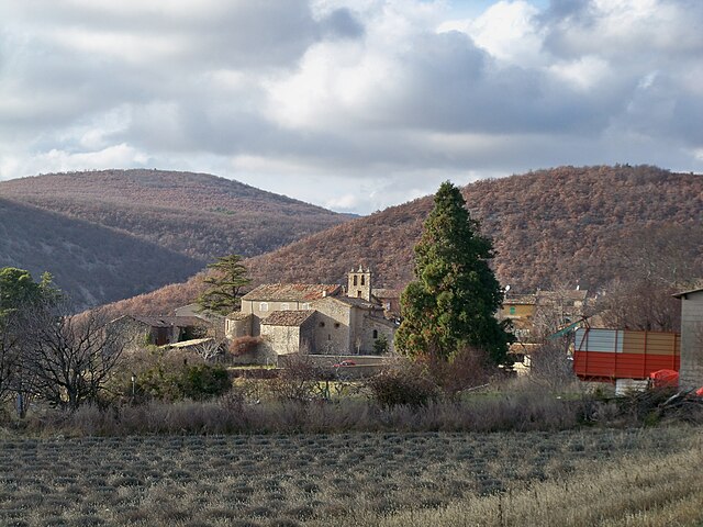
Lardiers
- commune in Alpes-de-Haute-Provence, France
Hiking in Lardiers
Lardiers is a small village located in the Alpes-de-Haute-Provence region of France. It's known for its picturesque scenery and offers a variety of hiking opportunities that cater to different skill levels. Here are some key points to consider when hiking in and around Lardiers:...
- Country:
- Postal Code: 04230
- Coordinates: 44° 3' 25" N, 5° 42' 44" E
- GPS tracks (wikiloc): [Link]
- Area: 30.08 sq km
- Population: 112

Sigoyer
- commune in Alpes-de-Haute-Provence, France
Hiking in Sigoyer
Sigoyer, located in the Alpes-de-Haute-Provence region of France, is a charming village surrounded by beautiful natural landscapes, making it an excellent destination for hiking enthusiasts. The area offers a variety of hiking trails that cater to different skill levels, providing opportunities for both casual walkers and experienced trekkers....
- Country:
- Postal Code: 04200
- Coordinates: 44° 19' 9" N, 5° 57' 30" E
- GPS tracks (wikiloc): [Link]
- Area: 15.3 sq km
- Population: 104

La Brillanne
- commune in Alpes-de-Haute-Provence, France
Hiking in La Brillanne
La Brillanne is a charming commune located in the Alpes-de-Haute-Provence region of southern France. It’s surrounded by beautiful natural landscapes, making it an appealing destination for hiking enthusiasts. Here are some key points to consider if you're planning a hiking trip in and around La Brillanne:...
- Country:
- Postal Code: 04700
- Coordinates: 43° 55' 36" N, 5° 53' 28" E
- GPS tracks (wikiloc): [Link]
- Area: 7.22 sq km
- Population: 1112
- Web site: [Link]

Noyers-sur-Jabron
- commune in Alpes-de-Haute-Provence, France
Hiking in Noyers-sur-Jabron
Noyers-sur-Jabron is a charming village located in the Provence-Alpes-Côte d'Azur region of southeastern France, known for its picturesque landscapes, historical architecture, and natural beauty. Hiking in this area offers a variety of trails that cater to different skill levels, making it a great destination for both novice and experienced hikers....
- Country:
- Postal Code: 04200
- Coordinates: 44° 10' 8" N, 5° 49' 41" E
- GPS tracks (wikiloc): [Link]
- Area: 56.58 sq km
- Population: 510

La Javie
- commune in Alpes-de-Haute-Provence, France
Hiking in La Javie
La Javie is a charming commune located in the Alpes-de-Haute-Provence department in southeastern France. This area is known for its stunning natural landscapes, which provide excellent opportunities for hiking and outdoor activities. Here are some key points about hiking in La Javie:...
- Country:
- Postal Code: 04000
- Coordinates: 44° 10' 28" N, 6° 21' 5" E
- GPS tracks (wikiloc): [Link]
- Area: 37.27 sq km
- Population: 391
Shares border with regions:

Piedmont
- region in North-West Italy
Hiking in Piedmont
Hiking in the Piedmont region offers a wonderful blend of natural beauty, diverse landscapes, and rich cultural heritage. This area, which generally encompasses the foothills of the Appalachian Mountains and stretches across parts of Virginia, North Carolina, South Carolina, and more, features rolling hills, lush forests, and scenic views. Here are some highlights and tips for hiking in Piedmont:...
- Country:

- Capital: Turin
- Coordinates: 45° 15' 0" N, 7° 55' 0" E
- GPS tracks (wikiloc): [Link]
- AboveSeaLevel: 421 м m
- Area: 25402 sq km
- Population: 4367559
- Web site: [Link]


Var
- department in France
Hiking in Var
Hiking in the Var department, located in the Provence-Alpes-Côte d'Azur region of southeastern France, offers a diverse range of landscapes and trails suitable for hikers of varying skill levels. Here are some key highlights and tips for hiking in Var:...
- Country:
- Capital: Toulon
- Coordinates: 43° 24' 3" N, 6° 12' 36" E
- GPS tracks (wikiloc): [Link]
- Area: 5973 sq km
- Population: 1048652
- Web site: [Link]
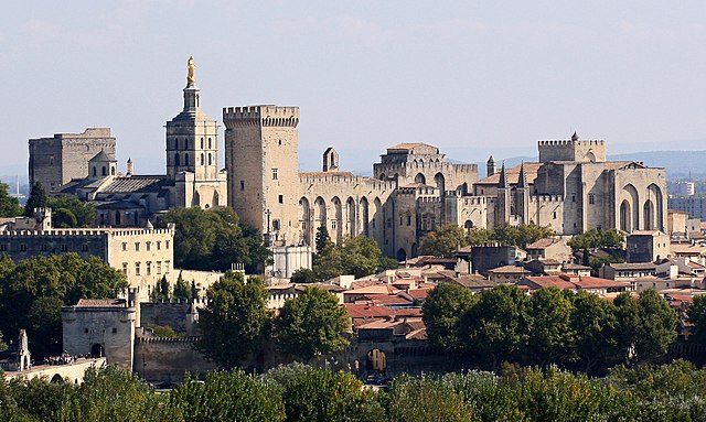
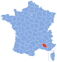
Vaucluse
- French department
Hiking in Vaucluse
Vaucluse, located in the Provence-Alpes-Côte d'Azur region of southeastern France, offers a diverse range of hiking opportunities, combining stunning landscapes, historical sites, and charming villages. Here are some highlights for hiking in Vaucluse:...
- Country:
- Capital: Avignon
- Licence Plate Code: 84
- Coordinates: 44° 0' 0" N, 5° 10' 0" E
- GPS tracks (wikiloc): [Link]
- Area: 3567 sq km
- Population: 557548
- Web site: [Link]


Province of Cuneo
- province in Italy
Hiking in Province of Cuneo
The Province of Cuneo, located in the Piedmont region of northwestern Italy, is a fantastic destination for hiking enthusiasts. This area is known for its stunning alpine landscapes, diverse ecosystems, and charming villages, making it an ideal spot for outdoor activities. Here are some highlights and key information about hiking in the Province of Cuneo:...
- Country:
- Capital: Cuneo
- Postal Code: 12100
- Licence Plate Code: CN
- Coordinates: 44° 23' 0" N, 7° 33' 0" E
- GPS tracks (wikiloc): [Link]
- Area: 6902.65 sq km
- Web site: [Link]

Hautes-Alpes
- department in southeastern France named after the Alps mountain range
Hiking in Hautes-Alpes
The Hautes-Alpes region in southeastern France is a spectacular destination for hiking enthusiasts, known for its stunning landscapes, diverse terrain, and rich biodiversity. The region is part of the French Alps and offers a variety of hiking trails suitable for different skill levels....
- Country:
- Capital: Gap
- Coordinates: 44° 40' 0" N, 6° 20' 0" E
- GPS tracks (wikiloc): [Link]
- AboveSeaLevel: 1665 м m
- Area: 5549 sq km
- Population: 140916
- Web site: [Link]

Alpes-Maritimes
- French department
Hiking in Alpes-Maritimes
Hiking in Alpes-Maritimes, located in the Provence-Alpes-Côte d'Azur region of France, offers a diverse range of trails and stunning landscapes. From coastal paths along the Mediterranean Sea to rocky mountain trails in the Mercantour National Park, the area caters to hikers of all levels....
- Country:
- Capital: Nice
- Coordinates: 43° 50' 0" N, 7° 10' 0" E
- GPS tracks (wikiloc): [Link]
- Area: 4299 sq km
- Population: 1082440
- Web site: [Link]


Drôme
- French department
Hiking in Drôme
Hiking in the Drôme department in southeastern France is a fantastic experience, known for its diverse landscapes, charming villages, and rich natural heritage. The area offers a variety of trails suitable for all levels of hikers, from beginners to advanced....
- Country:
- Capital: Valence
- Coordinates: 44° 45' 0" N, 5° 10' 0" E
- GPS tracks (wikiloc): [Link]
- Area: 6530 sq km
- Population: 504637
- Web site: [Link]