Breteuil (Breteuil)

- commune in Eure, France
- Country:

- Postal Code: 27160
- Coordinates: 48° 50' 10" N, 0° 54' 50" E


- GPS tracks (wikiloc): [Link]
- AboveSeaLevel: 179 м m
- Area: 27.46 sq km
- Population: 3232
- Web site: http://www.villedebreteuilsuriton.fr/index.asp
- Wikipedia en: wiki(en)
- Wikipedia: wiki(fr)
- Wikidata storage: Wikidata: Q467162
- Wikipedia Commons Category: [Link]
- Freebase ID: [/m/03mhqt1]
- Freebase ID: [/m/03mhqt1]
- GeoNames ID: Alt: [6616280]
- GeoNames ID: Alt: [6616280]
- BnF ID: [15253351p]
- BnF ID: [15253351p]
- PACTOLS thesaurus ID: [pcrtwD0OalOHGK]
- PACTOLS thesaurus ID: [pcrtwD0OalOHGK]
- INSEE municipality code: 27112
- INSEE municipality code: 27112
Shares border with regions:
Bémécourt
- commune in Eure, France
- Country:
- Postal Code: 27160
- Coordinates: 48° 50' 40" N, 0° 52' 31" E
- GPS tracks (wikiloc): [Link]
- Area: 17.11 sq km
- Population: 537

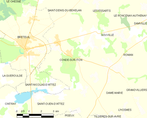
Condé-sur-Iton
- former commune in Eure, France
- Country:
- Postal Code: 27160
- Coordinates: 48° 49' 59" N, 0° 57' 45" E
- GPS tracks (wikiloc): [Link]
- AboveSeaLevel: 168 м m
- Area: 19.58 sq km
- Population: 887
Guernanville
- former commune in Eure, France
- Country:
- Postal Code: 27160
- Coordinates: 48° 53' 20" N, 0° 50' 32" E
- GPS tracks (wikiloc): [Link]
- Area: 3.23 sq km
- Population: 103
Les Baux-de-Breteuil
- commune in Eure, France
- Country:
- Postal Code: 27160
- Coordinates: 48° 52' 47" N, 0° 48' 43" E
- GPS tracks (wikiloc): [Link]
- Area: 34.22 sq km
- Population: 662