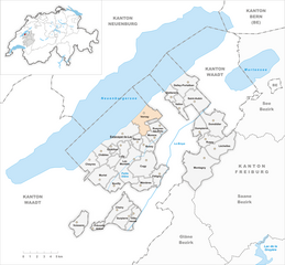
Broye District (Broyebezirk)
- district in Switzerland
The Broye District, located in Switzerland, is known for its picturesque landscapes, serene lakes, and charming villages. It's a wonderful region for hiking enthusiasts of all skill levels. Here are some key highlights and tips for hiking in Broye District:
Trails and Routes
- Lakeside Walks: The Broye District is home to beautiful lakes, including Lake Murten and Lake Neuchâtel. Walking pathways along the shores offer stunning views and opportunities to enjoy nature.
- Forest Trails: The region has numerous trails that wind through lush forests. These paths provide shade and a variety of wildlife sightings.
- Cultural Routes: Explore routes that connect historical sites and quaint Swiss villages. This allows you to enjoy both nature and the local culture.
Popular Hiking Areas
- Murten: The trails around this charming town often include views of the lake and the historic old town.
- Estavayer-le-Lac: This area features scenic routes along the lake and nature reserves where you can spot local wildlife.
- La Pêche: An area known for its diverse landscapes and serene ambiance, perfect for a peaceful hike.
Hiking Tips
- Seasonal Considerations: Spring through autumn is ideal for hiking, with summer offering the best weather, but early spring and late autumn can also provide beautiful landscapes.
- Level of Difficulty: Many trails in the Broye District range from easy to moderate. Always check trail maps and ratings beforehand.
- Preparation: Bring plenty of water, wear sturdy hiking shoes, and carry a map or GPS device. It's also wise to check the weather forecast before heading out.
- Local Resources: Consider visiting the local tourist office for updated trail information and any guided hikes that may be available.
Wildlife and Nature
The district is rich in biodiversity, so keep an eye out for various bird species and other wildlife during your hikes. The natural beauty and tranquility of the area are perfect for photography and peaceful contemplation.
Conclusion
Hiking in the Broye District offers a perfect blend of natural beauty, cultural heritage, and outdoor adventure. Whether you're interested in a leisurely lakeside stroll or a more challenging forest hike, this region has something for everyone. Enjoy your time exploring the breathtaking landscapes of Broye!
- Country:

- Capital: Estavayer-le-Lac
- Licence Plate Code: FR
- Coordinates: 46° 49' 20" N, 6° 54' 9" E


- GPS tracks (wikiloc): [Link]
- AboveSeaLevel: 443 м m
- Area: 173.88 sq km
- Web site: http://www.fr.ch/prbr
- Wikipedia en: wiki(en)
- Wikipedia: wiki(de)
- Wikidata storage: Wikidata: Q660600
- Wikipedia Commons Category: [Link]
- Freebase ID: [/m/026211_]
- GeoNames ID: Alt: [6458754]
- OSM relation ID: [1698881]
- GND ID: Alt: [4489888-5]
- HDS ID: [8753]
Includes regions:


Les Montets
- municipality in Switzerland
Les Montets is a beautiful area located in the Chamonix Valley of the French Alps, best known for its stunning landscapes and access to various hiking trails. Nestled near the Mont Blanc massif, it's a great spot for hikers of all levels. Here’s an overview of what you can expect when hiking in this region:...
- Country:

- Postal Code: 1483
- Local Dialing Code: 026
- Licence Plate Code: FR
- Coordinates: 46° 48' 59" N, 6° 52' 1" E


- GPS tracks (wikiloc): [Link]
- AboveSeaLevel: 490 м m
- Area: 10.35 sq km
- Population: 1439
- Web site: [Link]
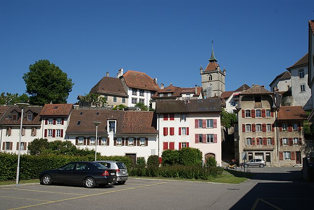

Estavayer-le-Lac
- municipality in Switzerland
Estavayer-le-Lac is a picturesque town located on the shores of Lake Neuchâtel in Switzerland. It offers a range of hiking opportunities that cater to various skill levels and preferences. Here are some highlights and tips for hiking in this beautiful region:...
- Country:

- Postal Code: 1470
- Local Dialing Code: 026
- Licence Plate Code: FR
- Coordinates: 46° 51' 0" N, 6° 50' 50" E


- GPS tracks (wikiloc): [Link]
- AboveSeaLevel: 448 м m
- Area: 8.93 sq km
- Web site: [Link]

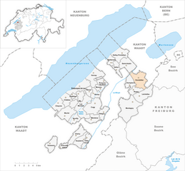
Domdidier
- former municipality of Switzerland
Domdidier, located in the canton of Fribourg in Switzerland, is surrounded by beautiful landscapes that offer various hiking opportunities. The area is characterized by rolling hills, charming farmlands, and scenic views of the surrounding Alps....
- Country:

- Postal Code: 1564
- Local Dialing Code: 026
- Licence Plate Code: FR
- Coordinates: 46° 52' 0" N, 7° 0' 42" E


- GPS tracks (wikiloc): [Link]
- AboveSeaLevel: 443 м m
- Area: 8.96 sq km
- Web site: [Link]


Montagny
- municipality in the canton of Fribourg, Switzerland
Montagny, located in the Fribourg region of Switzerland, is a charming destination for hikers and nature enthusiasts. The area features a variety of trails that cater to different skill levels, making it suitable for both beginners and experienced hikers....
- Country:

- Postal Code: 1774, 1775, 1776
- Local Dialing Code: 026
- Licence Plate Code: FR
- Coordinates: 46° 48' 38" N, 6° 59' 32" E


- GPS tracks (wikiloc): [Link]
- AboveSeaLevel: 563 м m
- Area: 17.52 sq km
- Population: 2536
- Web site: [Link]


Léchelles
- former municipality of Switzerland
Léchelles is a picturesque area located in the Fribourg region of Switzerland, offering a variety of hiking opportunities that showcase its stunning natural landscapes, charming villages, and rich biodiversity. Here are some highlights and tips for hiking in Léchelles:...
- Country:

- Postal Code: 1773
- Local Dialing Code: 026
- Licence Plate Code: FR
- Coordinates: 46° 49' 44" N, 7° 0' 57" E


- GPS tracks (wikiloc): [Link]
- AboveSeaLevel: 545 м m
- Area: 8.75 sq km
- Web site: [Link]


Delley-Portalban
- municipality in Switzerland
Delley-Portalban is a picturesque region located in Switzerland, near the shores of Lake Murten in the canton of Fribourg. It's a wonderful destination for hiking enthusiasts, offering a variety of trails that cater to different skill levels and preferences....
- Country:

- Postal Code: 1567, 1568
- Local Dialing Code: 026
- Licence Plate Code: FR
- Coordinates: 46° 54' 48" N, 6° 58' 4" E


- GPS tracks (wikiloc): [Link]
- AboveSeaLevel: 497 м m
- Area: 7.22 sq km
- Population: 1107
- Web site: [Link]
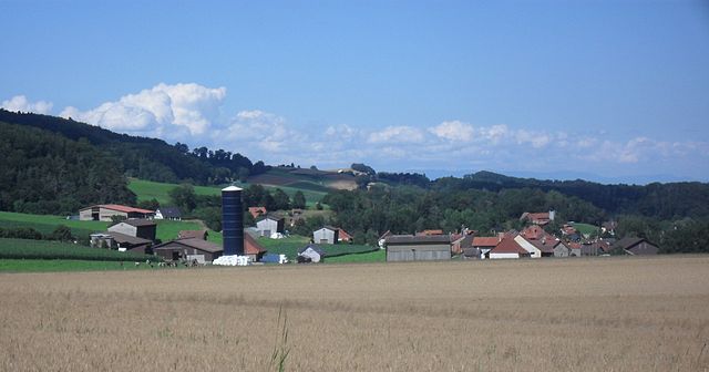

Cheiry
- municipality in Switzerland
Cheiry is a charming village located in the district of Broye, in the Canton of Fribourg, Switzerland. While it may not be as widely known as other hiking destinations in Switzerland, it offers beautiful nature and opportunities for outdoor activities....
- Country:

- Local Dialing Code: 026
- Licence Plate Code: FR
- Coordinates: 46° 44' 57" N, 6° 50' 0" E


- GPS tracks (wikiloc): [Link]
- AboveSeaLevel: 563 м m
- Area: 6.49 sq km
- Population: 412
- Web site: [Link]


Gletterens
- municipality in Switzerland
Gletterens, located in the canton of Vaud in Switzerland, offers a beautiful backdrop for hiking enthusiasts. Situated along the shores of Lake Neuchâtel, this small village is surrounded by stunning landscapes, rolling hills, and scenic views of the lake and the Jura mountains....
- Country:

- Postal Code: 1544
- Local Dialing Code: 026
- Licence Plate Code: FR
- Coordinates: 46° 54' 1" N, 6° 56' 11" E


- GPS tracks (wikiloc): [Link]
- AboveSeaLevel: 464 м m
- Area: 3.02 sq km
- Population: 1051
- Web site: [Link]


Sévaz
- municipality of Switzerland
Sévaz, situated in Switzerland, offers a unique hiking experience with its picturesque landscapes and scenic trails. Nestled near the city of Fribourg, this area is characterized by rolling hills, lush forests, and stunning views of the surrounding region....
- Country:

- Postal Code: 1541
- Local Dialing Code: 026
- Licence Plate Code: FR
- Coordinates: 46° 50' 21" N, 6° 52' 30" E


- GPS tracks (wikiloc): [Link]
- AboveSeaLevel: 489 м m
- Area: 2.46 sq km
- Population: 293
- Web site: [Link]
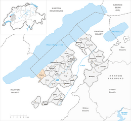
Cheyres
- municipality in Switzerland
Cheyres is a charming village located in the Canton of Fribourg in Switzerland. While it might not be the most well-known hiking destination, it offers beautiful landscapes and is surrounded by scenic trails that are perfect for hikers of all levels....
- Country:

- Local Dialing Code: 026
- Licence Plate Code: FR
- Coordinates: 46° 48' 51" N, 6° 47' 14" E


- GPS tracks (wikiloc): [Link]
- AboveSeaLevel: 454 м m
- Area: 5.16 sq km
- Web site: [Link]


Villeneuve
- municipality in the canton of Fribourg, Switzerland
Villeneuve is a beautiful area located in the Fribourg region of Switzerland, offering a variety of hiking opportunities that showcase the stunning landscapes and the rich natural and cultural heritage of the area. Here are some details about hiking in and around Villeneuve:...
- Country:

- Postal Code: 1527
- Local Dialing Code: 026
- Licence Plate Code: FR
- Coordinates: 46° 44' 45" N, 6° 52' 7" E


- GPS tracks (wikiloc): [Link]
- AboveSeaLevel: 481 м m
- Area: 3.54 sq km


Châbles
- municipality in Switzerland
Châbles, a picturesque village in Switzerland, offers beautiful hiking opportunities, situated in the scenic landscapes of the Fribourg region. The area is characterized by rolling hills, lush forests, and stunning views of the surrounding mountains. Here are some key points about hiking in Châbles:...
- Country:

- Local Dialing Code: 026
- Licence Plate Code: FR
- Coordinates: 46° 49' 32" N, 6° 48' 29" E


- GPS tracks (wikiloc): [Link]
- AboveSeaLevel: 571 м m
- Area: 4.80 sq km
- Web site: [Link]


Bussy
- municipality in the canton of Fribourg, Switzerland
Bussy, located in the Fribourg region of Switzerland, is surrounded by beautiful landscapes that are perfect for hiking enthusiasts. The area offers a mix of flatlands, rolling hills, and scenic views of the Swiss countryside, making it a great destination for both casual walkers and more adventurous hikers....
- Country:

- Local Dialing Code: 026
- Licence Plate Code: FR
- Coordinates: 46° 50' 5" N, 6° 53' 18" E


- GPS tracks (wikiloc): [Link]
- AboveSeaLevel: 468 м m
- Area: 3.60 sq km
- Web site: [Link]

Surpierre
- municipality in Switzerland
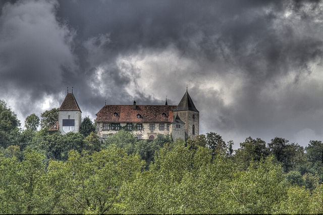
Surpierre is a charming area located in Switzerland, known for its picturesque landscapes and tranquil nature suitable for hiking enthusiasts. Nestled between rolling hills and lush forests, it offers a variety of trails catering to different skill levels....
- Country:

- Postal Code: 1528
- Local Dialing Code: 026
- Licence Plate Code: FR
- Coordinates: 46° 44' 40" N, 6° 51' 40" E


- GPS tracks (wikiloc): [Link]
- AboveSeaLevel: 618 м m
- Area: 4.77 sq km
- Population: 715
- Web site: [Link]

Murist
- municipality in Switzerland
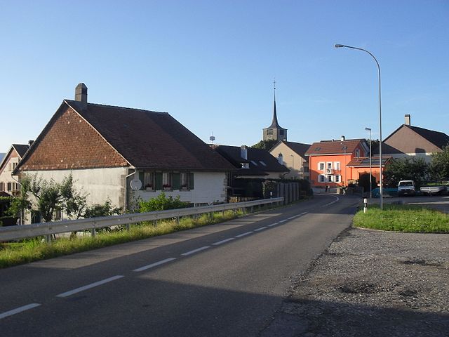
Murist is a charming area that offers a range of hiking opportunities, but it seems there might be some confusion about the exact location or specific features you’re referring to. If you mean Murist in the context of a location, it's essential to clarify which region or country you're discussing since there may be multiple places with a similar name....
- Country:

- Postal Code: 1489
- Local Dialing Code: 026
- Licence Plate Code: FR
- Coordinates: 46° 47' 23" N, 6° 48' 25" E


- GPS tracks (wikiloc): [Link]
- AboveSeaLevel: 662 м m
- Area: 8.20 sq km
- Web site: [Link]


Rueyres-les-Prés
- municipality in Switzerland
Rueyres-les-Prés is a picturesque village located in the heart of Switzerland, known for its beautiful landscapes and outdoor activities, including hiking. The area offers various trails that cater to different skill levels, from easy walks for beginners to more challenging hikes for experienced adventurers. Here are some key aspects to consider when hiking in Rueyres-les-Prés:...
- Country:

- Postal Code: 1542
- Local Dialing Code: 026
- Licence Plate Code: FR
- Coordinates: 46° 51' 34" N, 6° 55' 2" E


- GPS tracks (wikiloc): [Link]
- AboveSeaLevel: 473 м m
- Area: 3.18 sq km
- Web site: [Link]


Prévondavaux
- municipality in Switzerland
Prévondavaux is a lesser-known gem for hiking enthusiasts, located in Switzerland. It generally features picturesque landscapes, including lush forests, rolling hills, and scenic vistas that make for enjoyable and accessible hiking opportunities....
- Country:

- Postal Code: 1410
- Local Dialing Code: 026
- Licence Plate Code: FR
- Coordinates: 46° 43' 40" N, 6° 47' 36" E


- GPS tracks (wikiloc): [Link]
- AboveSeaLevel: 688 м m
- Area: 1.80 sq km
- Population: 70
- Web site: [Link]


Ménières
- municipality in Switzerland
Ménières is a lovely area known for its scenic beauty and nature trails, although it's more commonly associated with the condition called Meniere's disease rather than a specific hiking destination. If you're looking for hiking opportunities in a region with a similar name or related attractions, please provide a bit more context or specify the location, and I'd be happy to guide you!...
- Country:

- Postal Code: 1533
- Local Dialing Code: 026
- Licence Plate Code: FR
- Coordinates: 46° 46' 56" N, 6° 52' 51" E


- GPS tracks (wikiloc): [Link]
- AboveSeaLevel: 503 м m
- Area: 4.33 sq km
- Population: 415
- Web site: [Link]


Morens
- municipality in Switzerland
It seems there may be a misunderstanding regarding the location you're referring to as "Morens." If you're thinking of a specific hiking area, it may be helpful to provide more context or clarify the name of the place....
- Country:

- Postal Code: 1541
- Local Dialing Code: 026
- Licence Plate Code: FR
- Coordinates: 46° 50' 36" N, 6° 54' 23" E


- GPS tracks (wikiloc): [Link]
- AboveSeaLevel: 449 м m
- Area: 2.58 sq km


Vuissens
- municipality in Switzerland
Vuissens is a picturesque village located in the Canton of Vaud in Switzerland, surrounded by beautiful landscapes that make it an excellent destination for hiking enthusiasts. The area offers a variety of trails that cater to different skill levels, from leisurely walks to more challenging hikes. Here are some key points about hiking in Vuissens:...
- Country:

- Postal Code: 1486
- Local Dialing Code: 024
- Licence Plate Code: FR
- Coordinates: 46° 44' 9" N, 6° 45' 51" E


- GPS tracks (wikiloc): [Link]
- AboveSeaLevel: 709 м m
- Area: 5.6 sq km
- Web site: [Link]


Châtillon
- municipality in the canton of Fribourg, Switzerland
Châtillon, located in the Fribourg district of Switzerland, is surrounded by beautiful landscapes that are perfect for hiking. The region features a mix of lush forests, rolling hills, and stunning panoramas of the Swiss countryside....
- Country:

- Postal Code: 1473
- Local Dialing Code: 026
- Licence Plate Code: FR
- Coordinates: 46° 49' 59" N, 6° 49' 33" E


- GPS tracks (wikiloc): [Link]
- AboveSeaLevel: 515 м m
- Area: 1.30 sq km
- Population: 462
- Web site: [Link]
Russy
- municipality in the canton of Fribourg, Switzerland
Russy, located in the Vaud canton of Switzerland, is a charming destination for hikers and nature lovers. Nestled between the vineyards of the Lavaux region and the shores of Lake Geneva, Russy offers stunning views, diverse landscapes, and a variety of hiking trails suitable for all skill levels....
- Country:

- Postal Code: 1773
- Local Dialing Code: 026
- Licence Plate Code: FR
- Coordinates: 46° 50' 28" N, 7° 0' 15" E


- GPS tracks (wikiloc): [Link]
- AboveSeaLevel: 600 м m
- Web site: [Link]


Cugy
- municipality in the canton of Fribourg, Switzerland
Cugy, located in the canton of Fribourg in Switzerland, offers a variety of beautiful hiking opportunities for outdoor enthusiasts. The area is characterized by picturesque landscapes, rolling hills, forests, and serene lakes, making it an ideal location for both leisurely walks and more challenging hikes....
- Country:

- Postal Code: 1482
- Local Dialing Code: 026
- Licence Plate Code: FR
- Coordinates: 46° 48' 53" N, 6° 53' 27" E


- GPS tracks (wikiloc): [Link]
- AboveSeaLevel: 475 м m
- Area: 9.91 sq km
- Population: 1729
- Web site: [Link]

Fétigny
- municipality in the canton of Fribourg, Switzerland
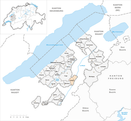
Fétigny, located in the Swiss region of Vaud, is a charming village surrounded by picturesque landscapes, making it a great starting point for hiking enthusiasts. Here are some key points to consider when hiking in and around Fétigny:...
- Country:

- Postal Code: 1532
- Local Dialing Code: 026
- Licence Plate Code: FR
- Coordinates: 46° 47' 46" N, 6° 54' 52" E


- GPS tracks (wikiloc): [Link]
- AboveSeaLevel: 458 м m
- Area: 4.08 sq km
- Population: 1044
- Web site: [Link]


Nuvilly
- municipality in Switzerland
Nuvilly is a lesser-known area, and specific details about hiking trails there may not be widely documented. However, if you're considering hiking in a region that sounds like it or a similar locality, here are some general tips and recommendations for hiking in rural or mountainous areas:...
- Country:

- Postal Code: 1485
- Local Dialing Code: 026
- Licence Plate Code: FR
- Coordinates: 46° 46' 57" N, 6° 49' 52" E


- GPS tracks (wikiloc): [Link]
- AboveSeaLevel: 629 м m
- Area: 3.98 sq km
- Population: 424
- Web site: [Link]


Vallon
- municipality in the canton of Fribourg, Switzerland
Vallon is a picturesque region, often appreciated for its stunning natural beauty and a variety of hiking trails suitable for all levels of hikers. While it’s important to verify the specifics based on the exact location you're referring to (as "Vallon" could indicate different areas), I can provide general information about hiking in mountainous or valley regions that might correlate with a location named Vallon....
- Country:

- Postal Code: 1565
- Local Dialing Code: 026
- Licence Plate Code: FR
- Coordinates: 46° 53' 5" N, 6° 57' 13" E


- GPS tracks (wikiloc): [Link]
- AboveSeaLevel: 482 м m
- Area: 3.51 sq km
- Population: 436
- Web site: [Link]


Saint-Aubin
- municipality in the canton of Fribourg, Switzerland
Saint-Aubin, located in the Fribourg district of Switzerland, is a charming village that offers a variety of hiking opportunities amidst scenic landscapes. The region is known for its stunning views of the surrounding mountains, lush forests, and tranquil lakes, making it an excellent destination for hiking enthusiasts. Here are some highlights you can expect:...
- Country:

- Postal Code: 1566
- Local Dialing Code: 026
- Licence Plate Code: FR
- Coordinates: 46° 53' 24" N, 6° 58' 50" E


- GPS tracks (wikiloc): [Link]
- AboveSeaLevel: 471 м m
- Area: 7.90 sq km
- Population: 1755
- Web site: [Link]

Lully
- municipality in the canton of Fribourg, Switzerland
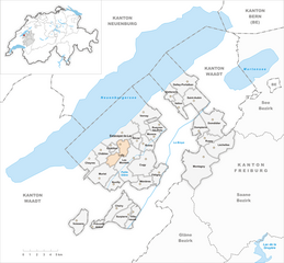
Lully, located in the Fribourg region of Switzerland, is a charming area that offers opportunities for hiking amidst beautiful landscapes. The region is characterized by rolling hills, lush forests, and picturesque views of the Swiss countryside. Here are some highlights and tips for hiking in and around Lully:...
- Country:

- Postal Code: 1470
- Local Dialing Code: 026
- Licence Plate Code: FR
- Coordinates: 46° 50' 0" N, 6° 50' 41" E


- GPS tracks (wikiloc): [Link]
- AboveSeaLevel: 494 м m
- Area: 5.44 sq km
- Population: 1161
- Web site: [Link]


Dompierre
- municipality in the canton of Fribourg, Switzerland
Dompierre, located in the canton of Fribourg in Switzerland, is a charming village known for its beautiful landscapes and hiking opportunities. The region surrounding Dompierre is characterized by rolling hills, lush forests, and picturesque views of the Swiss countryside....
- Country:

- Postal Code: 1563
- Local Dialing Code: 026
- Licence Plate Code: FR
- Coordinates: 46° 51' 10" N, 6° 59' 18" E


- GPS tracks (wikiloc): [Link]
- AboveSeaLevel: 470 м m
- Web site: [Link]

Vernay
- municipality in the canton of Fribourg, Switzerland
Vernay is a lesser-known gem in the Swiss hiking scene, located in the cantonal region of Vaud. While it may not have the fame of larger areas like Zermatt or Interlaken, it offers beautiful landscapes and a more tranquil hiking experience. Here are some highlights you might consider when hiking in the Vernay region:...
- Country:

- Postal Code: 1475
- Local Dialing Code: 026
- Licence Plate Code: FR
- Coordinates: 46° 53' 0" N, 6° 53' 0" E


- GPS tracks (wikiloc): [Link]
- AboveSeaLevel: 465 м m
- Area: 8.32 sq km
- Web site: [Link]

