Buis-sur-Damville (Buis-sur-Damville)

- commune in Eure, France
- Country:

- Postal Code: 27240
- Coordinates: 48° 49' 54" N, 1° 7' 18" E


- GPS tracks (wikiloc): [Link]
- AboveSeaLevel: 159 м m
- Area: 24.56 sq km
- Population: 992
- Web site: http://buissurdamville.free.fr/
- Wikipedia en: wiki(en)
- Wikipedia: wiki(fr)
- Wikidata storage: Wikidata: Q1077061
- Wikipedia Commons Category: [Link]
- Freebase ID: [/m/03mhqwg]
- Freebase ID: [/m/03mhqwg]
- GeoNames ID: Alt: [6616298]
- GeoNames ID: Alt: [6616298]
- SIREN number: [212704167]
- SIREN number: [212704167]
- BnF ID: [15253651h]
- BnF ID: [15253651h]
- PACTOLS thesaurus ID: [pcrtOBF0SwPdsk]
- PACTOLS thesaurus ID: [pcrtOBF0SwPdsk]
- INSEE municipality code: 27416
- INSEE municipality code: 27416
Shares border with regions:
Droisy
- commune in Eure, France
- Country:
- Postal Code: 27320
- Coordinates: 48° 48' 22" N, 1° 8' 32" E
- GPS tracks (wikiloc): [Link]
- Area: 17.49 sq km
- Population: 428


Corneuil
- former commune in Eure, France
- Country:
- Postal Code: 27240
- Coordinates: 48° 52' 54" N, 1° 8' 24" E
- GPS tracks (wikiloc): [Link]
- Area: 11.31 sq km
- Population: 594


Chavigny-Bailleul
- commune in Eure, France
- Country:
- Postal Code: 27220
- Coordinates: 48° 52' 35" N, 1° 12' 9" E
- GPS tracks (wikiloc): [Link]
- Area: 18.42 sq km
- Population: 580


Marcilly-la-Campagne
- commune in Eure, France
- Country:
- Postal Code: 27320
- Coordinates: 48° 50' 2" N, 1° 12' 3" E
- GPS tracks (wikiloc): [Link]
- Area: 19.5 sq km
- Population: 1167
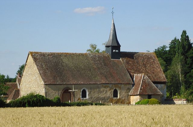
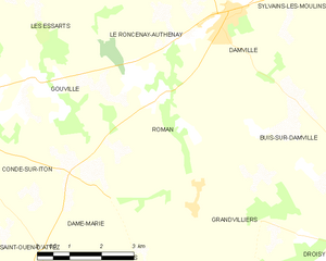
Roman
- commune in Eure, France
- Country:
- Postal Code: 27240
- Coordinates: 48° 50' 44" N, 1° 2' 43" E
- GPS tracks (wikiloc): [Link]
- Area: 15.2 sq km
- Population: 282


Grandvilliers
- commune in Eure, France
- Country:
- Postal Code: 27240
- Coordinates: 48° 48' 52" N, 1° 3' 39" E
- GPS tracks (wikiloc): [Link]
- Area: 17.66 sq km
- Population: 333


Moisville
- commune in Eure, France
- Country:
- Postal Code: 27320
- Coordinates: 48° 50' 23" N, 1° 9' 53" E
- GPS tracks (wikiloc): [Link]
- Area: 6.99 sq km
- Population: 227