Bully-les-Mines (Bully-les-Mines)

- commune in Pas-de-Calais, France
- Country:

- Postal Code: 62160
- Coordinates: 50° 26' 31" N, 2° 43' 28" E


- GPS tracks (wikiloc): [Link]
- Area: 7.66 sq km
- Population: 12512
- Web site: http://www.bullylesmines.fr
- Wikipedia en: wiki(en)
- Wikipedia: wiki(fr)
- Wikidata storage: Wikidata: Q516081
- Wikipedia Commons Category: [Link]
- Freebase ID: [/m/0dkc0_]
- GeoNames ID: Alt: [6439413]
- SIREN number: [216201863]
- BnF ID: [15268628d]
- VIAF ID: Alt: [195929129]
- MusicBrainz area ID: [b2efff91-5bb0-4374-b780-a546b075ed73]
- INSEE municipality code: 62186
Shares border with regions:


Liévin
- commune in Pas-de-Calais, France
- Country:
- Postal Code: 62800
- Coordinates: 50° 25' 19" N, 2° 46' 40" E
- GPS tracks (wikiloc): [Link]
- Area: 12.83 sq km
- Population: 31237
- Web site: [Link]


Mazingarbe
- commune in Pas-de-Calais, France
- Country:
- Postal Code: 62670
- Coordinates: 50° 28' 23" N, 2° 43' 5" E
- GPS tracks (wikiloc): [Link]
- Area: 10.29 sq km
- Population: 7970
- Web site: [Link]


Sains-en-Gohelle
- commune in Pas-de-Calais, France
- Country:
- Postal Code: 62114
- Coordinates: 50° 26' 41" N, 2° 41' 1" E
- GPS tracks (wikiloc): [Link]
- Area: 5.71 sq km
- Population: 6280
- Web site: [Link]

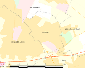
Grenay
- commune in Pas-de-Calais, France
- Country:
- Postal Code: 62160
- Coordinates: 50° 27' 8" N, 2° 44' 35" E
- GPS tracks (wikiloc): [Link]
- Area: 3.22 sq km
- Population: 6914
- Web site: [Link]

Aix-Noulette
- commune in Pas-de-Calais, France
- Country:
- Postal Code: 62160
- Coordinates: 50° 25' 33" N, 2° 42' 35" E
- GPS tracks (wikiloc): [Link]
- Area: 10.44 sq km
- Population: 3924
- Web site: [Link]