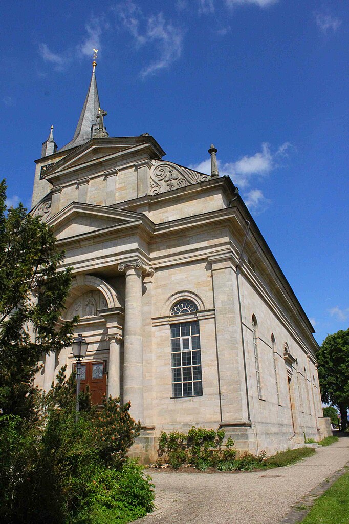
Buttenheim (Buttenheim)

- municipality of Germany
 Hiking in Buttenheim
Buttenheim is a quaint town located in Bavaria, Germany, ideal for hiking enthusiasts looking to explore picturesque landscapes. Although it may not be as well-known as some larger hiking areas, it offers lovely trails and scenic views of the surrounding countryside.
Hiking Trails
-
Local Trails: There are several well-marked local trails around Buttenheim that are suitable for varying skill levels. These often meander through lush fields, forests, and offer views of local landmarks.
-
Frankenwald Nature Park: A bit further afield, the nearby Frankenwald Nature Park presents excellent hiking opportunities with more extensive trail systems. This area features diverse flora and fauna, as well as beautiful mountainous terrain.
-
Historic Trails: You could also combine hikes with cultural experiences by following trails that connect to historical sites or local Bavarian villages.
Recommendations
-
Difficulty Levels: Most trails around Buttenheim are suitable for beginners to intermediate hikers. Make sure to check trail maps for difficulty ratings and length before setting out.
-
Preparation: Always carry water, wear sturdy hiking shoes, and pack snacks. Depending on the season, dress in layers to accommodate changing weather conditions.
-
Navigation: Use local maps or apps to keep track of your route. Some trails may be less well-marked, so having a map or GPS could be beneficial.
Additional Activities
- Cultural Exploration: While hiking, take some time to explore Buttenheim itself. Its charm lies in its traditional Bavarian architecture and local breweries.
- Seasonal Hiking: If you're hiking in spring or summer, you may also encounter beautiful wildflowers. Autumn offers stunning foliage, making it a prime time for nature photography.
Visiting Buttenheim for hiking can be a rewarding experience, blending the beauty of nature with cultural heritage. Enjoy your adventures!
- Country:

- Postal Code: 96155
- Local Dialing Code: 09545
- Licence Plate Code: BA
- Coordinates: 49° 47' 0" N, 11° 1' 0" E


- GPS tracks (wikiloc): [Link]
- AboveSeaLevel: 273 м m
- Area: 30.03 sq km
- Population: 2786
- Web site: http://www.buttenheim.de/
- Wikipedia en: wiki(en)
- Wikipedia: wiki(de)
- Wikidata storage: Wikidata: Q545388
- Wikipedia Commons Category: [Link]
- Freebase ID: [/m/02q0ysm]
- GeoNames ID: Alt: [2940613]
- VIAF ID: Alt: [156741330]
- OSM relation ID: [1077540]
- GND ID: Alt: [4080600-5]
- Library of Congress authority ID: Alt: [n89119196]
- Bavarikon ID: [ODB_A00001948]
- German municipality key: 09471123
Shares border with regions:


Altendorf
- place in Bavaria, Germany
Hiking in Altendorf
Altendorf, located in Upper Franconia, Germany, is a charming community surrounded by beautiful landscapes that provide great opportunities for hiking and outdoor activities. Here’s what you should know if you're considering hiking in this area:...
- Country:
- Postal Code: 96146
- Local Dialing Code: 09545
- Licence Plate Code: BA
- Coordinates: 49° 48' 0" N, 11° 1' 0" E
- GPS tracks (wikiloc): [Link]
- AboveSeaLevel: 257 м m
- Area: 8.61 sq km
- Population: 1542
- Web site: [Link]

Eggolsheim
- municipality in Landkreis Forchheim in Germany
Hiking in Eggolsheim
Eggolsheim is a small town located in Bavaria, Germany, offering a quaint backdrop for hiking enthusiasts and outdoor adventurers. While the town itself is not a major hiking destination, its location provides access to several trails and scenic routes in the surrounding areas, especially within the Franconian Switzerland region....
- Country:
- Postal Code: 91330
- Local Dialing Code: 09545
- Licence Plate Code: FO
- Coordinates: 49° 46' 15" N, 11° 3' 29" E
- GPS tracks (wikiloc): [Link]
- AboveSeaLevel: 255 м m
- Area: 48.90 sq km
- Population: 6487
- Web site: [Link]

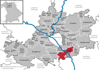
Hirschaid
- municipality of Germany
Hiking in Hirschaid
Hirschaid, a small town in Bavaria, Germany, offers a variety of hiking opportunities in the surrounding countryside. While Hirschaid itself may not have extensive hiking trails, it serves as a great starting point for exploring the picturesque landscapes of the Upper Franconia region. Here are some highlights for hiking in and around Hirschaid:...
- Country:
- Postal Code: 96114
- Local Dialing Code: 09543
- Licence Plate Code: BA
- Coordinates: 49° 49' 0" N, 10° 59' 0" E
- GPS tracks (wikiloc): [Link]
- AboveSeaLevel: 248 м m
- Area: 40.95 sq km
- Population: 12193
- Web site: [Link]