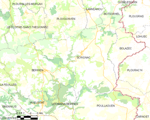
canton of Huelgoat (canton d'Huelgoat)
- canton of France
- Country:

- Capital: Huelgoat
- Coordinates: 48° 23' 7" N, 3° 44' 40" E


- GPS tracks (wikiloc): [Link]
- Wikidata storage: Wikidata: Q1725515
- Library of Congress authority ID: Alt: [no2010194623]
- INSEE canton code: [2916]
Includes regions:

Scrignac
- commune in Finistère, France
- Country:
- Postal Code: 29640
- Coordinates: 48° 26' 1" N, 3° 40' 42" E
- GPS tracks (wikiloc): [Link]
- Area: 70.94 sq km
- Population: 801


Bolazec
- commune in Finistère, France
- Country:
- Postal Code: 29640
- Coordinates: 48° 26' 38" N, 3° 35' 6" E
- GPS tracks (wikiloc): [Link]
- Area: 17.47 sq km
- Population: 204


Berrien
- commune in Finistère, France
- Country:
- Postal Code: 29690
- Coordinates: 48° 24' 15" N, 3° 45' 7" E
- GPS tracks (wikiloc): [Link]
- Area: 56.42 sq km
- Population: 963


Botmeur
- commune in Finistère, France
- Country:
- Postal Code: 29690
- Coordinates: 48° 23' 1" N, 3° 54' 55" E
- GPS tracks (wikiloc): [Link]
- Area: 13.62 sq km
- Population: 212


Huelgoat
- commune in Finistère, France
- Country:
- Postal Code: 29690
- Coordinates: 48° 21' 52" N, 3° 44' 41" E
- GPS tracks (wikiloc): [Link]
- Area: 14.87 sq km
- Population: 1530


Plouyé
- commune in Finistère, France
- Country:
- Postal Code: 29690
- Coordinates: 48° 18' 51" N, 3° 44' 8" E
- GPS tracks (wikiloc): [Link]
- Area: 37.55 sq km
- Population: 703


Locmaria-Berrien
- former commune in Finistère, France
- Country:
- Postal Code: 29690
- Coordinates: 48° 21' 14" N, 3° 41' 41" E
- GPS tracks (wikiloc): [Link]
- Area: 17.2 sq km
- Population: 244


La Feuillée
- commune in Finistère, France
- Country:
- Postal Code: 29690
- Coordinates: 48° 23' 30" N, 3° 51' 13" E
- GPS tracks (wikiloc): [Link]
- Area: 31.55 sq km
- Population: 638