
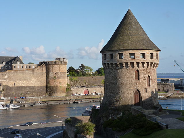
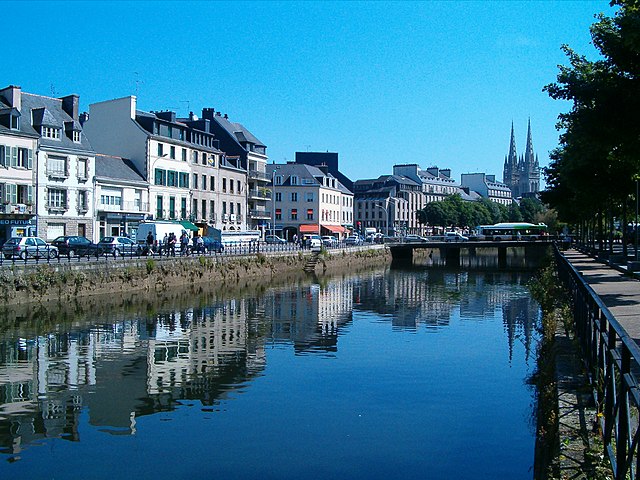
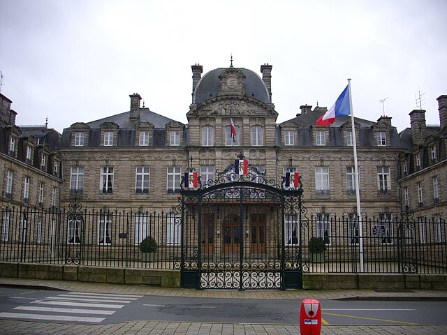
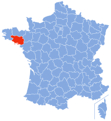
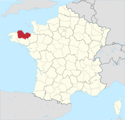
Finistère (Finistère)


- French department
- Country:

- Capital: Quimper
- Coordinates: 48° 15' 0" N, 4° 0' 0" E


- GPS tracks (wikiloc): [Link]
- Area: 6733 sq km
- Population: 907796
- Web site: http://www.finistere.fr/
- Wikipedia en: wiki(en)
- Wikipedia: wiki(fr)
- Wikidata storage: Wikidata: Q3389
- Wikipedia Commons Gallery: [Link]
- Wikipedia Commons Category: [Link]
- Wikipedia Commons Maps Category: [Link]
- Freebase ID: [/m/0gl9p]
- GeoNames ID: Alt: [3018471]
- BnF ID: [118814011]
- VIAF ID: Alt: [125093876]
- OSM relation ID: [102430]
- GND ID: Alt: [4086488-1]
- archINFORM location ID: [2738]
- Library of Congress authority ID: Alt: [n50029298]
- MusicBrainz area ID: [7148756d-941c-41ac-9ab7-2fec4611a7aa]
- TGN ID: [7002938]
- SUDOC authorities ID: [026597217]
- Encyclopædia Britannica Online ID: [place/Finistere]
- Twitter username: Alt: [finistere_29]
- NUTS code: [FR522]
- INSEE department code: [29]
- ISO 3166-2 code: FR-29
Includes regions:
Herby [CC BY-SA 4.0 (https://creativecommons.org/licenses/by-sa/4.0)], via Wikimedia Commons" href="Arrondissement%20of%20Ch%C3%A2teaulin">

arrondissement of Châteaulin
- arrondissement of France
- Country:
- Capital: Châteaulin
- Coordinates: 48° 15' 0" N, 4° 5' 0" E
- GPS tracks (wikiloc): [Link]
- Area: 1804 sq km
- Population: 82932
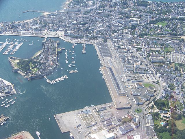
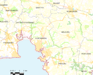
Concarneau
- commune in Finistère, France
- Country:
- Postal Code: 29900
- Coordinates: 47° 52' 31" N, 3° 55' 8" E
- GPS tracks (wikiloc): [Link]
- AboveSeaLevel: 6 м m
- Area: 41.08 sq km
- Population: 19182
- Web site: [Link]


Crozon
- commune in Finistère, France
- Country:
- Postal Code: 29160
- Coordinates: 48° 14' 43" N, 4° 29' 20" E
- GPS tracks (wikiloc): [Link]
- Area: 80.37 sq km
- Population: 7601
- Web site: [Link]


Argol
- commune in Finistère, France
- Country:
- Postal Code: 29560
- Coordinates: 48° 14' 47" N, 4° 18' 59" E
- GPS tracks (wikiloc): [Link]
- Area: 31.73 sq km
- Population: 1030
- Web site: [Link]


Audierne
- former commune in Finistère, France
- Country:
- Postal Code: 29770
- Coordinates: 48° 1' 27" N, 4° 32' 30" E
- GPS tracks (wikiloc): [Link]
- AboveSeaLevel: 0 м m
- Area: 2.95 sq km
- Population: 2116
- Web site: [Link]

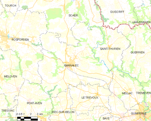
Bannalec
- commune in Finistère, France
- Country:
- Postal Code: 29380
- Coordinates: 47° 55' 57" N, 3° 41' 49" E
- GPS tracks (wikiloc): [Link]
- Area: 77.51 sq km
- Population: 5634
- Web site: [Link]


Gouesnou
- commune in Finistère, France
- Country:
- Postal Code: 29850
- Coordinates: 48° 27' 10" N, 4° 27' 52" E
- GPS tracks (wikiloc): [Link]
- Area: 12.08 sq km
- Population: 6009
- Web site: [Link]

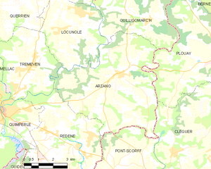
Arzano
- commune in Finistère, France
- Country:
- Postal Code: 29300
- Coordinates: 47° 54' 4" N, 3° 26' 25" E
- GPS tracks (wikiloc): [Link]
- Area: 34.04 sq km
- Population: 1387
- Web site: [Link]


arrondissement of Morlaix
- arrondissement of France
- Country:
- Capital: Morlaix
- Coordinates: 48° 35' 0" N, 4° 0' 0" E
- GPS tracks (wikiloc): [Link]
- Area: 1319 sq km
- Population: 128816

arrondissement of Brest
- arrondissement of France
- Country:
- Capital: Brest
- Coordinates: 48° 30' 0" N, 4° 30' 0" E
- GPS tracks (wikiloc): [Link]
- Area: 1408 sq km
- Population: 373028

arrondissement of Quimper
- arrondissement of France
- Country:
- Capital: Quimper
- Coordinates: 48° 0' 0" N, 4° 5' 0" E
- GPS tracks (wikiloc): [Link]
- Area: 2202 sq km
- Population: 323020
Shares border with regions:
Morbihan
- French department
- Country:
- Capital: Vannes
- Coordinates: 47° 50' 0" N, 2° 50' 0" E
- GPS tracks (wikiloc): [Link]
- Area: 6823 sq km
- Population: 744813
- Web site: [Link]
Côtes-d'Armor
- French department
- Country:
- Capital: Saint-Brieuc
- Coordinates: 48° 20' 0" N, 2° 50' 0" E
- GPS tracks (wikiloc): [Link]
- Area: 6878 sq km
- Population: 598357
- Web site: [Link]