canton of Issoudun-Nord (canton d'Issoudun-Nord)

- canton of France (until March 2015)
- Country:

- Capital: Issoudun
- Coordinates: 46° 57' 39" N, 1° 59' 40" E


- GPS tracks (wikiloc): [Link]
- Wikidata storage: Wikidata: Q864205
- Wikipedia Commons Category: [Link]
- INSEE canton code: [3612]
Includes regions:
Les Bordes
- commune in Indre, France
- Country:
- Postal Code: 36100
- Coordinates: 46° 58' 50" N, 1° 58' 33" E
- GPS tracks (wikiloc): [Link]
- Area: 16.3 sq km
- Population: 895


La Champenoise
- commune in Indre, France
- Country:
- Postal Code: 36100
- Coordinates: 46° 56' 24" N, 1° 48' 6" E
- GPS tracks (wikiloc): [Link]
- Area: 44.34 sq km
- Population: 279


Diou
- commune in Indre, France
- Country:
- Postal Code: 36260
- Coordinates: 47° 2' 46" N, 2° 1' 35" E
- GPS tracks (wikiloc): [Link]
- Area: 16.39 sq km
- Population: 245


Sainte-Lizaigne
- commune in Indre, France
- Country:
- Postal Code: 36260
- Coordinates: 47° 0' 25" N, 2° 1' 22" E
- GPS tracks (wikiloc): [Link]
- Area: 26.36 sq km
- Population: 1205
- Web site: [Link]
Saint-Georges-sur-Arnon
- commune in Indre, France
- Country:
- Postal Code: 36100
- Coordinates: 46° 59' 55" N, 2° 5' 33" E
- GPS tracks (wikiloc): [Link]
- Area: 23.87 sq km
- Population: 566
Paudy
- commune in Indre, France
- Country:
- Postal Code: 36260
- Coordinates: 47° 2' 17" N, 1° 55' 6" E
- GPS tracks (wikiloc): [Link]
- Area: 30.28 sq km
- Population: 476


Saint-Aoustrille
- commune in Indre, France
- Country:
- Postal Code: 36100
- Coordinates: 46° 56' 19" N, 1° 55' 16" E
- GPS tracks (wikiloc): [Link]
- Area: 19.47 sq km
- Population: 213


Reuilly
- commune in Indre, France
- Country:
- Postal Code: 36260
- Coordinates: 47° 5' 2" N, 2° 2' 39" E
- GPS tracks (wikiloc): [Link]
- Area: 25.8 sq km
- Population: 2037
- Web site: [Link]


Lizeray
- commune in Indre, France
- Country:
- Postal Code: 36100
- Coordinates: 46° 58' 55" N, 1° 54' 20" E
- GPS tracks (wikiloc): [Link]
- Area: 35.41 sq km
- Population: 86

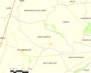
Saint-Valentin
- commune in Indre, France
- Country:
- Postal Code: 36100
- Coordinates: 46° 57' 6" N, 1° 51' 53" E
- GPS tracks (wikiloc): [Link]
- Area: 24.9 sq km
- Population: 283
- Web site: [Link]
Migny
- commune in Indre, France
- Country:
- Postal Code: 36260
- Coordinates: 47° 1' 30" N, 2° 4' 0" E
- GPS tracks (wikiloc): [Link]
- Area: 13.35 sq km
- Population: 126