
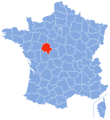
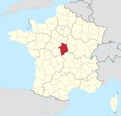
Indre (Indre)


- French department
- Country:

- Capital: Châteauroux
- Coordinates: 46° 46' 0" N, 1° 36' 0" E


- GPS tracks (wikiloc): [Link]
- Area: 6791 sq km
- Population: 224200
- Web site: http://www.indre.pref.gouv.fr/
- Wikipedia en: wiki(en)
- Wikipedia: wiki(fr)
- Wikidata storage: Wikidata: Q12553
- Wikipedia Commons Gallery: [Link]
- Wikipedia Commons Category: [Link]
- Wikipedia Commons Maps Category: [Link]
- Freebase ID: [/m/0mh68]
- GeoNames ID: Alt: [3012805]
- SIREN number: [223600016]
- BnF ID: [11940421r]
- VIAF ID: Alt: [167743789]
- OSM relation ID: [7417]
- GND ID: Alt: [4109223-5]
- archINFORM location ID: [106]
- Library of Congress authority ID: Alt: [n82073040]
- Quora topic ID: [Indre]
- Encyclopædia Britannica Online ID: [place/Indre]
- Twitter username: Alt: [Indre36]
- NUTS code: [FR243]
- INSEE department code: [36]
- ISO 3166-2 code: FR-36
Includes regions:


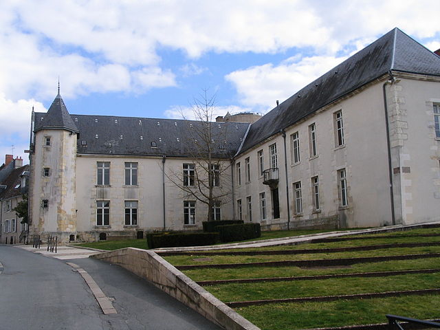
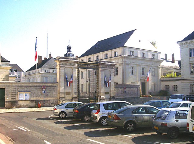
Châteauroux
- commune in Indre, France
- Country:
- Postal Code: 36000
- Coordinates: 46° 48' 35" N, 1° 41' 25" E
- GPS tracks (wikiloc): [Link]
- Area: 25.54 sq km
- Population: 43732
- Web site: [Link]

arrondissement of Châteauroux
- arrondissement of France
- Country:
- Capital: Châteauroux
- Coordinates: 46° 55' 0" N, 1° 30' 0" E
- GPS tracks (wikiloc): [Link]
- Area: 2524 sq km
- Population: 128965

arrondissement of Issoudun
- arrondissement of France
- Country:
- Capital: Issoudun
- Coordinates: 47° 0' 0" N, 1° 50' 0" E
- GPS tracks (wikiloc): [Link]
- Area: 1182 sq km
- Population: 34573


arrondissement of La Châtre
- arrondissement of France
- Country:
- Capital: La Châtre
- Coordinates: 46° 35' 0" N, 1° 50' 0" E
- GPS tracks (wikiloc): [Link]
- Area: 1323 sq km
- Population: 28634


arrondissement of Le Blanc
- arrondissement of France
- Country:
- Capital: Le Blanc
- Coordinates: 46° 40' 0" N, 1° 10' 0" E
- GPS tracks (wikiloc): [Link]
- Area: 1761 sq km
- Population: 32028
Shares border with regions:
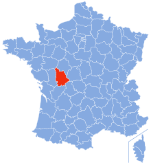
Indre-et-Loire
- French department
- Country:
- Capital: Tours
- Coordinates: 47° 15' 0" N, 0° 40' 0" E
- GPS tracks (wikiloc): [Link]
- Area: 6127 sq km
- Population: 604966
- Web site: [Link]


Loir-et-Cher
- French department
- Country:
- Capital: Blois
- Coordinates: 47° 16' 0" N, 0° 40' 0" E
- GPS tracks (wikiloc): [Link]
- Area: 6343 sq km
- Population: 333050
- Web site: [Link]

Vienne
- French department
- Country:
- Capital: Poitiers
- Coordinates: 46° 34' 53" N, 0° 20' 26" E
- GPS tracks (wikiloc): [Link]
- Area: 6990 sq km
- Population: 434887
- Web site: [Link]


Haute-Vienne
- French department
- Country:
- Capital: Limoges
- Coordinates: 45° 50' 0" N, 1° 16' 0" E
- GPS tracks (wikiloc): [Link]
- Area: 5520 sq km
- Population: 375795
- Web site: [Link]

Cher
- French department
- Country:
- Capital: Bourges
- Coordinates: 47° 4' 52" N, 2° 26' 40" E
- GPS tracks (wikiloc): [Link]
- Area: 7235 sq km
- Population: 308992
- Web site: [Link]


Creuse
- French department
- Country:
- Capital: Guéret
- Coordinates: 46° 35' 0" N, 2° 3' 0" E
- GPS tracks (wikiloc): [Link]
- Area: 5565 sq km
- Population: 120365
- Web site: [Link]