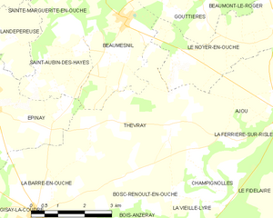
canton of Beaumesnil (canton de Beaumesnil)
- canton of France (until March 2015)
- Country:

- Capital: Beaumesnil
- Coordinates: 48° 59' 29" N, 0° 40' 31" E


- GPS tracks (wikiloc): [Link]
- Wikidata storage: Wikidata: Q1274460
- INSEE canton code: [2703]
Includes regions:


Saint-Pierre-du-Mesnil
- former commune in Eure, France
- Country:
- Postal Code: 27330
- Coordinates: 48° 56' 5" N, 0° 34' 37" E
- GPS tracks (wikiloc): [Link]
- Area: 7.92 sq km
- Population: 99


Sainte-Marguerite-en-Ouche
- former commune in Eure, France
- Country:
- Postal Code: 27410
- Coordinates: 49° 1' 28" N, 0° 39' 28" E
- GPS tracks (wikiloc): [Link]
- Area: 5.35 sq km
- Population: 130

Thevray
- former commune in Eure, France
- Country:
- Postal Code: 27330
- Coordinates: 48° 58' 39" N, 0° 43' 51" E
- GPS tracks (wikiloc): [Link]
- Area: 14.9 sq km
- Population: 292