canton of Beynat (canton de Beynat)
- French administrative unit
- Country:

- Capital: Beynat
- Coordinates: 45° 7' 26" N, 1° 43' 26" E


- GPS tracks (wikiloc): [Link]
- Wikidata storage: Wikidata: Q16786
- INSEE canton code: [1904]
Includes regions:


Le Pescher
- commune in Corrèze, France
- Country:
- Postal Code: 19190
- Coordinates: 45° 4' 11" N, 1° 44' 16" E
- GPS tracks (wikiloc): [Link]
- Area: 11.18 sq km
- Population: 282

Palazinges
- commune in Corrèze, France
- Country:
- Postal Code: 19190
- Coordinates: 45° 9' 33" N, 1° 41' 42" E
- GPS tracks (wikiloc): [Link]
- Area: 5.25 sq km
- Population: 142


Lanteuil
- commune in Corrèze, France
- Country:
- Postal Code: 19190
- Coordinates: 45° 7' 48" N, 1° 39' 32" E
- GPS tracks (wikiloc): [Link]
- Area: 22.47 sq km
- Population: 536
Sérilhac
- commune in Corrèze, France
- Country:
- Postal Code: 19190
- Coordinates: 45° 5' 19" N, 1° 43' 32" E
- GPS tracks (wikiloc): [Link]
- Area: 12.53 sq km
- Population: 271

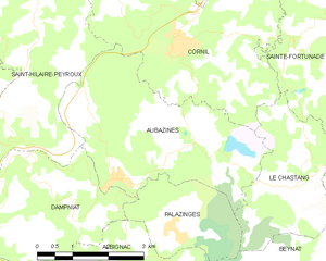
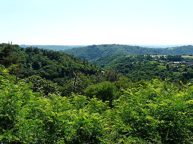
Aubazines
- commune in Corrèze, France
- Country:
- Postal Code: 19190
- Coordinates: 45° 10' 27" N, 1° 40' 12" E
- GPS tracks (wikiloc): [Link]
- AboveSeaLevel: 345 м m
- Area: 14.1 sq km
- Population: 915
- Web site: [Link]

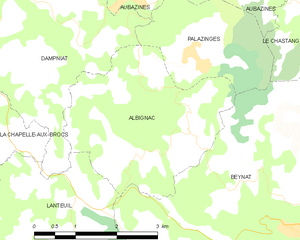
Albignac
- commune in Corrèze, France
- Country:
- Postal Code: 19190
- Coordinates: 45° 8' 21" N, 1° 40' 41" E
- GPS tracks (wikiloc): [Link]
- Area: 9.74 sq km
- Population: 248


Beynat
- commune in Corrèze, France
- Country:
- Postal Code: 19190
- Coordinates: 45° 7' 28" N, 1° 43' 24" E
- GPS tracks (wikiloc): [Link]
- Area: 34.84 sq km
- Population: 1284
- Web site: [Link]