canton of Blesle (canton de Blesle)
- canton of France (until March 2015)
- Country:

- Capital: Blesle
- Coordinates: 45° 19' 8" N, 3° 10' 15" E


- GPS tracks (wikiloc): [Link]
- Wikidata storage: Wikidata: Q276541
- VIAF ID: Alt: [234764120]
- INSEE canton code: [4304]
Includes regions:
Chambezon
- commune in Haute-Loire, France
- Country:
- Postal Code: 43410
- Coordinates: 45° 22' 46" N, 3° 14' 34" E
- GPS tracks (wikiloc): [Link]
- Area: 5.09 sq km
- Population: 112


Espalem
- commune in Haute-Loire, France
- Country:
- Postal Code: 43450
- Coordinates: 45° 18' 27" N, 3° 13' 58" E
- GPS tracks (wikiloc): [Link]
- Area: 14.62 sq km
- Population: 298

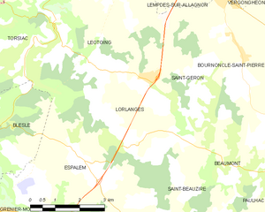
Lorlanges
- commune in Haute-Loire, France
- Country:
- Postal Code: 43360
- Coordinates: 45° 20' 9" N, 3° 15' 59" E
- GPS tracks (wikiloc): [Link]
- Area: 14.49 sq km
- Population: 364
Lubilhac
- commune in Haute-Loire, France
- Country:
- Postal Code: 43100
- Coordinates: 45° 15' 10" N, 3° 14' 40" E
- GPS tracks (wikiloc): [Link]
- Area: 24.09 sq km
- Population: 93


Grenier-Montgon
- commune in Haute-Loire, France
- Country:
- Postal Code: 43450
- Coordinates: 45° 17' 16" N, 3° 11' 41" E
- GPS tracks (wikiloc): [Link]
- Area: 5.01 sq km
- Population: 114

Léotoing
- commune in Haute-Loire, France
- Country:
- Postal Code: 43410
- Coordinates: 45° 21' 43" N, 3° 13' 24" E
- GPS tracks (wikiloc): [Link]
- Area: 19.56 sq km
- Population: 238

Torsiac
- commune in Haute-Loire, France
- Country:
- Postal Code: 43450
- Coordinates: 45° 21' 3" N, 3° 13' 1" E
- GPS tracks (wikiloc): [Link]
- Area: 9.06 sq km
- Population: 73

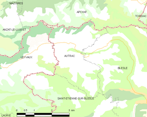
Autrac
- commune in Haute-Loire, France
- Country:
- Postal Code: 43450
- Coordinates: 45° 19' 48" N, 3° 7' 57" E
- GPS tracks (wikiloc): [Link]
- Area: 8.46 sq km
- Population: 63


Blesle
- commune in Haute-Loire, France
- Country:
- Postal Code: 43450
- Coordinates: 45° 19' 8" N, 3° 10' 14" E
- GPS tracks (wikiloc): [Link]
- Area: 29.8 sq km
- Population: 628
- Web site: [Link]


Saint-Étienne-sur-Blesle
- commune in Haute-Loire, France
- Country:
- Postal Code: 43450
- Coordinates: 45° 18' 41" N, 3° 8' 14" E
- GPS tracks (wikiloc): [Link]
- Area: 17.65 sq km
- Population: 54