canton of Château-Renard (canton de Château-Renard)
- canton of France (until March 2015)
- Country:

- Capital: Château-Renard
- Coordinates: 47° 57' 22" N, 2° 56' 47" E


- GPS tracks (wikiloc): [Link]
- Wikidata storage: Wikidata: Q1387784
- INSEE canton code: [4507]
Includes regions:


Gy-les-Nonains
- commune in Loiret, France
- Country:
- Postal Code: 45220
- Coordinates: 47° 56' 50" N, 2° 51' 5" E
- GPS tracks (wikiloc): [Link]
- Area: 20.13 sq km
- Population: 643


Chuelles
- commune in Loiret, France
- Country:
- Postal Code: 45220
- Coordinates: 48° 0' 10" N, 2° 57' 56" E
- GPS tracks (wikiloc): [Link]
- Area: 30.82 sq km
- Population: 1185
- Web site: [Link]

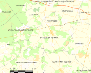
La Selle-en-Hermoy
- commune in Loiret, France
- Country:
- Postal Code: 45210
- Coordinates: 48° 0' 39" N, 2° 53' 39" E
- GPS tracks (wikiloc): [Link]
- Area: 19.56 sq km
- Population: 843

Saint-Firmin-des-Bois
- commune in Loiret, France
- Country:
- Postal Code: 45220
- Coordinates: 47° 57' 55" N, 2° 54' 40" E
- GPS tracks (wikiloc): [Link]
- Area: 19.05 sq km
- Population: 479


Saint-Germain-des-Prés
- commune in Loiret, France
- Country:
- Postal Code: 45220
- Coordinates: 47° 57' 12" N, 2° 50' 50" E
- GPS tracks (wikiloc): [Link]
- Area: 26.18 sq km
- Population: 1904
- Web site: [Link]
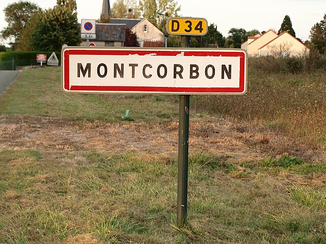

Montcorbon
- former commune in Loiret, France
- Country:
- Postal Code: 45220
- Coordinates: 47° 58' 11" N, 3° 4' 16" E
- GPS tracks (wikiloc): [Link]
- Area: 26.61 sq km
- Population: 498


Douchy
- former commune in Loiret, France
- Country:
- Postal Code: 45220
- Coordinates: 47° 56' 36" N, 3° 3' 9" E
- GPS tracks (wikiloc): [Link]
- Area: 23.51 sq km
- Population: 979


Château-Renard
- commune in Loiret, France
- Country:
- Postal Code: 45220
- Coordinates: 47° 55' 50" N, 2° 55' 39" E
- GPS tracks (wikiloc): [Link]
- Area: 40.34 sq km
- Population: 2237
- Web site: [Link]


Triguères
- commune in Loiret, France
- Country:
- Postal Code: 45220
- Coordinates: 47° 56' 22" N, 2° 58' 52" E
- GPS tracks (wikiloc): [Link]
- Area: 35.78 sq km
- Population: 1320
- Web site: [Link]
Melleroy
- commune in Loiret, France
- Country:
- Postal Code: 45220
- Coordinates: 47° 53' 41" N, 2° 57' 8" E
- GPS tracks (wikiloc): [Link]
- Area: 24.23 sq km
- Population: 502