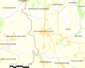
canton of Coulonges-sur-l'Autize (canton de Coulonges-sur-l'Autize)
- canton of France
- Country:

- Capital: Coulonges-sur-l'Autize
- Coordinates: 46° 30' 36" N, 0° 33' 10" E


- GPS tracks (wikiloc): [Link]
- Wikidata storage: Wikidata: Q1725077
- INSEE canton code: [7911]
Includes regions:


Béceleuf
- commune in Deux-Sèvres, France
- Country:
- Postal Code: 79160
- Coordinates: 46° 28' 15" N, 0° 30' 28" E
- GPS tracks (wikiloc): [Link]
- Area: 19.04 sq km
- Population: 749


La Chapelle-Thireuil
- commune in Deux-Sèvres, France
- Country:
- Postal Code: 79160
- Coordinates: 46° 33' 29" N, 0° 33' 24" E
- GPS tracks (wikiloc): [Link]
- Area: 17.12 sq km
- Population: 436


Le Busseau
- commune in Deux-Sèvres, France
- Country:
- Postal Code: 79240
- Coordinates: 46° 34' 46" N, 0° 35' 43" E
- GPS tracks (wikiloc): [Link]
- Area: 27.65 sq km
- Population: 734
Scillé
- commune in Deux-Sèvres, France
- Country:
- Postal Code: 79240
- Coordinates: 46° 35' 59" N, 0° 33' 31" E
- GPS tracks (wikiloc): [Link]
- Area: 11.43 sq km
- Population: 371

Puihardy
- commune in Deux-Sèvres, France
- Country:
- Postal Code: 79160
- Coordinates: 46° 31' 24" N, 0° 32' 13" E
- GPS tracks (wikiloc): [Link]
- Area: 1.18 sq km
- Population: 55


Faye-sur-Ardin
- commune in Deux-Sèvres, France
- Country:
- Postal Code: 79160
- Coordinates: 46° 26' 53" N, 0° 30' 44" E
- GPS tracks (wikiloc): [Link]
- Area: 15.03 sq km
- Population: 616

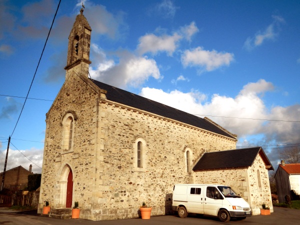
Coulonges-sur-l'Autize
- commune in Deux-Sèvres, France
- Country:
- Postal Code: 79160
- Coordinates: 46° 29' 0" N, 0° 35' 57" E
- GPS tracks (wikiloc): [Link]
- Area: 18.87 sq km
- Population: 2363
- Web site: [Link]


Fenioux
- commune in Deux-Sèvres, France
- Country:
- Postal Code: 79160
- Coordinates: 46° 32' 41" N, 0° 29' 37" E
- GPS tracks (wikiloc): [Link]
- Area: 33.65 sq km
- Population: 657
- Web site: [Link]


Saint-Pompain
- commune in Deux-Sèvres, France
- Country:
- Postal Code: 79160
- Coordinates: 46° 26' 29" N, 0° 36' 0" E
- GPS tracks (wikiloc): [Link]
- Area: 24.28 sq km
- Population: 953


Le Beugnon
- commune in Deux-Sèvres, France
- Country:
- Postal Code: 79130
- Coordinates: 46° 34' 52" N, 0° 30' 1" E
- GPS tracks (wikiloc): [Link]
- Area: 16.3 sq km
- Population: 295


Saint-Maixent-de-Beugné
- commune in Deux-Sèvres, France
- Country:
- Postal Code: 79160
- Coordinates: 46° 30' 17" N, 0° 36' 33" E
- GPS tracks (wikiloc): [Link]
- Area: 11.02 sq km
- Population: 395

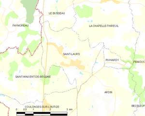
Saint-Laurs
- commune in Deux-Sèvres, France
- Country:
- Postal Code: 79160
- Coordinates: 46° 31' 31" N, 0° 35' 2" E
- GPS tracks (wikiloc): [Link]
- Area: 8.14 sq km
- Population: 561


Villiers-en-Plaine
- commune in Deux-Sèvres, France
- Country:
- Postal Code: 79160
- Coordinates: 46° 24' 31" N, 0° 32' 14" E
- GPS tracks (wikiloc): [Link]
- Area: 27.89 sq km
- Population: 1765


Ardin
- commune in Deux-Sèvres, France
- Country:
- Postal Code: 79160
- Coordinates: 46° 28' 28" N, 0° 33' 28" E
- GPS tracks (wikiloc): [Link]
- Area: 29.59 sq km
- Population: 1255
- Web site: [Link]