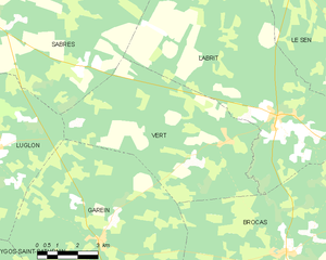
canton of Labrit (canton de Labrit)
- canton of France (until March 2015)
- Country:

- Capital: Labrit
- Coordinates: 44° 10' 4" N, 0° 31' 14" E


- GPS tracks (wikiloc): [Link]
- Wikidata storage: Wikidata: Q666091
- Library of Congress authority ID: Alt: [n79062547]
- INSEE canton code: [4009]
Includes regions:


Le Sen
- commune in Landes, France
- Country:
- Postal Code: 40420
- Coordinates: 44° 7' 36" N, 0° 30' 3" E
- GPS tracks (wikiloc): [Link]
- Area: 51.1 sq km
- Population: 211


Maillères
- commune in Landes, France
- Country:
- Postal Code: 40120
- Coordinates: 44° 1' 41" N, 0° 26' 38" E
- GPS tracks (wikiloc): [Link]
- Area: 15.05 sq km
- Population: 240

Vert
- commune in Landes, France
- Country:
- Postal Code: 40420
- Coordinates: 44° 5' 25" N, 0° 34' 49" E
- GPS tracks (wikiloc): [Link]
- Area: 40.03 sq km
- Population: 259


Brocas
- commune in Landes, France
- Country:
- Postal Code: 40420
- Coordinates: 44° 2' 37" N, 0° 32' 6" E
- GPS tracks (wikiloc): [Link]
- Area: 53.46 sq km
- Population: 785
- Web site: [Link]


Cère
- commune in Landes, France
- Country:
- Postal Code: 40090
- Coordinates: 43° 59' 31" N, 0° 32' 5" E
- GPS tracks (wikiloc): [Link]
- Area: 39.87 sq km
- Population: 406

Garein
- commune in Landes, France
- Country:
- Postal Code: 40420
- Coordinates: 44° 2' 48" N, 0° 39' 6" E
- GPS tracks (wikiloc): [Link]
- Area: 57.1 sq km
- Population: 437
- Web site: [Link]


Labrit
- commune in Landes, France
- Country:
- Postal Code: 40420
- Coordinates: 44° 6' 17" N, 0° 32' 40" E
- GPS tracks (wikiloc): [Link]
- Area: 72.18 sq km
- Population: 870

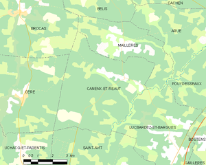
Canenx-et-Réaut
- commune in Landes, France
- Country:
- Postal Code: 40090
- Coordinates: 44° 0' 24" N, 0° 26' 33" E
- GPS tracks (wikiloc): [Link]
- Area: 28.07 sq km
- Population: 161


Bélis
- commune in Landes, France
- Country:
- Postal Code: 40120
- Coordinates: 44° 3' 49" N, 0° 27' 40" E
- GPS tracks (wikiloc): [Link]
- Area: 20.46 sq km
- Population: 164