canton of Mauron (canton de Mauron)
- canton of France (until March 2015)
- Country:

- Capital: Mauron
- Coordinates: 48° 3' 59" N, 2° 20' 6" E


- GPS tracks (wikiloc): [Link]
- Wikidata storage: Wikidata: Q167138
- VIAF ID: Alt: [305194735]
- Library of Congress authority ID: Alt: [n2013051737]
- INSEE canton code: [5620]
Includes regions:


Saint-Léry
- commune in Morbihan, France
- Country:
- Postal Code: 56430
- Coordinates: 48° 5' 24" N, 2° 15' 22" E
- GPS tracks (wikiloc): [Link]
- Area: 1.58 sq km
- Population: 189


Néant-sur-Yvel
- commune in Morbihan, France
- Country:
- Postal Code: 56430
- Coordinates: 48° 0' 49" N, 2° 19' 45" E
- GPS tracks (wikiloc): [Link]
- Area: 32.3 sq km
- Population: 1030
- Web site: [Link]


Tréhorenteuc
- commune in Morbihan, France
- Country:
- Postal Code: 56430
- Coordinates: 48° 0' 31" N, 2° 17' 18" E
- GPS tracks (wikiloc): [Link]
- Area: 5.42 sq km
- Population: 117


Saint-Brieuc-de-Mauron
- commune in Morbihan, France
- Country:
- Postal Code: 56430
- Coordinates: 48° 5' 23" N, 2° 21' 47" E
- GPS tracks (wikiloc): [Link]
- Area: 14.35 sq km
- Population: 344


Mauron
- commune in Morbihan, France
- Country:
- Postal Code: 56430
- Coordinates: 48° 4' 56" N, 2° 17' 9" E
- GPS tracks (wikiloc): [Link]
- Area: 67.23 sq km
- Population: 3105
- Web site: [Link]

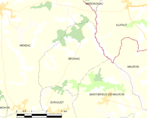
Brignac
- commune in Morbihan, France
- Country:
- Postal Code: 56430
- Coordinates: 48° 7' 14" N, 2° 23' 18" E
- GPS tracks (wikiloc): [Link]
- Area: 13.12 sq km
- Population: 181

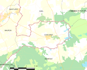
Concoret
- commune in Morbihan, France
- Country:
- Postal Code: 56430
- Coordinates: 48° 3' 51" N, 2° 12' 23" E
- GPS tracks (wikiloc): [Link]
- Area: 15.76 sq km
- Population: 735