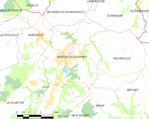
canton of Montaigut (canton de Montaigut)
- canton of France (until March 2015)
- Country:

- Capital: Montaigut
- Coordinates: 46° 10' 54" N, 2° 48' 49" E


- GPS tracks (wikiloc): [Link]
- Wikidata storage: Wikidata: Q285000
- Library of Congress authority ID: Alt: [n80119161]
- INSEE canton code: [6326]
Includes regions:
Buxières-sous-Montaigut
- commune in Puy-de-Dôme, France
- Country:
- Postal Code: 63700
- Coordinates: 46° 12' 11" N, 2° 50' 52" E
- GPS tracks (wikiloc): [Link]
- Area: 10.88 sq km
- Population: 238
Ars-les-Favets
- commune in Puy-de-Dôme, France
- Country:
- Postal Code: 63700
- Coordinates: 46° 11' 37" N, 2° 45' 19" E
- GPS tracks (wikiloc): [Link]
- Area: 14.6 sq km
- Population: 228
Durmignat
- commune in Puy-de-Dôme, France
- Country:
- Postal Code: 63700
- Coordinates: 46° 11' 11" N, 2° 53' 21" E
- GPS tracks (wikiloc): [Link]
- Area: 12.36 sq km
- Population: 194

Saint-Éloy-les-Mines
- commune in Puy-de-Dôme, France
- Country:
- Postal Code: 63700
- Coordinates: 46° 9' 38" N, 2° 50' 2" E
- GPS tracks (wikiloc): [Link]
- Area: 22.11 sq km
- Population: 3723
- Web site: [Link]
Moureuille
- commune in Puy-de-Dôme, France
- Country:
- Postal Code: 63700
- Coordinates: 46° 10' 1" N, 2° 54' 24" E
- GPS tracks (wikiloc): [Link]
- Area: 16.83 sq km
- Population: 328


Youx
- commune in Puy-de-Dôme, France
- Country:
- Postal Code: 63700
- Coordinates: 46° 8' 41" N, 2° 47' 57" E
- GPS tracks (wikiloc): [Link]
- Area: 19.13 sq km
- Population: 921
- Web site: [Link]
Lapeyrouse
- commune in Puy-de-Dôme, France
- Country:
- Postal Code: 63700
- Coordinates: 46° 13' 27" N, 2° 52' 20" E
- GPS tracks (wikiloc): [Link]
- Area: 36.14 sq km
- Population: 563
- Web site: [Link]
La Crouzille
- commune in Puy-de-Dôme, France
- Country:
- Postal Code: 63700
- Coordinates: 46° 10' 51" N, 2° 44' 42" E
- GPS tracks (wikiloc): [Link]
- Area: 18.6 sq km
- Population: 271

Montaigut
- commune in Puy-de-Dôme, France
- Country:
- Postal Code: 63700
- Coordinates: 46° 10' 46" N, 2° 48' 31" E
- GPS tracks (wikiloc): [Link]
- Area: 8.18 sq km
- Population: 996
- Web site: [Link]


Virlet
- commune in Puy-de-Dôme, France
- Country:
- Postal Code: 63330
- Coordinates: 46° 9' 18" N, 2° 41' 53" E
- GPS tracks (wikiloc): [Link]
- AboveSeaLevel: 530 м m
- Area: 17.37 sq km
- Population: 272