canton of Penne-d'Agenais (canton de Penne-d'Agenais)
- canton of France (until March 2015)
- Country:

- Capital: Penne-d'Agenais
- Coordinates: 44° 23' 0" N, 0° 50' 0" E


- GPS tracks (wikiloc): [Link]
- Wikidata storage: Wikidata: Q1597520
- INSEE canton code: [4726]
Includes regions:


Dausse
- commune in Lot-et-Garonne, France
- Country:
- Postal Code: 47140
- Coordinates: 44° 23' 1" N, 0° 53' 24" E
- GPS tracks (wikiloc): [Link]
- Area: 6.94 sq km
- Population: 505


Trentels
- commune in Lot-et-Garonne, France
- Country:
- Postal Code: 47140
- Coordinates: 44° 26' 8" N, 0° 51' 46" E
- GPS tracks (wikiloc): [Link]
- Area: 19.47 sq km
- Population: 832


Massels
- commune in Lot-et-Garonne, France
- Country:
- Postal Code: 47140
- Coordinates: 44° 19' 7" N, 0° 51' 13" E
- GPS tracks (wikiloc): [Link]
- Area: 6.17 sq km
- Population: 114
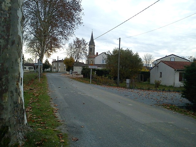

Trémons
- commune in Lot-et-Garonne, France
- Country:
- Postal Code: 47140
- Coordinates: 44° 24' 36" N, 0° 53' 58" E
- GPS tracks (wikiloc): [Link]
- Area: 13.49 sq km
- Population: 385
Massoulès
- commune in Lot-et-Garonne, France
- Country:
- Postal Code: 47140
- Coordinates: 44° 20' 21" N, 0° 52' 6" E
- GPS tracks (wikiloc): [Link]
- Area: 7.86 sq km
- Population: 204

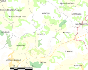
Frespech
- commune in Lot-et-Garonne, France
- Country:
- Postal Code: 47140
- Coordinates: 44° 18' 36" N, 0° 49' 29" E
- GPS tracks (wikiloc): [Link]
- Area: 11.7 sq km
- Population: 314


Penne-d'Agenais
- commune in Lot-et-Garonne, France
- Country:
- Postal Code: 47140
- Coordinates: 44° 23' 19" N, 0° 49' 8" E
- GPS tracks (wikiloc): [Link]
- Area: 46.71 sq km
- Population: 2347
- Web site: [Link]


Hautefage-la-Tour
- commune in Lot-et-Garonne, France
- Country:
- Postal Code: 47340
- Coordinates: 44° 19' 19" N, 0° 47' 4" E
- GPS tracks (wikiloc): [Link]
- Area: 20.75 sq km
- Population: 928
- Web site: [Link]


Saint-Sylvestre-sur-Lot
- commune in Lot-et-Garonne, France
- Country:
- Postal Code: 47140
- Coordinates: 44° 23' 55" N, 0° 48' 22" E
- GPS tracks (wikiloc): [Link]
- Area: 21.27 sq km
- Population: 2286
- Web site: [Link]


Auradou
- commune in Lot-et-Garonne, France
- Country:
- Postal Code: 47140
- Coordinates: 44° 20' 2" N, 0° 48' 39" E
- GPS tracks (wikiloc): [Link]
- Area: 11.17 sq km
- Population: 379