canton of Saint-Pierre-d'Oléron (canton de Saint-Pierre-d'Oléron)
- canton of France
- Country:

- Capital: Saint-Pierre-d'Oléron
- Coordinates: 45° 59' 31" N, 1° 20' 27" E


- GPS tracks (wikiloc): [Link]
- Wikidata storage: Wikidata: Q1727302
- INSEE canton code: [1731]
Includes regions:

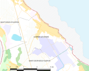
La Brée-les-Bains
- commune in Charente-Maritime, France
- Country:
- Postal Code: 17840
- Coordinates: 46° 0' 56" N, 1° 20' 56" E
- GPS tracks (wikiloc): [Link]
- AboveSeaLevel: 10 м m
- Area: 7.27 sq km
- Population: 700
- Web site: [Link]


Saint-Denis-d'Oléron
- commune in Charente-Maritime, France
- Country:
- Postal Code: 17650
- Coordinates: 46° 1' 58" N, 1° 22' 44" E
- GPS tracks (wikiloc): [Link]
- Area: 11.75 sq km
- Population: 1353
- Web site: [Link]


Saint-Georges-d'Oléron
- commune in Charente-Maritime, France
- Country:
- Postal Code: 17190
- Coordinates: 45° 58' 43" N, 1° 19' 59" E
- GPS tracks (wikiloc): [Link]
- Area: 46.55 sq km
- Population: 3642
- Web site: [Link]


Saint-Pierre-d'Oléron
- commune in Charente-Maritime, France
- Country:
- Postal Code: 17310
- Coordinates: 45° 56' 37" N, 1° 18' 21" E
- GPS tracks (wikiloc): [Link]
- Area: 40.55 sq km
- Population: 6751
- Web site: [Link]