canton of Brionne (canton de Brionne)

- canton of France
- Country:

- Capital: Brionne
- Coordinates: 49° 11' 54" N, 0° 42' 3" E


- GPS tracks (wikiloc): [Link]
- Population: 25452
- Wikipedia en: wiki(en)
- Wikipedia: wiki(fr)
- Wikidata storage: Wikidata: Q1724609
- INSEE canton code: [2707]
Includes regions:

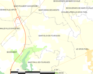
Saint-Éloi-de-Fourques
- commune in Eure, France
- Country:
- Postal Code: 27800
- Coordinates: 49° 13' 54" N, 0° 47' 46" E
- GPS tracks (wikiloc): [Link]
- Area: 7.23 sq km
- Population: 506
- Web site: [Link]


Saint-Pierre-de-Salerne
- commune in Eure, France
- Country:
- Postal Code: 27800
- Coordinates: 49° 12' 6" N, 0° 39' 50" E
- GPS tracks (wikiloc): [Link]
- Area: 6.92 sq km
- Population: 251


Saint-Paul-de-Fourques
- commune in Eure, France
- Country:
- Postal Code: 27800
- Coordinates: 49° 13' 16" N, 0° 47' 44" E
- GPS tracks (wikiloc): [Link]
- Area: 4.03 sq km
- Population: 295


Saint-Cyr-de-Salerne
- commune in Eure, France
- Country:
- Postal Code: 27800
- Coordinates: 49° 10' 59" N, 0° 39' 28" E
- GPS tracks (wikiloc): [Link]
- Area: 6.38 sq km
- Population: 206


Saint-Victor-d'Épine
- commune in Eure, France
- Country:
- Postal Code: 27800
- Coordinates: 49° 12' 34" N, 0° 36' 24" E
- GPS tracks (wikiloc): [Link]
- Area: 7.89 sq km
- Population: 322