canton of Gerzat (canton de Gerzat)
- canton of France
- Country:

- Capital: Gerzat
- Coordinates: 45° 49' 12" N, 3° 7' 14" E


- GPS tracks (wikiloc): [Link]
- Population: 17637
- Wikipedia en: wiki(en)
- Wikipedia: wiki(fr)
- Wikidata storage: Wikidata: Q285154
- INSEE canton code: [6317]
Includes regions:


Gerzat
- commune in Puy-de-Dôme, France
- Country:

- Postal Code: 63360
- Coordinates: 45° 49' 33" N, 3° 8' 41" E


- GPS tracks (wikiloc): [Link]
- Area: 16.28 sq km
- Population: 10432
- Web site: [Link]


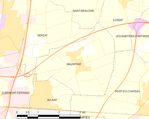
Malintrat
- commune in Puy-de-Dôme, France
- Country:

- Postal Code: 63510
- Coordinates: 45° 48' 54" N, 3° 11' 10" E


- GPS tracks (wikiloc): [Link]
- Area: 8.16 sq km
- Population: 1096
- Web site: [Link]


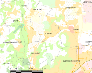
Blanzat
- commune in Puy-de-Dôme, France
- Country:

- Postal Code: 63112
- Coordinates: 45° 49' 47" N, 3° 4' 41" E


- GPS tracks (wikiloc): [Link]
- Area: 6.96 sq km
- Population: 3740
- Web site: [Link]


Aulnat
- commune in Puy-de-Dôme, France
- Country:

- Postal Code: 63510
- Coordinates: 45° 47' 57" N, 3° 10' 3" E


- GPS tracks (wikiloc): [Link]
- Area: 4.21 sq km
- Population: 4007
- Web site: [Link]


Sayat
- commune in Puy-de-Dôme, France
- Country:

- Postal Code: 63530
- Coordinates: 45° 49' 35" N, 3° 3' 9" E


- GPS tracks (wikiloc): [Link]
- Area: 8.29 sq km
- Population: 2252
- Web site: [Link]


Cébazat
- commune in Puy-de-Dôme, France
- Country:

- Postal Code: 63118
- Coordinates: 45° 49' 53" N, 3° 6' 0" E


- GPS tracks (wikiloc): [Link]
- Area: 10.02 sq km
- Population: 7947
- Web site: [Link]
