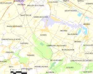
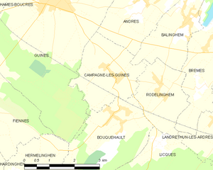
canton of Guînes (canton de Guînes)
- canton of France
- Country:

- Capital: Guînes
- Coordinates: 50° 49' 9" N, 1° 52' 20" E


- GPS tracks (wikiloc): [Link]
- Wikipedia en: wiki(en)
- Wikipedia: wiki(fr)
- Wikidata storage: Wikidata: Q1725462
- Freebase ID: [/m/0412tll]
- OSM relation ID: [2381328]
- INSEE canton code: [6225]
Includes regions:


Sanghen
- commune in Pas-de-Calais, France
- Country:

- Postal Code: 62850
- Coordinates: 50° 46' 34" N, 1° 54' 10" E


- GPS tracks (wikiloc): [Link]
- Area: 6.17 sq km
- Population: 311


Pihen-lès-Guînes
- commune in Pas-de-Calais, France
- Country:

- Postal Code: 62340
- Coordinates: 50° 52' 17" N, 1° 47' 12" E


- GPS tracks (wikiloc): [Link]
- Area: 9.25 sq km
- Population: 476
- Web site: [Link]


Licques
- commune in Pas-de-Calais, France
- Country:

- Postal Code: 62850
- Coordinates: 50° 47' 7" N, 1° 56' 12" E


- GPS tracks (wikiloc): [Link]
- Area: 18.36 sq km
- Population: 1631
- Web site: [Link]


Hocquinghen
- commune in Pas-de-Calais, France
- Country:

- Postal Code: 62850
- Coordinates: 50° 46' 7" N, 1° 56' 17" E


- GPS tracks (wikiloc): [Link]
- Area: 1.94 sq km
- Population: 113


Guînes
- commune in Pas-de-Calais, France
- Country:

- Postal Code: 62340
- Coordinates: 50° 52' 4" N, 1° 52' 25" E


- GPS tracks (wikiloc): [Link]
- Area: 26.42 sq km
- Population: 5683
- Web site: [Link]


Fiennes
- commune in Pas-de-Calais, France
- Country:

- Postal Code: 62132
- Coordinates: 50° 49' 36" N, 1° 49' 30" E


- GPS tracks (wikiloc): [Link]
- Area: 11.64 sq km
- Population: 891


Hermelinghen
- commune in Pas-de-Calais, France
- Country:

- Postal Code: 62132
- Coordinates: 50° 48' 8" N, 1° 51' 37" E


- GPS tracks (wikiloc): [Link]
- Area: 6.43 sq km
- Population: 390


Hames-Boucres
- commune in Pas-de-Calais, France
- Country:

- Postal Code: 62340
- Coordinates: 50° 52' 53" N, 1° 50' 34" E


- GPS tracks (wikiloc): [Link]
- Area: 12.82 sq km
- Population: 1474
- Web site: [Link]


Caffiers
- commune in Pas-de-Calais, France
- Country:

- Postal Code: 62132
- Coordinates: 50° 50' 24" N, 1° 48' 42" E


- GPS tracks (wikiloc): [Link]
- Area: 4.77 sq km
- Population: 757
- Web site: [Link]


Bouquehault
- commune in Pas-de-Calais, France
- Country:

- Postal Code: 62340
- Coordinates: 50° 49' 36" N, 1° 54' 12" E


- GPS tracks (wikiloc): [Link]
- Area: 8.04 sq km
- Population: 742


Hardinghen
- commune in Pas-de-Calais, France
- Country:

- Postal Code: 62132
- Coordinates: 50° 47' 58" N, 1° 49' 17" E


- GPS tracks (wikiloc): [Link]
- Area: 8.24 sq km
- Population: 1203


Alembon
- commune in Pas-de-Calais, France
- Country:

- Postal Code: 62850
- Coordinates: 50° 47' 5" N, 1° 53' 13" E


- GPS tracks (wikiloc): [Link]
- Area: 8.97 sq km
- Population: 635


Herbinghen
- commune in Pas-de-Calais, France
- Country:

- Postal Code: 62850
- Coordinates: 50° 46' 22" N, 1° 54' 42" E


- GPS tracks (wikiloc): [Link]
- Area: 4.31 sq km
- Population: 368


Campagne-lès-Guines
- commune in Pas-de-Calais, France
- Country:

- Postal Code: 62340
- Coordinates: 50° 50' 24" N, 1° 54' 14" E


- GPS tracks (wikiloc): [Link]
- Area: 5.72 sq km
- Population: 445


Boursin
- commune in Pas-de-Calais, France
- Country:

- Postal Code: 62132
- Coordinates: 50° 46' 35" N, 1° 50' 6" E


- GPS tracks (wikiloc): [Link]
- Area: 7.58 sq km
- Population: 269


Andres
- commune in Pas-de-Calais, France
- Country:

- Postal Code: 62340
- Coordinates: 50° 52' 2" N, 1° 55' 15" E


- GPS tracks (wikiloc): [Link]
- Area: 7.15 sq km
- Population: 1574