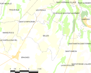
canton of Pont-Audemer (canton de Pont-Audemer)

- canton of France
- Country:

- Capital: Pont-Audemer
- Coordinates: 49° 20' 33" N, 0° 31' 5" E


- GPS tracks (wikiloc): [Link]
- Population: 28047
- Wikipedia en: wiki(en)
- Wikipedia: wiki(fr)
- Wikidata storage: Wikidata: Q1726771
- Wikipedia Commons Category: [Link]
- Freebase ID: [/m/08mtf7]
- Library of Congress authority ID: Alt: [n2016035419]
- INSEE canton code: [2717]
Includes regions:


Toutainville
- commune in Eure, France
- Country:
- Postal Code: 27500
- Coordinates: 49° 21' 49" N, 0° 27' 44" E
- GPS tracks (wikiloc): [Link]
- Area: 11.85 sq km
- Population: 1322


Saint-Germain-Village
- former commune in Eure, France
- Country:
- Postal Code: 27500
- Coordinates: 49° 20' 57" N, 0° 30' 14" E
- GPS tracks (wikiloc): [Link]
- Area: 5.31 sq km
- Population: 1675
- Web site: [Link]

Selles
- commune in Eure, France
- Country:
- Postal Code: 27500
- Coordinates: 49° 18' 7" N, 0° 30' 22" E
- GPS tracks (wikiloc): [Link]
- Area: 10.09 sq km
- Population: 462
- Web site: [Link]


Saint-Symphorien
- commune in Indre et Loire, France
- Country:
- Postal Code: 27500
- Coordinates: 49° 18' 51" N, 0° 28' 1" E
- GPS tracks (wikiloc): [Link]
- Area: 3.78 sq km
- Population: 471


Tourville-sur-Pont-Audemer
- commune in Eure, France
- Country:
- Postal Code: 27500
- Coordinates: 49° 19' 53" N, 0° 30' 30" E
- GPS tracks (wikiloc): [Link]
- AboveSeaLevel: 105 м m
- Area: 10.8 sq km
- Population: 737


Triqueville
- commune in Eure, France
- Country:
- Postal Code: 27500
- Coordinates: 49° 20' 11" N, 0° 26' 27" E
- GPS tracks (wikiloc): [Link]
- AboveSeaLevel: 98 м m
- Area: 9.48 sq km
- Population: 341


Saint-Mards-de-Blacarville
- commune in Eure, France
- Country:
- Postal Code: 27500
- Coordinates: 49° 22' 42" N, 0° 30' 49" E
- GPS tracks (wikiloc): [Link]
- Area: 8.78 sq km
- Population: 796