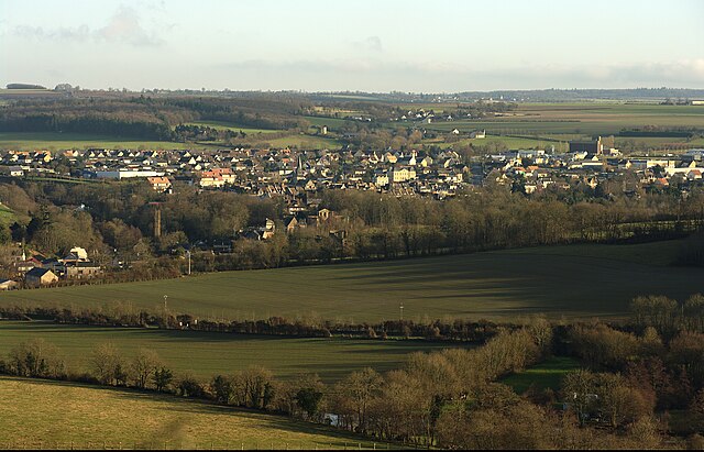
canton of Thury-Harcourt (canton de Thury-Harcourt)

- canton of France
- Country:

- Capital: Thury-Harcourt
- Coordinates: 48° 56' 44" N, 0° 27' 0" E


- GPS tracks (wikiloc): [Link]
- Population: 23894
- Wikipedia en: wiki(en)
- Wikipedia: wiki(fr)
- Wikidata storage: Wikidata: Q507969
Includes regions:


Saint-Rémy
- commune in Calvados, France
- Country:
- Postal Code: 14570
- Coordinates: 48° 56' 24" N, 0° 30' 12" E
- GPS tracks (wikiloc): [Link]
- Area: 7.52 sq km
- Population: 1017
- Web site: [Link]


Saint-Lambert
- commune in Calvados, France
- Country:
- Postal Code: 14570
- Coordinates: 48° 56' 13" N, 0° 32' 55" E
- GPS tracks (wikiloc): [Link]
- Area: 7.45 sq km
- Population: 282

Thury-Harcourt
- former commune in Calvados, France
- Country:
- Postal Code: 14220
- Coordinates: 48° 59' 2" N, 0° 28' 27" E
- GPS tracks (wikiloc): [Link]
- Area: 4.9 sq km
- Population: 2017
- Web site: [Link]


Saint-Omer
- commune in Calvados, France
- Country:
- Postal Code: 14220
- Coordinates: 48° 55' 33" N, 0° 27' 12" E
- GPS tracks (wikiloc): [Link]
- Area: 8.07 sq km
- Population: 177

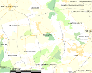
Tournebu
- commune in Calvados, France
- Country:
- Postal Code: 14220
- Coordinates: 48° 58' 8" N, 0° 20' 26" E
- GPS tracks (wikiloc): [Link]
- Area: 11.4 sq km
- Population: 355