canton of Troarn (canton de Troarn)

- canton of France
- Country:

- Capital: Troarn
- Coordinates: 49° 9' 47" N, 0° 11' 42" E


- GPS tracks (wikiloc): [Link]
- Population: 29292
- Wikipedia en: wiki(en)
- Wikipedia: wiki(fr)
- Wikidata storage: Wikidata: Q1424042
- INSEE canton code: [1424]
Includes regions:

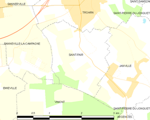
Saint-Pair
- commune in Calvados, France
- Country:
- Postal Code: 14670
- Coordinates: 49° 10' 9" N, 0° 11' 7" E
- GPS tracks (wikiloc): [Link]
- Area: 3.28 sq km
- Population: 214


Troarn
- former commune in Calvados, France
- Country:
- Postal Code: 14670
- Coordinates: 49° 10' 54" N, 0° 11' 4" E
- GPS tracks (wikiloc): [Link]
- Area: 11.53 sq km
- Population: 3574
- Web site: [Link]


Sannerville
- former commune in Calvados, France
- Country:
- Postal Code: 14940
- Coordinates: 49° 10' 50" N, 0° 13' 22" E
- GPS tracks (wikiloc): [Link]
- Area: 5.14 sq km
- Population: 1877


Saint-Ouen-du-Mesnil-Oger
- commune in Calvados, France
- Country:
- Postal Code: 14670
- Coordinates: 49° 9' 23" N, 0° 7' 18" E
- GPS tracks (wikiloc): [Link]
- Area: 5.89 sq km
- Population: 209


Touffréville
- commune in Calvados, France
- Country:
- Postal Code: 14940
- Coordinates: 49° 11' 24" N, 0° 13' 27" E
- GPS tracks (wikiloc): [Link]
- Area: 5.75 sq km
- Population: 317


Vimont
- commune in Calvados, France
- Country:
- Postal Code: 14370
- Coordinates: 49° 7' 17" N, 0° 11' 55" E
- GPS tracks (wikiloc): [Link]
- Area: 8.96 sq km
- Population: 729

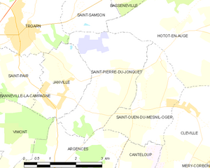
Saint-Pierre-du-Jonquet
- commune in Calvados, France
- Country:
- Postal Code: 14670
- Coordinates: 49° 10' 7" N, 0° 8' 20" E
- GPS tracks (wikiloc): [Link]
- Area: 8.17 sq km
- Population: 226