Carrouges (Carrouges)

- commune in Orne, France
- Country:

- Postal Code: 61320
- Coordinates: 48° 34' 3" N, 0° 8' 44" E


- GPS tracks (wikiloc): [Link]
- Area: 8.58 sq km
- Population: 678
- Web site: http://www.carrouges.fr
- Wikipedia en: wiki(en)
- Wikipedia: wiki(fr)
- Wikidata storage: Wikidata: Q1361772
- Wikipedia Commons Category: [Link]
- Freebase ID: [/m/02w7n6g]
- Freebase ID: [/m/02w7n6g]
- GeoNames ID: Alt: [6613068]
- GeoNames ID: Alt: [6613068]
- SIREN number: [216100743]
- SIREN number: [216100743]
- BnF ID: [15268009g]
- BnF ID: [15268009g]
- VIAF ID: Alt: [139726974]
- VIAF ID: Alt: [139726974]
- INSEE municipality code: 61074
- INSEE municipality code: 61074
Shares border with regions:


Chahains
- commune in Orne, France
- Country:
- Postal Code: 61320
- Coordinates: 48° 33' 44" N, 0° 6' 52" E
- GPS tracks (wikiloc): [Link]
- Area: 7.65 sq km
- Population: 92


Joué-du-Bois
- commune in Orne, France
- Country:
- Postal Code: 61320
- Coordinates: 48° 34' 54" N, 0° 13' 55" E
- GPS tracks (wikiloc): [Link]
- Area: 21.08 sq km
- Population: 421

Sainte-Marguerite-de-Carrouges
- commune in Orne, France
- Country:
- Postal Code: 61320
- Coordinates: 48° 35' 3" N, 0° 9' 15" E
- GPS tracks (wikiloc): [Link]
- Area: 8.69 sq km
- Population: 226


Saint-Martin-l'Aiguillon
- commune in Orne, France
- Country:
- Postal Code: 61320
- Coordinates: 48° 36' 58" N, 0° 10' 32" E
- GPS tracks (wikiloc): [Link]
- Area: 14.61 sq km
- Population: 198


Saint-Martin-des-Landes
- commune in Orne, France
- Country:
- Postal Code: 61320
- Coordinates: 48° 32' 46" N, 0° 8' 16" E
- GPS tracks (wikiloc): [Link]
- Area: 11.19 sq km
- Population: 210


Saint-Sauveur-de-Carrouges
- commune in Orne, France
- Country:
- Postal Code: 61320
- Coordinates: 48° 35' 9" N, 0° 6' 26" E
- GPS tracks (wikiloc): [Link]
- Area: 11.42 sq km
- Population: 244
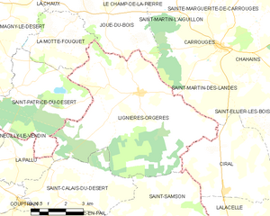
Lignières-Orgères
- commune in Mayenne, France
- Country:
- Postal Code: 53140
- Coordinates: 48° 32' 32" N, 0° 12' 25" E
- GPS tracks (wikiloc): [Link]
- AboveSeaLevel: 280 м m
- Area: 40.89 sq km
- Population: 778
- Web site: [Link]