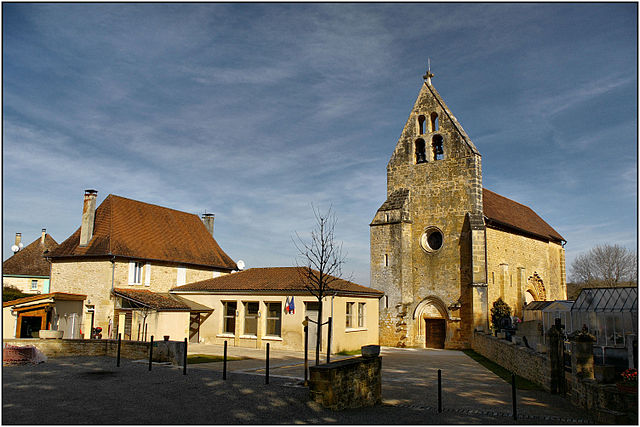
Carsac-Aillac (Carsac-Aillac)

- commune in Dordogne, France
- Country:

- Postal Code: 24200
- Coordinates: 44° 50' 23" N, 1° 16' 34" E


- GPS tracks (wikiloc): [Link]
- Area: 17.31 sq km
- Population: 1592
- Web site: http://www.carsac-aillac.fr/
- Wikipedia en: wiki(en)
- Wikipedia: wiki(fr)
- Wikidata storage: Wikidata: Q195763
- Wikipedia Commons Category: [Link]
- Freebase ID: [/m/03mg54m]
- Freebase ID: [/m/03mg54m]
- GeoNames ID: Alt: [6447793]
- GeoNames ID: Alt: [6447793]
- SIREN number: [212400824]
- SIREN number: [212400824]
- BnF ID: [152517321]
- BnF ID: [152517321]
- INSEE municipality code: 24082
- INSEE municipality code: 24082
Shares border with regions:

Saint-Vincent-le-Paluel
- commune in Dordogne, France
- Country:
- Postal Code: 24200
- Coordinates: 44° 53' 31" N, 1° 17' 9" E
- GPS tracks (wikiloc): [Link]
- Area: 6.86 sq km
- Population: 267


Groléjac
- commune in Dordogne, France
- Country:
- Postal Code: 24250
- Coordinates: 44° 49' 2" N, 1° 17' 44" E
- GPS tracks (wikiloc): [Link]
- Area: 12.28 sq km
- Population: 644
- Web site: [Link]
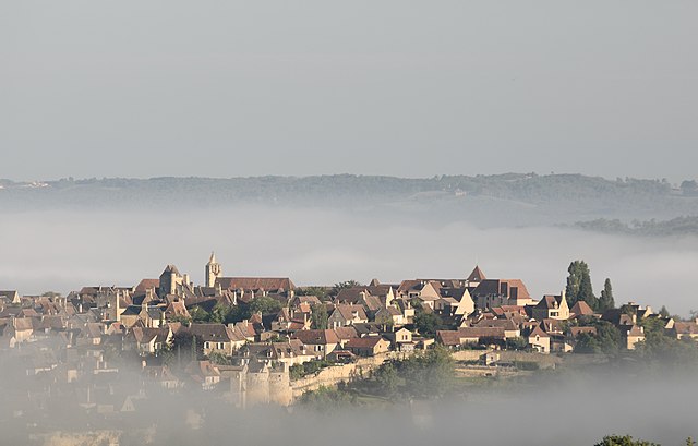
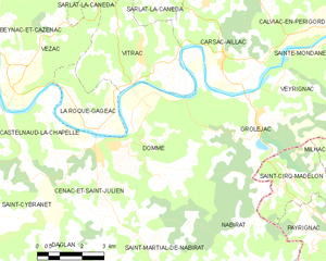
Domme
- commune in Dordogne, France
- Country:
- Postal Code: 24250
- Coordinates: 44° 48' 8" N, 1° 12' 52" E
- GPS tracks (wikiloc): [Link]
- Area: 24.91 sq km
- Population: 923
- Web site: [Link]


Sarlat-la-Canéda
- commune in Dordogne, France
- Country:
- Postal Code: 24200
- Coordinates: 44° 53' 24" N, 1° 13' 0" E
- GPS tracks (wikiloc): [Link]
- AboveSeaLevel: 189 м m
- Area: 47.13 sq km
- Population: 9030
- Web site: [Link]


Calviac-en-Périgord
- commune in Dordogne, France
- Country:
- Postal Code: 24370
- Coordinates: 44° 51' 17" N, 1° 20' 1" E
- GPS tracks (wikiloc): [Link]
- AboveSeaLevel: 86 м m
- Area: 14.52 sq km
- Population: 496
- Web site: [Link]