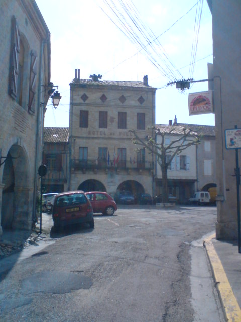
Caudecoste (Caudecoste)

- commune in Lot-et-Garonne, France
- Country:

- Postal Code: 47220
- Coordinates: 44° 7' 0" N, 0° 44' 12" E


- GPS tracks (wikiloc): [Link]
- Area: 17.13 sq km
- Population: 1030
- Wikipedia en: wiki(en)
- Wikipedia: wiki(fr)
- Wikidata storage: Wikidata: Q216887
- Wikipedia Commons Category: [Link]
- Freebase ID: [/m/03qm10_]
- GeoNames ID: Alt: [6449301]
- SIREN number: [214700601]
- BnF ID: [15261141j]
- INSEE municipality code: 47060
Shares border with regions:


Sauveterre-Saint-Denis
- commune in Lot-et-Garonne, France
- Country:
- Postal Code: 47220
- Coordinates: 44° 9' 16" N, 0° 42' 24" E
- GPS tracks (wikiloc): [Link]
- Area: 8.25 sq km
- Population: 425
- Web site: [Link]
Saint-Nicolas-de-la-Balerme
- commune in Lot-et-Garonne, France
- Country:
- Postal Code: 47220
- Coordinates: 44° 8' 12" N, 0° 45' 48" E
- GPS tracks (wikiloc): [Link]
- Area: 4.72 sq km
- Population: 399
- Web site: [Link]

Layrac
- commune in Lot-et-Garonne, France
- Country:
- Postal Code: 47390
- Coordinates: 44° 8' 3" N, 0° 39' 42" E
- GPS tracks (wikiloc): [Link]
- Area: 38.11 sq km
- Population: 3559
- Web site: [Link]

Dunes
- commune in Tarn-et-Garonne, France
- Country:
- Postal Code: 82340
- Coordinates: 44° 5' 14" N, 0° 46' 14" E
- GPS tracks (wikiloc): [Link]
- Area: 23.19 sq km
- Population: 1218

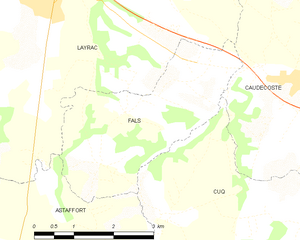
Fals
- commune in Lot-et-Garonne, France
- Country:
- Postal Code: 47220
- Coordinates: 44° 5' 35" N, 0° 40' 28" E
- GPS tracks (wikiloc): [Link]
- Area: 9.4 sq km
- Population: 364
Cuq
- commune in Lot-et-Garonne, France
- Country:
- Postal Code: 47220
- Coordinates: 44° 4' 59" N, 0° 41' 54" E
- GPS tracks (wikiloc): [Link]
- Area: 16.89 sq km
- Population: 267


Saint-Jean-de-Thurac
- commune in Lot-et-Garonne, France
- Country:
- Postal Code: 47270
- Coordinates: 44° 9' 14" N, 0° 44' 35" E
- GPS tracks (wikiloc): [Link]
- Area: 5.12 sq km
- Population: 539
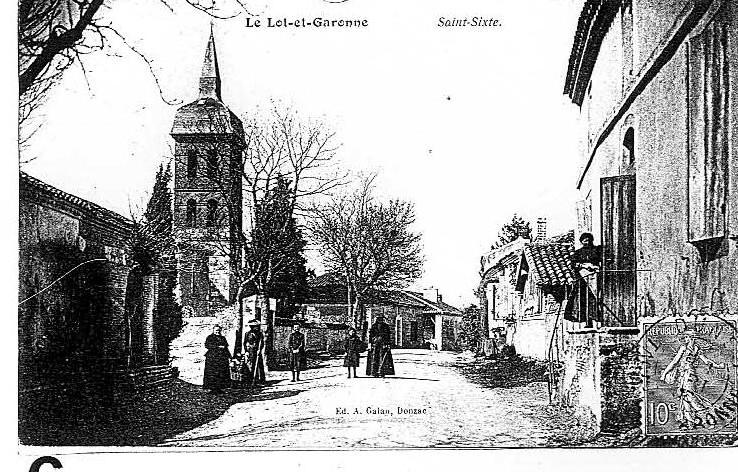

Saint-Sixte
- commune in Lot-et-Garonne, France
- Country:
- Postal Code: 47220
- Coordinates: 44° 7' 42" N, 0° 47' 0" E
- GPS tracks (wikiloc): [Link]
- AboveSeaLevel: 70 м m
- Area: 5.92 sq km
- Population: 362